1970s Maps of Stonycreek Township, Pennsylvania
Explore 6 historic maps of Stonycreek Township from the 1970s. These maps offer a rare glimpse into what life looked like during the 1970s — showing old roads, neighborhoods, homes, and landmarks that have changed or disappeared over time.
Whether you're researching your family's past, planning a metal detecting trip, or studying how Stonycreek Township's landscape evolved across the 1970s, these high-resolution maps are a powerful tool for exploring the history of this region.
- Focus on a specific era: All maps on this page are from the 1970s, giving you a focused view of this time period.
- See what’s changed: Compare century-old streets, trails, and buildings to today's modern landscape using overlays and satellite layers.
- Research with precision: Use these maps for genealogy, historical research, land use analysis, or educational projects.
- View, download, or print: Maps are fully viewable online in high resolution, and can be downloaded or printed for your own records.
Start exploring Stonycreek Township's history through authentic maps from the 1970s. This is your window into the past.
Stonycreek Township, PA maps
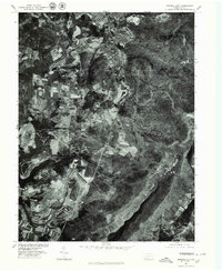
(6)- 1971 Map of Central City, 1972 Print
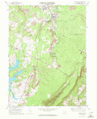 1971 Central City1972 Print · USGSSomerset County coal towns and lakeside developments are captured here in the early seventies. Genealogists and industrial historians can trace the Penn Central rail lines connecting Central City and Cairnbrook to local strip mines and the Township High Sch.2 unique versions available
 - 1971 Map of Stoystown, 1973 Print
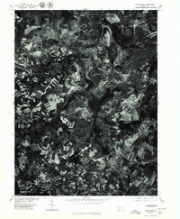
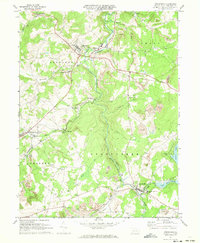 1971 Stoystown1973 Print · USGSSomerset County's industrial and rural character is caught in transition during the early seventies as coal extraction and residential development expanded. Genealogists can locate family landmarks like Walker Cem and Hayman Ch or trace the Baltimore and Ohio rail line through Shanksville and Stoystown.4 unique versions available
 - 1977 Map of Berlin, 1978 Print
 1977 Berlin1978 Print · USGSSomerset County agriculture and industry are captured in high detail in the late seventies. Genealogists and local researchers can trace family lands near Berlin and identify the specific layouts of small settlements like Macdonaldton and Shaft.
 - 1977 Map of New Baltimore, 1979 Print
 1977 New Baltimore1979 Print · USGSThe Somerset County countryside comes into focus in the late seventies, showing the intricate patchwork of farms and timber along the Raystown Branch Juniata River. Trace the rural layout of New Baltimore, Mt Zion, and the high terrain of Dividing Ridge.
 - 1977 Map of Central City, 1979 Print
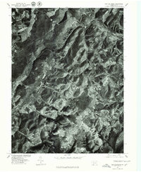
 1977 Central City1979 Print · USGSSomerset County's coal towns and developing lakes are seen in this late-seventies aerial survey. Trace industrial land use and neighborhood growth near Central City or explore the shorelines of Indian Lake and Lake Stonycreek.
 - 1977 Map of Stoystown, 1979 Print
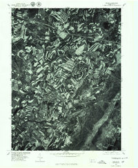
 1977 Stoystown1979 Print · USGSSomerset County agriculture and industry are visible in this late 1970s orthophotograph as the region balanced farming with surface mining. Researchers can trace the development of small communities like Stoystown, Shanksville, and Kimmelton along the banks of Stony Creek.
End of results
Showing maps 1-6 of 6
Top cities near Stonycreek Township
- Somerset historical maps
- Windber historical maps
- Meyersdale historical maps
- Napier Township historical maps
- Berlin historical maps
- Milford historical maps
See more
Top neighborhoods of Stonycreek Township
- Glade historical maps
- Coleman historical maps
- Boone historical maps
- Buckstown historical maps
- Reels Corners historical maps
- Lambertsville historical maps
See more
Frequently asked questions
- What are the different types of historical maps available for Stonycreek Township?
- What is the oldest map of Stonycreek Township?
- Where can I purchase historical maps of Stonycreek Township for my home or office?
- Where can I download high-res historical maps of Stonycreek Township?
- Are there historical topographic maps available for Stonycreek Township?
- Is there historical aerial imagery available for Stonycreek Township?
- Where are historical maps of Stonycreek Township sourced from?