Old Maps of Stonycreek Township, Pennsylvania for Academic Research
Study the evolution of Stonycreek Township with 48 high-resolution historic maps. Whether you're teaching, researching, or modeling changes in land use, these maps provide essential visual documentation of urban, environmental, and geographic change.
- Analyze long-term change: Track patterns in development, transportation, and natural features.
- Ideal for environmental or urban studies: Support academic projects with primary historical map data.
- Use in the classroom or lab: Educators and researchers rely on these maps to bring historical context to life.
These maps are a powerful tool for teaching, research, and visualizing how Stonycreek Township has changed over the decades.
Stonycreek Township, PA maps
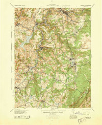
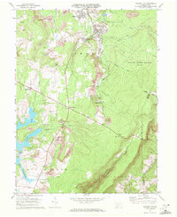
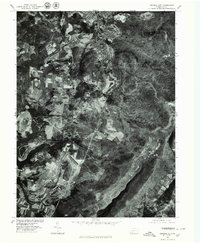
(48)- 1914 Map of Windber, 1955 Print
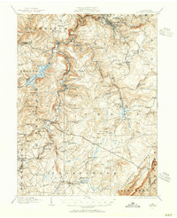 1914 Windber1955 Print · USGSSomerset County coal and rail towns thrive along the Allegheny front during the height of the early industrial era. Genealogists and historians can trace the foundations of Windber, locate the Old Shade Furnace, and map family-named schools like Keafer School.3 unique versions available
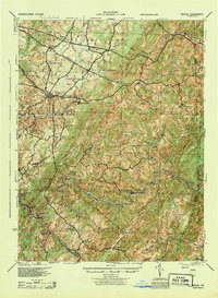
 - 1916 Map of Windber
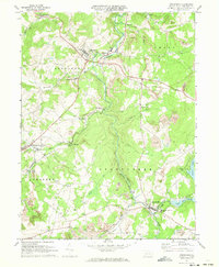
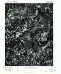
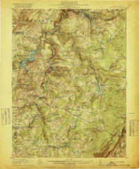 1916 Windber1916 Print · USGSSomerset County coal country and the Laurel Highlands come alive in the decade before the Great War. Genealogists and historians can trace family locations through dozens of named sites like Old Shade Furnace, Stauffer Mine No 3, and Walkers Mill.4 unique versions available
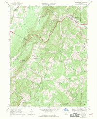
 - 1923 Map of Berlin
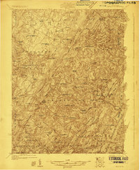 1923 Berlin1923 Print · USGSSomerset County’s high ridges and deep valleys are documented in the early 1920s as the rail and mining industries shaped the local economy. Genealogists and researchers can locate numerous family-named landmarks and rural hubs, including Butners Mill, Sand Patch, and the Shipley Brothers Mine.3 unique versions available
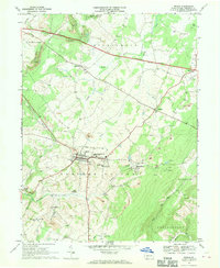
 - 1929 Map of Berlin
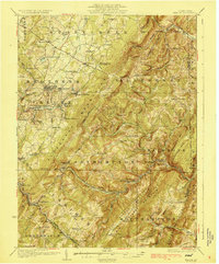 1929 Berlin1929 Print · USGSSomerset County is shown here in the late twenties, during the peak of the mountain coal and rail era. Genealogists and historians can trace family roots through dozens of rural landmarks like Whiteoak Churches, Salco Mines, and the Falls Cut Tunnel along the B&O line.3 unique versions available
 - 1944 Map of Windber
 1944 Windber1944 Print · USGSSomerset County's coal and rail corridors are captured here during the 1940s, showing the region's industrial peak. Genealogists can locate family landmarks like Kaufman Ch, Stoystown Sta, and numerous country schools such as Breastwork Sch.
 - 1944 Map of Berlin
 1944 Berlin1944 Print · USGSSomerset County was undergoing a major transformation in the 1940s as the Pennsylvania Turnpike and its Allegheny Tunnel modernised the landscape. Researchers can trace rural family roots at sites like Sandy Hollow Sch, Lebanon Ch, and old operations like the Salco Mines.
 - 1948 Map of Cumberland
 1948 Cumberland1948 Print · USGSMid-century Appalachia and the Shenandoah Valley are shown in detail, documenting the industrial and transportation hubs of the tri-state area. Genealogists can trace family roots through settlements like Double Tollgate and Bunker Hill or along the Baltimore & Ohio RR.3 unique versions available
 - 1952 Map of Cumberland
 1952 Cumberland1952 Print · USGSThe Potomac Highlands and the Shenandoah Valley are revealed in this early 1950s survey of the Appalachian interior. Researchers can trace the river-and-rail corridors connecting Cumberland, Winchester, and the recreational waters of Deep Creek Lake.
 - 1953 Map of Pittsburgh
 1953 Pittsburgh1953 Print · USGSWestern Pennsylvania's industrial landscape at the start of the fifties shows the steel and rail corridors between Pittsburgh and Altoona. Trace family roots in river towns like Tarentum or follow the Pennsylvania Turnpike across Laurel Hill.
 - 1954 Map of Pittsburgh
 1954 Pittsburgh1954 Print · USGSWestern Pennsylvania in the early fifties remains a powerhouse of heavy industry and vital transit corridors. Genealogists and historians can trace the rail-and-river network connecting Pittsburgh, Johnstown, and Altoona via the Pennsylvania RR and the Lincoln Highway.2 unique versions available
 - 1956 Map of Cumberland, 1966 Print
 1956 Cumberland1966 Print · USGSThe tri-state Highlands in the mid-1950s show a landscape shaped by coal, timber, and the massive presence of the Baltimore & Ohio RR. Researchers can trace the industrial corridor from Cumberland through the Allegheny Mountains to mountain retreats like Deep Creek Lake.6 unique versions available
 - 1957 Map of Cumberland
 1957 Cumberland1957 Print · USGSThe Potomac River valley and the ridges of the Allegheny Front define this mid-century landscape at the intersection of Maryland, West Virginia, and Pennsylvania. Trace the steam-era rail lines of the Baltimore and Ohio RR or locate rural landmarks like St Stephens Church and Stony River Dam.
 - 1958 Map of Pittsburgh
 1958 Pittsburgh1958 Print · USGSWestern Pennsylvania in the late fifties shows an industrial heartland defined by the confluence of the Allegheny River and Monongahela River. Researchers can trace the sprawling rail networks of the Pennsylvania RR and find established towns like Butler, Latrobe, and Windber.5 unique versions available
 - 1959 Map of Pittsburgh
 1959 Pittsburgh1959 Print · USGSWestern Pennsylvania in the late fifties is captured here at the height of its industrial era. Genealogists and historians can trace the riverfront growth of Pittsburgh, the rail works at Altoona, and the mountain gaps of Laurel Hill.
 - 1961 Map of Cumberland
 1961 Cumberland1961 Print · USGSThe tri-state highlands of Maryland, West Virginia, and Pennsylvania are shown in the mid-twentieth century as a complex landscape of ridges and river valleys. Researchers can trace the winding Potomac River and find old rail-and-river towns like Cumberland, Keyser, and Morgantown.
 - 1962 Map of Cumberland
 1962 Cumberland1962 Print · USGSThe central Appalachians meet at the height of the mid-century industrial era, showing the rugged topography between Morgantown and Winchester. Genealogists can trace family lands near Fort Necessity or along the vital Baltimore & Ohio RR corridors.
 - 1964 Map of Pittsburgh
 1964 Pittsburgh1964 Print · USGSWestern Pennsylvania in the late fifties and early sixties shows a landscape of powerful river industries and expanding highways. Genealogists and historians can trace the rail corridors of the Pennsylvania RR through industrial hubs like Johnstown, Altoona, and Nanty Glo.
 - 1967 Map of New Baltimore, 1970 Print
 1967 New Baltimore1970 Print · USGSSomerset County's mountain landscape is captured here in the late sixties, showing the intersection of the Pennsylvania Turnpike and the winding Raystown Branch Juniata River. Genealogists can locate country churches and cemeteries like Sarver Ch and St Johns Cem, or trace old property lines near Glen Savage.3 unique versions available
 - 1967 Map of Berlin, 1970 Print
 1967 Berlin1970 Print · USGSSomerset County is captured in the late sixties as a center of coal mining and rural crossroads. Researchers can trace the BALTIMORE AND OHIO rail lines to industrial sites like Salco or locate community landmarks such as Hillcrest Grange and St Michaels Ch.5 unique versions available
 - 1971 Map of Central City, 1972 Print
 1971 Central City1972 Print · USGSSomerset County coal towns and lakeside developments are captured here in the early seventies. Genealogists and industrial historians can trace the Penn Central rail lines connecting Central City and Cairnbrook to local strip mines and the Township High Sch.2 unique versions available
 - 1971 Map of Stoystown, 1973 Print
 1971 Stoystown1973 Print · USGSSomerset County's industrial and rural character is caught in transition during the early seventies as coal extraction and residential development expanded. Genealogists can locate family landmarks like Walker Cem and Hayman Ch or trace the Baltimore and Ohio rail line through Shanksville and Stoystown.4 unique versions available
 - 1977 Map of Berlin, 1978 Print
 1977 Berlin1978 Print · USGSSomerset County agriculture and industry are captured in high detail in the late seventies. Genealogists and local researchers can trace family lands near Berlin and identify the specific layouts of small settlements like Macdonaldton and Shaft.
 - 1977 Map of New Baltimore, 1979 Print
 1977 New Baltimore1979 Print · USGSThe Somerset County countryside comes into focus in the late seventies, showing the intricate patchwork of farms and timber along the Raystown Branch Juniata River. Trace the rural layout of New Baltimore, Mt Zion, and the high terrain of Dividing Ridge.
 - 1977 Map of Central City, 1979 Print
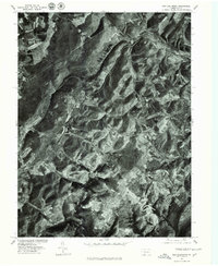
 1977 Central City1979 Print · USGSSomerset County's coal towns and developing lakes are seen in this late-seventies aerial survey. Trace industrial land use and neighborhood growth near Central City or explore the shorelines of Indian Lake and Lake Stonycreek.
 - 1977 Map of Stoystown, 1979 Print
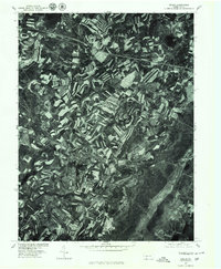
 1977 Stoystown1979 Print · USGSSomerset County agriculture and industry are visible in this late 1970s orthophotograph as the region balanced farming with surface mining. Researchers can trace the development of small communities like Stoystown, Shanksville, and Kimmelton along the banks of Stony Creek.
Showing maps 1-25 of 48
Top cities near Stonycreek Township
- Somerset historical maps
- Windber historical maps
- Meyersdale historical maps
- Napier Township historical maps
- Berlin historical maps
- Milford historical maps
See more
Top neighborhoods of Stonycreek Township
- Glade historical maps
- Coleman historical maps
- Boone historical maps
- Buckstown historical maps
- Reels Corners historical maps
- Lambertsville historical maps
See more
Frequently asked questions
- What are the different types of historical maps available for Stonycreek Township?
- What is the oldest map of Stonycreek Township?
- Where can I purchase historical maps of Stonycreek Township for my home or office?
- Where can I download high-res historical maps of Stonycreek Township?
- Are there historical topographic maps available for Stonycreek Township?
- Is there historical aerial imagery available for Stonycreek Township?
- Where are historical maps of Stonycreek Township sourced from?