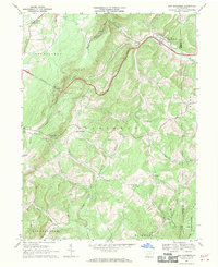
1967 Map of New Baltimore
USGS Topo · Published 1970About this map
The Raystown Branch Juniata River snakes through the northeast corner of this quadrangle, where the borough of New Baltimore sits along its banks near the Pennsylvania Turnpike. This area of the Allegheny Mountains is defined by sharp elevation changes, particularly at Dividing Ridge and Deeters Gap. The settlement pattern reflects a deeply rooted rural community, with family and congregational hubs like Sarver Ch, St Lukes Ch, and Mt Olive Ch scattered across the township lines of Northampton and Fairhope.
Find a feature on this map
33 named features on this map. Tap any name to fly to it.
Don’t see what you’re looking for? This feature index may not catch every label — zoom into the map to look around manually.
Map Details
Editions of this 1967 New Baltimore Map
Other maps of this area

1908 · Bedford
USGS Topo · 1:62,500

1910 · Bedford
USGS Topo · 1:62,500

1914 · Windber
USGS Topo · 1:62,500

1916 · Windber
USGS Topo · 1:62,500

1923 · Berlin
USGS Topo · 1:48,000

1927 · Hyndman
USGS Topo · 1:62,500

1929 · Berlin
USGS Topo · 1:62,500

1931 · Hyndman
USGS Topo · 1:62,500

1944 · Hyndman
USGS Topo · 1:62,500

1944 · Windber
USGS Topo · 1:62,500
Featured Places
- Fairhope Township, PA
- New Baltimore, PA
- Stonycreek Township, PA
- Glen Savage, Allegheny Township
- Glade, Stonycreek Township