2020s Maps of Oakland Township, Pennsylvania
Explore 2 historic maps of Oakland Township from the 2020s. These maps offer a rare glimpse into what life looked like during the 2020s — showing old roads, neighborhoods, homes, and landmarks that have changed or disappeared over time.
Whether you're researching your family's past, planning a metal detecting trip, or studying how Oakland Township's landscape evolved across the 2020s, these high-resolution maps are a powerful tool for exploring the history of this region.
- Focus on a specific era: All maps on this page are from the 2020s, giving you a focused view of this time period.
- See what’s changed: Compare century-old streets, trails, and buildings to today's modern landscape using overlays and satellite layers.
- Research with precision: Use these maps for genealogy, historical research, land use analysis, or educational projects.
- View, download, or print: Maps are fully viewable online in high resolution, and can be downloaded or printed for your own records.
Start exploring Oakland Township's history through authentic maps from the 2020s. This is your window into the past.
Oakland Township, PA maps
(2)- 2023 Map of Susquehanna, 2023 Print
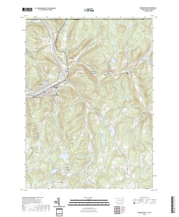 2023 Susquehanna2023 Print · USGSThe river valley at Susquehanna and Oakland is shown in this recent survey, capturing the region's transition from a major rail hub to a modern landscape. Researchers can locate numerous family burial sites like Evergreen Cem and trace the historic route of the D & H Rail-Trl.
 - 2023 Map of Great Bend, 2023 Print
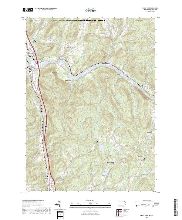 2023 Great Bend2023 Print · USGSThe Susquehanna River valley near the New York border is shown here in its modern landscape, where historical settlements and transportation corridors converge. Family historians can locate numerous burial sites, from Rose Hill Cem to the First Presbyterian Church Cem, alongside landmarks like Woodbridge Island.
End of results
Showing maps 1-2 of 2
Top cities near Oakland Township
- Chenango historical maps
- Fenton historical maps
- Windsor historical maps
- Kirkwood historical maps
- Conklin historical maps
- Colesville historical maps
See more
Top neighborhoods of Oakland Township
Frequently asked questions
- What are the different types of historical maps available for Oakland Township?
- What is the oldest map of Oakland Township?
- Where can I purchase historical maps of Oakland Township for my home or office?
- Where can I download high-res historical maps of Oakland Township?
- Are there historical topographic maps available for Oakland Township?
- Is there historical aerial imagery available for Oakland Township?
- Where are historical maps of Oakland Township sourced from?