2020s Maps of Cranberry Township, Pennsylvania
Explore 6 historic maps of Cranberry Township from the 2020s. These maps offer a rare glimpse into what life looked like during the 2020s — showing old roads, neighborhoods, homes, and landmarks that have changed or disappeared over time.
Whether you're researching your family's past, planning a metal detecting trip, or studying how Cranberry Township's landscape evolved across the 2020s, these high-resolution maps are a powerful tool for exploring the history of this region.
- Focus on a specific era: All maps on this page are from the 2020s, giving you a focused view of this time period.
- See what’s changed: Compare century-old streets, trails, and buildings to today's modern landscape using overlays and satellite layers.
- Research with precision: Use these maps for genealogy, historical research, land use analysis, or educational projects.
- View, download, or print: Maps are fully viewable online in high resolution, and can be downloaded or printed for your own records.
Start exploring Cranberry Township's history through authentic maps from the 2020s. This is your window into the past.
Cranberry Township, PA maps
(6)- 2023 Map of Franklin, 2023 Print
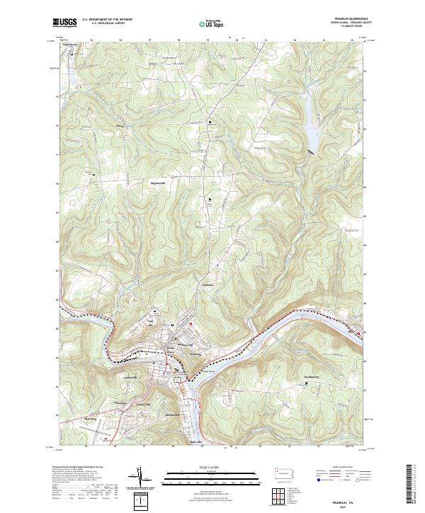 2023 Franklin2023 Print · USGSFranklin and the surrounding Allegheny River valley are shown in high detail in this recent survey. Local researchers can trace modern landmarks alongside historic sites like the Venango County Courthouse, Pioneer Cem, and the settlement of Bredinsburg.
 - 2023 Map of Oil City, 2023 Print
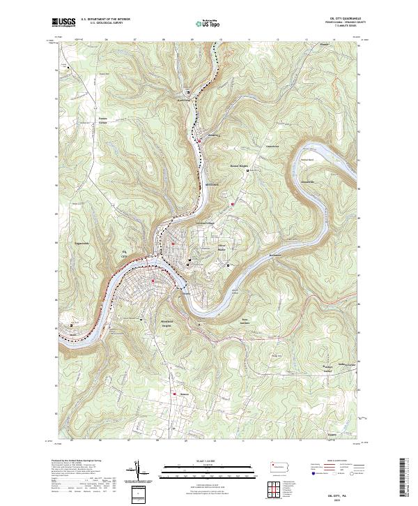 2023 Oil City2023 Print · USGSOil City and the surrounding Venango County hills appear here as a mature riverfront landscape defined by the Allegheny River and Oil Creek. Genealogists and researchers can locate Oil Seeps near Rynd Farm, numerous burial sites like Grove Hill Cem, and the campus of Venango College Clarion University.
 - 2023 Map of Kossuth, 2023 Print
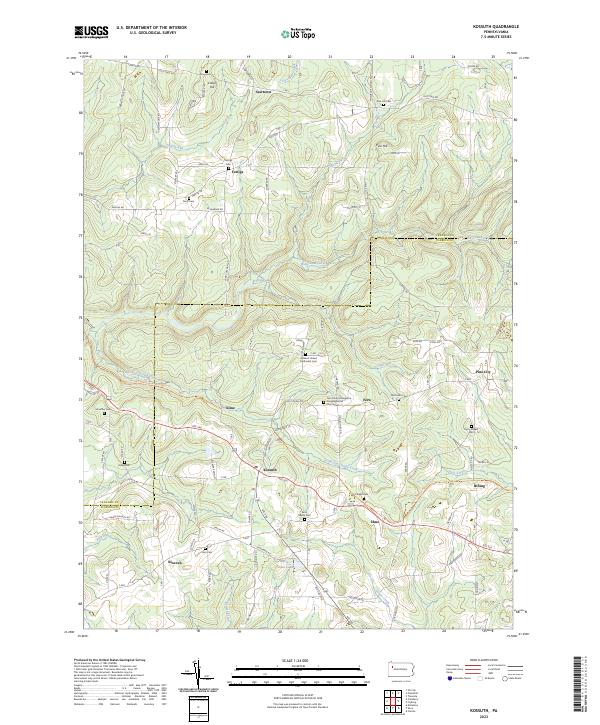 2023 Kossuth2023 Print · USGSClarion and Venango counties meet in this rural landscape at the dawn of the 2020s. Genealogists can trace family names across a high density of burial sites including Ashland United Methodist Cem, Fertigs Cem, and the Phipps Cem.
 - 2023 Map of President, 2023 Print
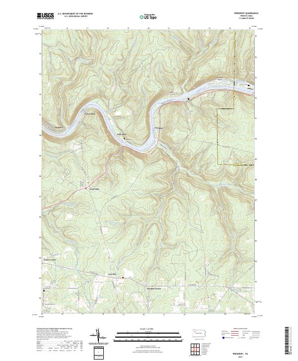 2023 President2023 Print · USGSThe Allegheny River corridor in northwestern Pennsylvania remains a landscape of winding water and isolated hamlets. Genealogists can trace family names at Heckathorn Cem and explore old riverside settlements like President and Henrys Bend.
 - 2023 Map of Kennerdell, 2023 Print
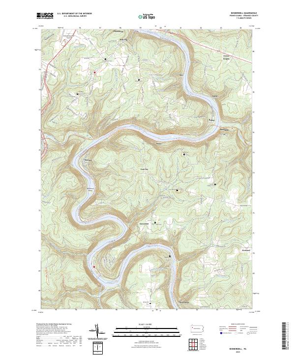 2023 Kennerdell2023 Print · USGSVenango County's river-driven geography is on full display here as the modern century finds the landscape shaped by its deep valleys. Researchers can trace ancestral sites at the Mays-Smith Cem, locate the small settlement of Coal City, or follow the Middle Allegheny River Water Trail and the North Country National Scenic Trl.
 - 2023 Map of Cranberry, 2023 Print
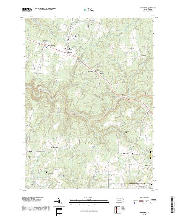 2023 Cranberry2023 Print · USGSThe ridges of Venango County come alive in this modern survey of the uplands south of Oil City. Genealogists and local historians can trace family plots at Saint Catherines Cem and Bickle Cem, or locate landmarks like Eakin Airport and Barrs Corners.
End of results
Showing maps 1-6 of 6
Top cities near Cranberry Township
- Oil City historical maps
- Franklin historical maps
- Sugarcreek historical maps
- Monroe historical maps
- Cherrytree Township historical maps
- Rockland Township historical maps
See more
Top neighborhoods of Cranberry Township
- Twin Oaks historical maps
- Van historical maps
- Egypt Corners historical maps
- Woodland Heights historical maps
- Rockmere historical maps
- Rose Gardens historical maps
See more
Frequently asked questions
- What are the different types of historical maps available for Cranberry Township?
- What is the oldest map of Cranberry Township?
- Where can I purchase historical maps of Cranberry Township for my home or office?
- Where can I download high-res historical maps of Cranberry Township?
- Are there historical topographic maps available for Cranberry Township?
- Is there historical aerial imagery available for Cranberry Township?
- Where are historical maps of Cranberry Township sourced from?