1960s Maps of Pittsfield Township, Pennsylvania
Explore 4 historic maps of Pittsfield Township from the 1960s. These maps offer a rare glimpse into what life looked like during the 1960s — showing old roads, neighborhoods, homes, and landmarks that have changed or disappeared over time.
Whether you're researching your family's past, planning a metal detecting trip, or studying how Pittsfield Township's landscape evolved across the 1960s, these high-resolution maps are a powerful tool for exploring the history of this region.
- Focus on a specific era: All maps on this page are from the 1960s, giving you a focused view of this time period.
- See what’s changed: Compare century-old streets, trails, and buildings to today's modern landscape using overlays and satellite layers.
- Research with precision: Use these maps for genealogy, historical research, land use analysis, or educational projects.
- View, download, or print: Maps are fully viewable online in high resolution, and can be downloaded or printed for your own records.
Start exploring Pittsfield Township's history through authentic maps from the 1960s. This is your window into the past.
Pittsfield Township, PA maps
(4)- 1968 Map of Pittsfield, 1971 Print
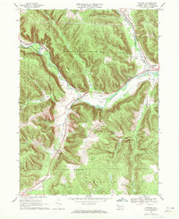 1968 Pittsfield1971 Print · USGSWestern Warren County in the late sixties shows a landscape of deep valleys and vital rail connections along Brokenstraw Creek. Researchers can trace the heritage of small settlements like Torpedo and Garland or locate family sites near Whitestown Cem.3 unique versions available
 - 1968 Map of Lottsville, 1971 Print
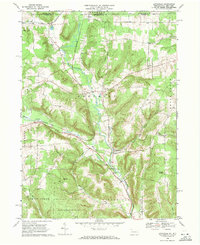 1968 Lottsville1971 Print · USGSWarren County’s northern borderlands in the late sixties remain a landscape of creek-side villages and family-named landmarks. Genealogists and local historians can trace burial sites at Bear Lake Cem or Brooks Hill Cem and follow the old Erie-Lackawanna rail line.3 unique versions available
 - 1968 Map of Sugar Grove, 1972 Print
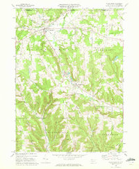 1968 Sugar Grove1972 Print · USGSThe Pennsylvania and New York border comes alive in the late sixties, showing a landscape of small farming valleys and early energy development. Genealogists and local historians can trace family roots through landmarks like Peoples Ch, Wesleyan Cem, and the old Stillwater Road.3 unique versions available
 - 1969 Map of Youngsville, 1971 Print
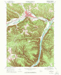 1969 Youngsville1971 Print · USGSYoungsville and the Allegheny River valley appear here in the late sixties, showing a landscape defined by industry and conservation. Local historians can trace the Penn Central rail lines and locate the County Home and Hospital or the historic St Lukes Ch.4 unique versions available
End of results
Showing maps 1-4 of 4
Top cities near Pittsfield Township
- Busti historical maps
- Corry historical maps
- Titusville historical maps
- Harmony historical maps
- Columbus historical maps
- Clymer historical maps
See more
Top neighborhoods of Pittsfield Township
Frequently asked questions
- What are the different types of historical maps available for Pittsfield Township?
- What is the oldest map of Pittsfield Township?
- Where can I purchase historical maps of Pittsfield Township for my home or office?
- Where can I download high-res historical maps of Pittsfield Township?
- Are there historical topographic maps available for Pittsfield Township?
- Is there historical aerial imagery available for Pittsfield Township?
- Where are historical maps of Pittsfield Township sourced from?