1950s Maps of York County, Pennsylvania
Explore 32 historic maps of York County from the 1950s. These maps offer a rare glimpse into what life looked like during the 1950s — showing old roads, neighborhoods, homes, and landmarks that have changed or disappeared over time.
Whether you're researching your family's past, planning a metal detecting trip, or studying how York County's landscape evolved across the 1950s, these high-resolution maps are a powerful tool for exploring the history of this region.
- Focus on a specific era: All maps on this page are from the 1950s, giving you a focused view of this time period.
- See what’s changed: Compare century-old streets, trails, and buildings to today's modern landscape using overlays and satellite layers.
- Research with precision: Use these maps for genealogy, historical research, land use analysis, or educational projects.
- View, download, or print: Maps are fully viewable online in high resolution, and can be downloaded or printed for your own records.
Start exploring York County's history through authentic maps from the 1950s. This is your window into the past.
York County, PA maps
(32)- 1950 Map of Harrisburg, 1952 Print
 1950 Harrisburg1952 Print · USGSMid-century Central Pennsylvania comes alive through its dense rail networks and river valley settlements during the post-war industrial era. Genealogists and historians can trace family roots through hubs like Harrisburg, locate Carlisle Barracks, or follow the Pennsylvania RR through the Lebanon Valley.
 - 1951 Map of Gettysburg, 1954 Print
 1951 Gettysburg1954 Print · USGSGettysburg and its surrounding Adams County townships appear here during the early fifties, blending solemn Civil War landmarks with a bustling mid-century rural economy. Genealogists can locate family-named sites like Ziegler Mill, trace students at Locust Grove Sch, or find ancestors at Conewago Chapel.3 unique versions available
 - 1952 Map of Mount Holly Springs, 1958 Print
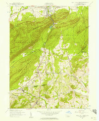 1952 Mount Holly Springs1958 Print · USGSCumberland and Adams counties meet at the mountain gaps of south-central Pennsylvania in the early 1950s. Trace the path of the Appalachian Trail and identify rural landmarks like the Telegraph relay station, Peach Glen, and Mt Zion Church.6 unique versions available
 - 1952 Map of Mechanicsburg, 1958 Print
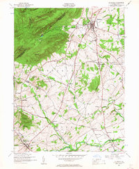
 1952 Mechanicsburg1958 Print · USGSCumberland County at mid-century shows a landscape of historic crossroad villages and burgeoning military infrastructure. Trace the early routes of the Appalachian Trail and find family-named landmarks like Leidighs, Churchtown, and Hickorytown.6 unique versions available
 - 1952 Map of Dillsburg, 1958 Print
 1952 Dillsburg1958 Print · USGSDillsburg and the surrounding rural townships of York and Adams Counties are shown in the early fifties as the region balanced agriculture with growing community centers. Researchers can trace old family sites and rural landmarks like Deardorffs Mill, Sunny Side Cemetery, and the Appalachian Trail.5 unique versions available
 - 1952 Map of Carlisle, 1959 Print
 1952 Carlisle1959 Print · USGSCumberland County at the midpoint of the century shows a landscape defined by its historic military presence and the emerging Turnpike. Genealogists and hikers can trace the Appalachian Trail over Long Mountain or locate family sites at Churchtown and Deardorffs Mill.2 unique versions available
 - 1953 Map of New Freedom
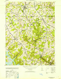 1953 New Freedom1953 Print · USGSThe Pennsylvania-Maryland border country comes to life in the early fifties, showing the rail-linked hamlets between York and Baltimore counties. Genealogists can trace family roots through sites like Summit Grove Camp Meeting, Heathcote Mill, and Ruhls School.
 - 1953 Map of Norrisville
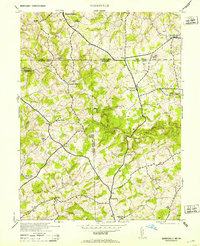 1953 Norrisville1953 Print · USGSThe Maryland-Pennsylvania border comes alive in this mid-century portrait of the Mason and Dixon Line and its surrounding farming communities. Genealogists and historians can trace the foundations of Norrisville and locate Ebaughs School or Amos Mill.2 unique versions available
 - 1953 Map of Lineboro, 1954 Print
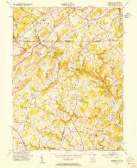 1953 Lineboro1954 Print · USGSThe Maryland-Pennsylvania borderlands come alive in this mid-century survey of the rural Gunpowder Falls watershed. Researchers can trace ancestral locations near Lineboro, find several early schools like Hokes Sch, or locate the flooding of the Prettyboy Reservoir.6 unique versions available
 - 1953 Map of Manchester, 1954 Print
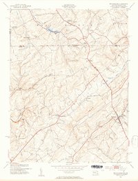 1953 Manchester1954 Print · USGSThe Maryland-Pennsylvania borderlands are captured here in the early fifties, where the historic Mason and Dixon Line bisects a landscape of small farming hamlets. Researchers can trace the layout of old rural crossroads such as Bachman Mills, Bixler, and Melrose.6 unique versions available
 - 1953 Map of Conowingo Dam, 1954 Print
 1953 Conowingo Dam1954 Print · USGSThe Cecil and Harford County borderlands are caught in a period of industrial transition during the 1950s. Genealogists and researchers can trace family landmarks like Darlington Cem, old schools at New Valley Sch, and the rail lines serving Conowingo Sta.6 unique versions available
 - 1953 Map of Red Lion, 1956 Print
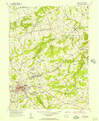 1953 Red Lion1956 Print · USGSYork County's industrial and rural landscape is captured here in the early fifties as the region's rail network supported growing boroughs and historic furnaces. Researchers can trace family sites at Snavelys Sch, Leiphart Mill, or the historic Canadochly Ch.5 unique versions available
 - 1953 Map of Stewartstown, 1956 Print
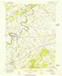
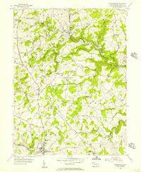 1953 Stewartstown1956 Print · USGSYork County's agricultural heartland is documented here in the early fifties, as the Maryland and Pennsylvania rail line served rural hubs like Stewartstown. Genealogists and historians can trace legacy landmarks from Sechrist Mill to local burials at Old Roundhill Cem.4 unique versions available
 - 1953 Map of Seven Valleys, 1956 Print
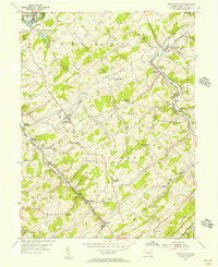 1953 Seven Valleys1956 Print · USGSYork County's rail-and-river geography is on full display in the mid-1950s as locomotives steamed through the valley corridors. Researchers can trace the heritage of rural communities and transit hubs like Hanover Junction, Brodbecks, and St Peters & Paul Ch.5 unique versions available
 - 1953 Map of Abbottstown, 1956 Print
 1953 Abbottstown1956 Print · USGSMid-century Adams and York counties are shown as a landscape of small farming communities and country churches linked by the three-lane Lincoln Highway. Genealogists can trace family footprints at Paradise Protectory, Mummerts Ch, and Airy Hill Sch.5 unique versions available
 - 1954 Map of Baltimore
 1954 Baltimore1954 Print · USGSThe Mid-Atlantic region in the early fifties shows a landscape of growing suburban centers and heavy rail corridors. Trace mid-century transit networks and military landmarks from the Aberdeen Proving Ground to the Gettysburg National Military Park.
 - 1954 Map of Glen Rock, 1956 Print
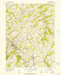 1954 Glen Rock1956 Print · USGSSouthern York County in the mid-fifties is characterized by the busy rail corridor between Glen Rock and New Freedom. Researchers can trace old family schoolhouses like Krout Sch, historic country churches such as Bupps Union Ch, and the winding Susquehanna Trail.6 unique versions available
 - 1954 Map of West York, 1956 Print
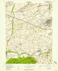
 1954 West York1956 Print · USGSMid-century York County is captured during a period of rapid suburban growth and industrial peak. Genealogists can trace family names at Strayers Cem or Codorus Cem, while researchers can follow the path of the Western Maryland RR and the West Branch Pennsylvania Canal.5 unique versions available
 - 1954 Map of Hanover, 1956 Print
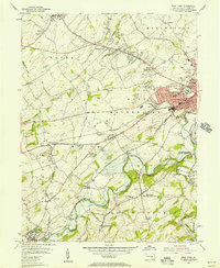
 1954 Hanover1956 Print · USGSMid-century York County is captured here during a period of steady growth along the Western Maryland rail line. Genealogists and local researchers can trace family landmarks like Menges Mills, Fuhrmans Mill, and the expansive Mt Olivet Cem.5 unique versions available
 - 1954 Map of York, 1957 Print
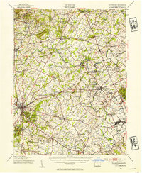
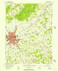
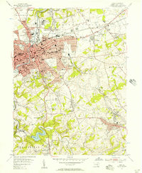 1954 York1957 Print · USGSMid-century York and its surrounding boroughs are captured here during a period of significant post-war growth. Researchers can trace family-named sites and vanished industrial markers like Reynolds Mill, Kralls Ch, and the Drive-in Theater near Stonybrook.4 unique versions available
 - 1955 Map of Holtwood, 1956 Print
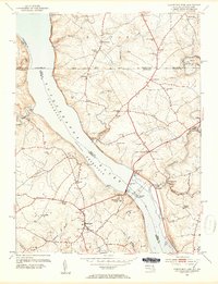
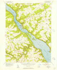 1955 Holtwood1956 Print · USGSThe Susquehanna River defines this mid-century landscape as it flows through the reservoirs of the Holtwood Dam. Genealogists and historians can trace family-named sites like Erbs Mill, the old Coyne Lock, and the Pennsylvania RR corridor.6 unique versions available
 - 1955 Map of Safe Harbor, 1956 Print
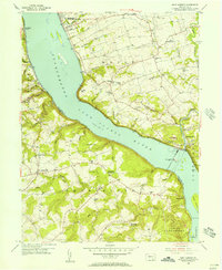 1955 Safe Harbor1956 Print · USGSThe Susquehanna River valley and the engineering of the river for power are seen here in the mid-1950s. Genealogists can trace family roots at Manor Meetinghouse, Bethany Ch, and small crossroads like Washington.7 unique versions available
 - 1955 Map of Airville, 1956 Print
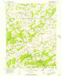
 1955 Airville1956 Print · USGSYork County in the mid-fifties shows a landscape of river-valley hamlets and upland farms centered around the winding Muddy Creek. Genealogists can trace family footprints at Guinston Ch, the Indian Steps Museum, and old schoolhouses like Township Sch.5 unique versions available
 - 1956 Map of Baltimore
 1956 Baltimore1956 Print · USGSMid-century Maryland and Pennsylvania are captured here during a period of massive suburban and military growth across the Chesapeake region. Genealogists and historians can trace the rail corridors of the Baltimore & Ohio RR and locate landmarks like Fort McHenry or the Aberdeen Proving Ground.
 - 1956 Map of Fawn Grove, 1957 Print
 1956 Fawn Grove1957 Print · USGSThe Pennsylvania and Maryland borderlands are captured here in the mid-fifties, showing a landscape of small farming settlements and winding creek valleys. Genealogists and local historians can trace family locations near Fawn Grove, St Pauls Ch, and the rural community of Constitution.3 unique versions available
Showing maps 1-25 of 32
Top cities of York County
- York historical maps
- Hanover historical maps
- West Manheim Township historical maps
- Shrewsbury historical maps
- Red Lion historical maps
- West York historical maps
See more
Frequently asked questions
- What are the different types of historical maps available for York County?
- What is the oldest map of York County?
- Where can I purchase historical maps of York County for my home or office?
- Where can I download high-res historical maps of York County?
- Are there historical topographic maps available for York County?
- Is there historical aerial imagery available for York County?
- Where are historical maps of York County sourced from?