1990s Maps of York County, Pennsylvania
Explore 24 historic maps of York County from the 1990s. These maps offer a rare glimpse into what life looked like during the 1990s — showing old roads, neighborhoods, homes, and landmarks that have changed or disappeared over time.
Whether you're researching your family's past, planning a metal detecting trip, or studying how York County's landscape evolved across the 1990s, these high-resolution maps are a powerful tool for exploring the history of this region.
- Focus on a specific era: All maps on this page are from the 1990s, giving you a focused view of this time period.
- See what’s changed: Compare century-old streets, trails, and buildings to today's modern landscape using overlays and satellite layers.
- Research with precision: Use these maps for genealogy, historical research, land use analysis, or educational projects.
- View, download, or print: Maps are fully viewable online in high resolution, and can be downloaded or printed for your own records.
Start exploring York County's history through authentic maps from the 1990s. This is your window into the past.
York County, PA maps
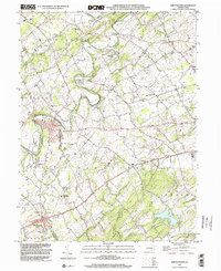
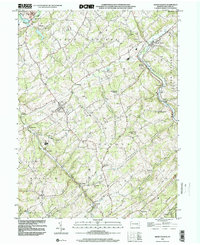
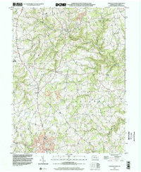
(24)- 1990 Map of Hampton, 1995 Print
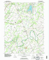 1990 Hampton1995 Print · USGSAdams County’s rural landscape is captured here in the early nineties, showcasing the area's transition between agricultural tradition and modern development. Genealogists can locate family sites near New Chester, St Johns Ch, and the many cemeteries dotting the banks of Conewago Creek.
 - 1992 Map of Airville, 1995 Print
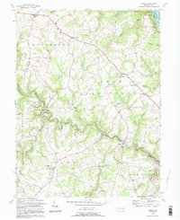 1992 Airville1995 Print · USGSSoutheastern York County is captured in the early nineties, showing a landscape defined by the deep valleys of Muddy Creek and the Susquehanna. Trace family history at Guinston Ch, Indian Steps Museum, and the many hamlets from Airville to Muddy Creek Forks.
 - 1992 Map of Conowingo Dam, 1995 Print
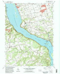
 1992 Conowingo Dam1995 Print · USGSThe Susquehanna River valley at the Maryland-Pennsylvania border is shown here during the late twentieth century, centered on the Conowingo Dam. Genealogists and historians can trace family locations near St Patricks Ch, the Mason and Dixon Line, and the old settlement of Rowlandsville.
 - 1992 Map of Fawn Grove, 1995 Print
 1992 Fawn Grove1995 Print · USGSThe Pennsylvania-Maryland border country comes to life in the 1990s, showcasing the rural landscapes of York and Harford Counties. Genealogists and historians can trace family locations near Fawn Grove Cem, the old Pennsylvania Railroad line, and the landmarks of Rocks State Park.
 - 1995 Map of Safe Harbor, 1996 Print
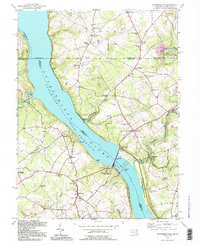
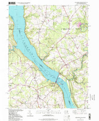
 1995 Safe Harbor1996 Print · USGSThe Susquehanna River splits Lancaster and York counties in the mid-nineties, centering on the massive engineering of the Safe Harbor Dam. Researchers can trace old family foundations near Washington Boro or locate rural landmarks like Ann Letort Sch and Shenks Ferry.
 - 1995 Map of Conowingo Dam, 1999 Print
 1995 Conowingo Dam1999 Print · USGSThe Susquehanna River borderlands in the late twentieth century highlight the massive Conowingo Dam and the historical Mason and Dixon Line. Genealogists and local historians can trace family locations near Darlington, Rowlandsville, and Harmony Chapel.
 - 1997 Map of Columbia West, 1999 Print
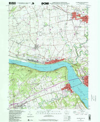 1997 Columbia West1999 Print · USGSThe Susquehanna River corridor thrives in the late nineties as a hub of rail activity and riverfront industry between Lancaster and York. Genealogists can locate family landmarks like Eberly Cem, Donegal Springs, and schools such as Kraybill Sch.
 - 1998 Map of Hanover, 2000 Print
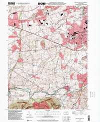
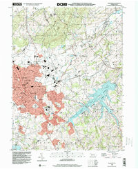 1998 Hanover2000 Print · USGSYork County's southern borderlands near the end of the century reveal a landscape of growing towns and industrial heritage. Genealogists and researchers can trace family landmarks like Mt Olivet Cem, Menges Mills, and several rural schools such as Bears Sch and Zumbrum Sch.
 - 1998 Map of Steelton, 2000 Print
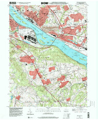 1998 Steelton2000 Print · USGSThe Susquehanna River corridor south of Harrisburg shows a landscape defined by heavy industry and aviation at the close of the century. Local historians can trace the development of Steelton and Goldsboro (Etters PO) or locate family sites like Paddletown Cem and St Pauls Ch.
 - 1998 Map of West York, 2000 Print
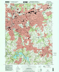
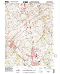
 1998 West York2000 Print · USGSWest York and its surrounding townships show the transition from rural landscape to suburban growth in the late nineties. Genealogists and historians can trace family locations through Strayers Cem, visit old school sites like Boyer Sch, and locate the New Salem (York New Salem PO).
 - 1999 Map of Middletown, 2001 Print
 1999 Middletown2001 Print · USGSThe Lower Susquehanna valley at the turn of the millennium shows a complex mix of industrial infrastructure and rural traditions. Researchers can trace the development of Middletown and Royalton or locate family sites like Stoverdale Ch and Goldsboro (Etters PO).
 - 1999 Map of Dover, 2001 Print
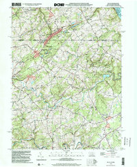
 1999 Dover2001 Print · USGSNorthern York County at the end of the century shows a blend of suburban growth and traditional rural landscapes. Trace local history through landmark sites like Susquehanna Speedway, Zions View, and historic country churches like St James Ch.
 - 1999 Map of York, 2001 Print
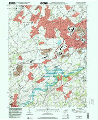
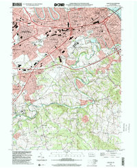
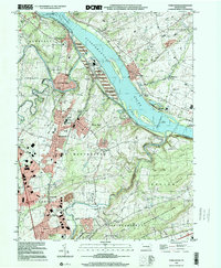
 1999 York2001 Print · USGSYork and its surrounding boroughs are captured at the close of the twentieth century, showing a transition from dense urban centers to burgeoning suburban valleys. Trace local history through family landmarks like Reynolds Mill, old burial grounds such as Stump Cem, and the historic Lincoln Highway.
 - 1999 Map of Lemoyne, 2001 Print
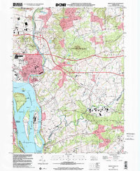
 1999 Lemoyne2001 Print · USGSThe West Shore communities and the Susquehanna River are captured here at the end of the century. Trace the evolution of historic settlements like Shiremanstown and Eberlys Mill, or locate family sites at Lantz Cem and Messiah College.
 - 1999 Map of Delta, 2001 Print
 1999 Delta2001 Print · USGSThe Pennsylvania-Maryland border country at the end of the century reveals a landscape shaped by stone extraction and rural commerce. Researchers can trace the industrial legacy of Funkhouser Quarry, the Old Railroad Grade, and local landmarks like the Fire Observation Station No 77.
 - 1999 Map of Glen Rock, 2001 Print
 1999 Glen Rock2001 Print · USGSSouthern York County at the end of the twentieth century shows a landscape of historic boroughs linked by winding creeks and modern interchanges. Genealogists and local historians can trace family sites at Friedensaal Ch Cem, the borough of Glen Rock, and the aptly named village of Railroad.
 - 1999 Map of Mechanicsburg, 2001 Print
 1999 Mechanicsburg2001 Print · USGSCumberland County at the close of the century shows a blend of military industry and rural tradition. Trace local genealogy at Bakers Church, the Silver Spring Meeting House, or the vanished schoolhouses like Givler School.
 - 1999 Map of York Haven, 2001 Print
 1999 York Haven2001 Print · USGSThe Susquehanna River corridor at the end of the twentieth century shows a blend of industrial legacy and growing residential communities. Genealogists and historians can locate family landmarks like Haldeman Cem, the historic Codorus Furnace, and Mundis Mill.
 - 1999 Map of Red Lion, 2002 Print
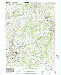 1999 Red Lion2002 Print · USGSYork County at the close of the twentieth century reveals a landscape shaped by early industry and community nodes like Red Lion and Hallam. Genealogists and historians can trace family roots through numerous sites including Margaretta Furnace, Mazie Gable Sch Cem, and Leiphart Mill.
 - 1999 Map of Wellsville, 2002 Print
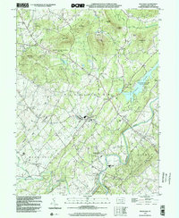 1999 Wellsville2002 Print · USGSThe Wellsville and Rossville area of York County is captured here at the end of the century, showing a landscape of state parklands and valley farms. Genealogists and local historians can locate Detters Mill, the Chestnut Grove Cem, and small crossroads like Kralltown.
 - 1999 Map of Airville, 2002 Print
 1999 Airville2002 Print · USGSSouthern York County remained a landscape of dispersed hamlets and historic congregations at the close of the twentieth century. Genealogists and local historians can map out rural life via Muddy Creek Forks, the Indian Steps Museum, and old country schools like Clearville School.
 - 1999 Map of Abbottstown, 2002 Print
 1999 Abbottstown2002 Print · USGSThe Adams and York county line comes alive in the late nineties, showing the historic corridor between Abbottstown and East Berlin. Genealogists and historians can trace family plots at St Marys Ch Cem or locate the Paradise Protectory near the Pigeon Hills.
 - 1999 Map of Seven Valleys, 2002 Print
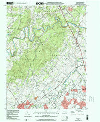
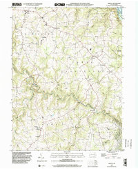
 1999 Seven Valleys2002 Print · USGSSouthern York County's rail-and-creek valleys come alive in this map from the late twentieth century. Genealogists and local historians can trace family roots through old rural crossroads and landmarks like Hanover Junction, Seitzville, and the Zion Shaeffer Union Ch.
 - 1999 Map of Stewartstown, 2002 Print
 1999 Stewartstown2002 Print · USGSSouthern York County's agrarian landscape is preserved here as it appeared in the late twentieth century, centered on the hub of Stewartstown. Researchers can trace the legacy of local industry through family-named landmarks like Sechrist Mill, Hyson Mill, and Grove Mill.
End of results
Showing maps 1-24 of 24
Top cities of York County
- York historical maps
- Hanover historical maps
- West Manheim Township historical maps
- Shrewsbury historical maps
- Red Lion historical maps
- West York historical maps
See more
Frequently asked questions
- What are the different types of historical maps available for York County?
- What is the oldest map of York County?
- Where can I purchase historical maps of York County for my home or office?
- Where can I download high-res historical maps of York County?
- Are there historical topographic maps available for York County?
- Is there historical aerial imagery available for York County?
- Where are historical maps of York County sourced from?