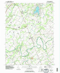
1990 Map of Hampton
USGS Topo · Published 1995About this map
Conewago Creek winds through this Adams County landscape, defining the rural character of a region where historic hamlets and modern recreation meet. Centered on the settlement of Hampton, the area is marked by a high density of long-standing community pillars, including the Huntington Friends Ch and the Lower Bermudian Ch. The northern portion is dominated by the reservoir at Lake Meade, featuring the private Biels & Lake Meade Landing Strip alongside established residential clusters.
Find a feature on this map
66 named features on this map. Tap any name to fly to it.
Don’t see what you’re looking for? This feature index may not catch every label — zoom into the map to look around manually.
Map Details
Editions of this 1990 Hampton Map
This is the sole edition of this map. No revisions or reprints were ever made.
Other maps of this area

1904 · Carlisle
USGS Topo · 1:62,500

1906 · New Cumberland
USGS Topo · 1:62,500

1908 · Gettysburg
USGS Topo · 1:62,500

1920 · Hanover
USGS Topo · 1:62,500

1922 · Hanover
USGS Topo · 1:62,500

1942 · Gettysburg
USGS Topo · 1:125,000

1943 · New Cumberland
USGS Topo · 1:62,500

1943 · Carlisle
USGS Topo · 1:62,500

1944 · Gettysburg
USGS Topo · 1:31,680

1944 · Mc Sherrystown
USGS Topo · 1:31,680
Featured Places
- Latimore Township, PA
- Huntington Township, PA
- Mount Pleasant Township, PA
- Hamilton Township, PA
- Oxford Township, PA