
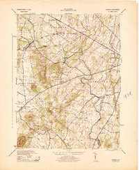
1944 Map of Gettysburg
USGS Topo · Published 1944About this map
Gettysburg National Military Park dominates the landscape of this 1944 survey, detailing the intricate topography and memorialized sites of the famous Civil War battlefield during the mid-20th century. The town of Gettysburg serves as the hub for a dense network of roads and railroads, including the Reading, Western, and Maryland lines. Beyond the borough, the map meticulously records the tactical terrain that defined the 1863 conflict, from Cemetery Hill and Culps Hill to the southern heights of Little Round Top and the jagged Devils Den.
Find a feature on this map
64 named features on this map. Tap any name to fly to it.
Don’t see what you’re looking for? This feature index may not catch every label — zoom into the map to look around manually.
Map Details
Editions of this 1944 Gettysburg Map
This is the sole edition of this map. No revisions or reprints were ever made.
Other maps of this area

1908 · Gettysburg
USGS Topo · 1:62,500

1909 · Fairfield
USGS Topo · 1:62,500

1911 · Taneytown
USGS Topo · 1:62,500

1911 · Emmitsburg
USGS Topo · 1:62,500

1942 · Gettysburg
USGS Topo · 1:125,000

1943 · Emmitsburg
USGS Topo · 1:62,500

1944 · Mc Sherrystown
USGS Topo · 1:31,680

1944 · Littlestown
USGS Topo · 1:31,680

1944 · Arendtsville
USGS Topo · 1:31,680
1944 · Fairfield
USGS Topo · 1:31,680