Old Maps of Dover Township, Pennsylvania for Genealogy
Trace your family roots with 41 historic maps of Dover Township. These high-res maps reveal old neighborhoods, homesites, landmarks, and streets — helping you uncover where your ancestors lived and how the area evolved over time.
- Explore historic neighborhoods: Identify where your relatives may have lived in the 1800s or 1900s.
- Compare maps over time: Trace the changes in streets, buildings, and landmarks for multi-generational research.
- Perfect for genealogy & ancestry research: Used by family historians and researchers to map out lineage and migration.
These maps are an incredible resource for exploring your personal connection to Dover Township's past.
Dover Township, PA maps
(41)- 1906 Map of New Cumberland
 1906 New Cumberland1906 Print · USGSCentral Pennsylvania at the opening of the twentieth century shows a landscape transitioning from canal-era transit to a heavy rail and industrial economy. Genealogists can locate family landmarks like Shafer Schoolhouse, Salem Church, and the Middletown Ferry.8 unique versions available
 - 1920 Map of Hanover, 1959 Print
 1920 Hanover1959 Print · USGSYork County's rail-and-mill economy is on full display in the early twentieth century, centered on the busy junctions of Hanover and Hanover Junction. Genealogists and local historians can trace hundreds of rural sites, including Lischy Church, Porters Sideling, and the Trimmer's School.
 - 1922 Map of Hanover
 1922 Hanover1922 Print · USGSYork County's rolling farmland and industrial hubs are captured here in the early 1920s, just as the Lincoln Highway began transforming rural travel. Genealogists can locate family-named landmarks and country institutions like Wildasin Chapel, Menges Mills, and the Iron Ridge Ironore PO.5 unique versions available
 - 1943 Map of New Cumberland
 1943 New Cumberland1943 Print · USGSGreater Harrisburg and the lower Susquehanna valley appear here in the midst of the Second World War, showing a landscape of intense military and social transition. Researchers can trace family roots through numerous country landmarks like Eberlys Mill, the Methodist Orphanage, and Messiah Bible College.
 - 1948 Map of Baltimore
 1948 Baltimore1948 Print · USGSMaryland and Pennsylvania crossroads are captured in the late 1940s, showing a landscape defined by historic rail lines and major military installations. Genealogists can trace family connections in Gettysburg, Westminster, and near the U.S. Naval Academy in Annapolis.2 unique versions available
 - 1950 Map of Harrisburg, 1952 Print
 1950 Harrisburg1952 Print · USGSMid-century Central Pennsylvania comes alive through its dense rail networks and river valley settlements during the post-war industrial era. Genealogists and historians can trace family roots through hubs like Harrisburg, locate Carlisle Barracks, or follow the Pennsylvania RR through the Lebanon Valley.
 - 1953 Map of Abbottstown, 1956 Print
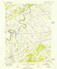 1953 Abbottstown1956 Print · USGSMid-century Adams and York counties are shown as a landscape of small farming communities and country churches linked by the three-lane Lincoln Highway. Genealogists can trace family footprints at Paradise Protectory, Mummerts Ch, and Airy Hill Sch.5 unique versions available
 - 1954 Map of Baltimore
 1954 Baltimore1954 Print · USGSThe Mid-Atlantic region in the early fifties shows a landscape of growing suburban centers and heavy rail corridors. Trace mid-century transit networks and military landmarks from the Aberdeen Proving Ground to the Gettysburg National Military Park.
 - 1954 Map of West York, 1956 Print
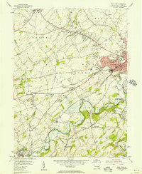 1954 West York1956 Print · USGSMid-century York County is captured during a period of rapid suburban growth and industrial peak. Genealogists can trace family names at Strayers Cem or Codorus Cem, while researchers can follow the path of the Western Maryland RR and the West Branch Pennsylvania Canal.5 unique versions available
 - 1956 Map of Baltimore
 1956 Baltimore1956 Print · USGSMid-century Maryland and Pennsylvania are captured here during a period of massive suburban and military growth across the Chesapeake region. Genealogists and historians can trace the rail corridors of the Baltimore & Ohio RR and locate landmarks like Fort McHenry or the Aberdeen Proving Ground.
 - 1956 Map of New Cumberland, 1958 Print
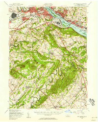 1956 New Cumberland1958 Print · USGSMid-century development meets deep-rooted Pennsylvania history as the post-war expansion of Harrisburg reaches toward the rural townships of York County. Trace family roots and local landmarks from Eberlys Mill and the Quaker Meetinghouse Cem to the sprawling Harrisburg State Airport.3 unique versions available
 - 1957 Map of Harrisburg
 1957 Harrisburg1957 Print · USGSMid-century Central Pennsylvania comes into focus as a bustling network of rail, river, and mountain ridges. Genealogists and historians can trace the development of the State Capitol and surrounding hubs like Middletown, Columbia, and Pottsville.7 unique versions available
 - 1957 Map of Baltimore, 1964 Print
 1957 Baltimore1964 Print · USGSMaryland and Southern Pennsylvania are shown during the mid-century expansion of the Baltimore-Washington corridor. Researchers can trace the extensive rail lines of the Baltimore & Ohio RR and locate sites like Fort Detrick and Gettysburg National Military Park.5 unique versions available
 - 1961 Map of Harrisburg
 1961 Harrisburg1961 Print · USGSCentral Pennsylvania is shown at a mid-century peak of industrial and military activity, from the Susquehanna water gaps to the fertile Dutch Country. Genealogists and historians can trace the rail corridors of the Pennsylvania RR and find landmarks like Carlisle Barracks or the Anthracite Coal Fields.2 unique versions available
 - 1961 Map of Baltimore
 1961 Baltimore1961 Print · USGSMaryland and Pennsylvania are captured at a mid-century peak of industrial and military expansion. Genealogists and historians can trace rail corridors like the Western Maryland Ry or locate regional landmarks such as Camp Detrick and Kent Island.
 - 1963 Map of Wellsville, 1964 Print
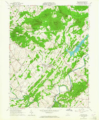 1963 Wellsville1964 Print · USGSWellsville and the York County valleys are captured in the early sixties as new recreational lands were established. Genealogists and historians can trace family locations near Rocky Spring Church, Detters Mill, and the many small crossroads like Kralltown.3 unique versions available
 - 1963 Map of Dover, 1965 Print
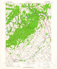 1963 Dover1965 Print · USGSYork County in the early sixties showcases a transition from rural mountain hollows to mid-century recreation and suburban growth. Trace family-named landmarks and local hubs like Strinestown, the Susquehanna Speedway, and Gifford Pinchot State Park.3 unique versions available
 - 1964 Map of Harrisburg
 1964 Harrisburg1964 Print · USGSCentral Pennsylvania in the mid-fifties reveals a landscape shaped by ridge-and-valley geology and critical Cold War infrastructure. Researchers can trace the massive Indiantown Gap Military Reservation or the rail corridors of the Pennsylvania RR and Reading RR.
 - 1983 Map of York, 1984 Print
 1983 York1984 Print · USGSSouth Central Pennsylvania and Northern Maryland meet along the Susquehanna during the early eighties. Genealogists and local historians can trace the transit networks of Conrail and Amtrak through towns like Red Lion and Seven Valleys.2 unique versions available
 - 1984 Map of Harrisburg, 1985 Print
 1984 Harrisburg1985 Print · USGSCentral Pennsylvania in the mid-eighties shows a landscape defined by the winding Susquehanna River and the industrial growth of its river towns. Researchers can trace the rail corridors of Amtrak and Conrail or explore the bounds of Fort Indiantown Gap Military Reservation.2 unique versions available
 - 1989 Map of Baltimore
 1989 Baltimore1989 Print · USGSThe Mid-Atlantic corridor in the late eighties is captured here, from the Baltimore harbor to the Blue Ridge foothills. Researchers can trace the sprawling footprints of Aberdeen Proving Ground, the historic grounds of Gettysburg National Military Park, and the winding Susquehanna River.
 - 1998 Map of West York, 2000 Print
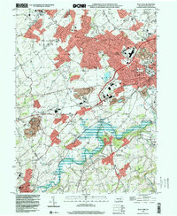 1998 West York2000 Print · USGSWest York and its surrounding townships show the transition from rural landscape to suburban growth in the late nineties. Genealogists and historians can trace family locations through Strayers Cem, visit old school sites like Boyer Sch, and locate the New Salem (York New Salem PO).
 - 1999 Map of Dover, 2001 Print
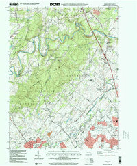 1999 Dover2001 Print · USGSNorthern York County at the end of the century shows a blend of suburban growth and traditional rural landscapes. Trace local history through landmark sites like Susquehanna Speedway, Zions View, and historic country churches like St James Ch.
 - 1999 Map of Wellsville, 2002 Print
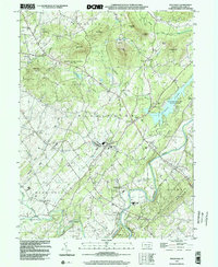 1999 Wellsville2002 Print · USGSThe Wellsville and Rossville area of York County is captured here at the end of the century, showing a landscape of state parklands and valley farms. Genealogists and local historians can locate Detters Mill, the Chestnut Grove Cem, and small crossroads like Kralltown.
 - 1999 Map of Abbottstown, 2002 Print
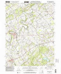 1999 Abbottstown2002 Print · USGSThe Adams and York county line comes alive in the late nineties, showing the historic corridor between Abbottstown and East Berlin. Genealogists and historians can trace family plots at St Marys Ch Cem or locate the Paradise Protectory near the Pigeon Hills.
Showing maps 1-25 of 41
Top cities near Dover Township
- Harrisburg historical maps
- York historical maps
- Hanover historical maps
- Middletown historical maps
- Parkville historical maps
- New Cumberland historical maps
See more
Top neighborhoods of Dover Township
- Admire historical maps
- Roler historical maps
- Davidsburg historical maps
- Harmony Grove historical maps
- Weigelstown historical maps
- Mackey Ford historical maps
See more
Frequently asked questions
- What are the different types of historical maps available for Dover Township?
- What is the oldest map of Dover Township?
- Where can I purchase historical maps of Dover Township for my home or office?
- Where can I download high-res historical maps of Dover Township?
- Are there historical topographic maps available for Dover Township?
- Is there historical aerial imagery available for Dover Township?
- Where are historical maps of Dover Township sourced from?