1900s (20th Century) Maps of Gatchellville, Fawn Township
Explore 12 historic maps of Gatchellville from the 1900s (20th Century). These maps offer a rare glimpse into what life looked like during the 1900s — showing old roads, neighborhoods, homes, and landmarks that have changed or disappeared over time.
Whether you're researching your family's past, planning a metal detecting trip, or studying how Gatchellville's landscape evolved across the 1900s, these high-resolution maps are a powerful tool for exploring the history of this region.
- Focus on a specific era: All maps on this page are from the 1900s, giving you a focused view of this time period.
- See what’s changed: Compare century-old streets, trails, and buildings to today's modern landscape using overlays and satellite layers.
- Research with precision: Use these maps for genealogy, historical research, land use analysis, or educational projects.
- View, download, or print: Maps are fully viewable online in high resolution, and can be downloaded or printed for your own records.
Start exploring Gatchellville's history through authentic maps from the 1900s. This is your window into the past.
Gatchellville, Fawn Township maps
(12)- 1912 Map of Mc Calls Ferry
 1912 Mc Calls Ferry1912 Print · USGSThe Susquehanna River valley near Safe Harbor is caught at a peak of rail-and-mill development during this pre-war survey. Genealogists and historians can trace the foundations of Martic Forge, find remote country schools like Red Hill School, and locate old stops on the Pennsylvania RR.5 unique versions available
 - 1943 Map of Mc Calls Ferry
 1943 Mc Calls Ferry1943 Print · USGSMid-century Pennsylvania life unfolds along the Susquehanna during the 1940s, where river-based industry and rail lines meet established farming townships. Researchers can trace ancestral locations from Washington Boro to rural landmarks like Erbs Mill, Bethel Church, and the Red Hill School.2 unique versions available
 - 1948 Map of Baltimore
 1948 Baltimore1948 Print · USGSMaryland and Pennsylvania crossroads are captured in the late 1940s, showing a landscape defined by historic rail lines and major military installations. Genealogists can trace family connections in Gettysburg, Westminster, and near the U.S. Naval Academy in Annapolis.2 unique versions available
 - 1954 Map of Baltimore
 1954 Baltimore1954 Print · USGSThe Mid-Atlantic region in the early fifties shows a landscape of growing suburban centers and heavy rail corridors. Trace mid-century transit networks and military landmarks from the Aberdeen Proving Ground to the Gettysburg National Military Park.
 - 1955 Map of Airville, 1956 Print
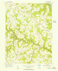 1955 Airville1956 Print · USGSYork County in the mid-fifties shows a landscape of river-valley hamlets and upland farms centered around the winding Muddy Creek. Genealogists can trace family footprints at Guinston Ch, the Indian Steps Museum, and old schoolhouses like Township Sch.5 unique versions available
 - 1956 Map of Baltimore
 1956 Baltimore1956 Print · USGSMid-century Maryland and Pennsylvania are captured here during a period of massive suburban and military growth across the Chesapeake region. Genealogists and historians can trace the rail corridors of the Baltimore & Ohio RR and locate landmarks like Fort McHenry or the Aberdeen Proving Ground.
 - 1957 Map of Baltimore, 1964 Print
 1957 Baltimore1964 Print · USGSMaryland and Southern Pennsylvania are shown during the mid-century expansion of the Baltimore-Washington corridor. Researchers can trace the extensive rail lines of the Baltimore & Ohio RR and locate sites like Fort Detrick and Gettysburg National Military Park.5 unique versions available
 - 1961 Map of Baltimore
 1961 Baltimore1961 Print · USGSMaryland and Pennsylvania are captured at a mid-century peak of industrial and military expansion. Genealogists and historians can trace rail corridors like the Western Maryland Ry or locate regional landmarks such as Camp Detrick and Kent Island.
 - 1983 Map of York, 1984 Print
 1983 York1984 Print · USGSSouth Central Pennsylvania and Northern Maryland meet along the Susquehanna during the early eighties. Genealogists and local historians can trace the transit networks of Conrail and Amtrak through towns like Red Lion and Seven Valleys.2 unique versions available
 - 1989 Map of Baltimore
 1989 Baltimore1989 Print · USGSThe Mid-Atlantic corridor in the late eighties is captured here, from the Baltimore harbor to the Blue Ridge foothills. Researchers can trace the sprawling footprints of Aberdeen Proving Ground, the historic grounds of Gettysburg National Military Park, and the winding Susquehanna River.
 - 1992 Map of Airville, 1995 Print
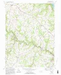 1992 Airville1995 Print · USGSSoutheastern York County is captured in the early nineties, showing a landscape defined by the deep valleys of Muddy Creek and the Susquehanna. Trace family history at Guinston Ch, Indian Steps Museum, and the many hamlets from Airville to Muddy Creek Forks.
 - 1999 Map of Airville, 2002 Print
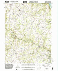 1999 Airville2002 Print · USGSSouthern York County remained a landscape of dispersed hamlets and historic congregations at the close of the twentieth century. Genealogists and local historians can map out rural life via Muddy Creek Forks, the Indian Steps Museum, and old country schools like Clearville School.
End of results
Showing maps 1-12 of 12
Top cities near Gatchellville
- Forest Hill historical maps
- West Lampeter Township historical maps
- Bel Air historical maps
- Willow Street historical maps
- Millersville historical maps
- Shrewsbury historical maps
See more
Frequently asked questions
- What are the different types of historical maps available for Gatchellville?
- What is the oldest map of Gatchellville?
- Where can I purchase historical maps of Gatchellville for my home or office?
- Where can I download high-res historical maps of Gatchellville?
- Are there historical topographic maps available for Gatchellville?
- Is there historical aerial imagery available for Gatchellville?
- Where are historical maps of Gatchellville sourced from?