2020s Maps of Foster, Rhode Island
Explore 10 historic maps of Foster from the 2020s. These maps offer a rare glimpse into what life looked like during the 2020s — showing old roads, neighborhoods, homes, and landmarks that have changed or disappeared over time.
Whether you're researching your family's past, planning a metal detecting trip, or studying how Foster's landscape evolved across the 2020s, these high-resolution maps are a powerful tool for exploring the history of this region.
- Focus on a specific era: All maps on this page are from the 2020s, giving you a focused view of this time period.
- See what’s changed: Compare century-old streets, trails, and buildings to today's modern landscape using overlays and satellite layers.
- Research with precision: Use these maps for genealogy, historical research, land use analysis, or educational projects.
- View, download, or print: Maps are fully viewable online in high resolution, and can be downloaded or printed for your own records.
Start exploring Foster's history through authentic maps from the 2020s. This is your window into the past.
Foster, RI maps
(10)- 2021 Map of East Killingly, 2021 Print
 2021 East Killingly2021 Print · USGSCovers Foster, including Killingly, Plainfield, and other nearby areas
 - 2021 Map of Clayville, 2021 Print
 2021 Clayville2021 Print · USGSCovers Foster, including Scituate, Glocester, and other nearby areas
 - 2021 Map of Oneco, 2021 Print
 2021 Oneco2021 Print · USGSCovers Foster, including Coventry, Plainfield, and other nearby areas
 - 2021 Map of Coventry Center, 2021 Print
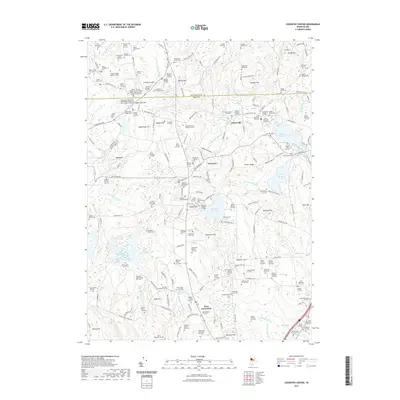 2021 Coventry Center2021 Print · USGSCovers Foster, including Coventry, Scituate, and other nearby areas
 - 2023 Map of East Killingly, 2023 Print
 2023 East Killingly2023 Print · USGSCovers Foster, including Killingly, Plainfield, and other nearby areas
 - 2023 Map of Oneco, 2023 Print
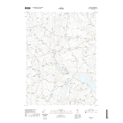
 2023 Oneco2023 Print · USGSCovers Foster, including Coventry, Plainfield, and other nearby areas
 - 2024 Map of Oneco, 2024 Print
 2024 Oneco2024 Print · USGSThe Connecticut and Rhode Island borderlands are documented here in recent years, showing the wooded hills and family settlements between Moosup and Greene. Researchers can trace dozens of family burial sites like the Stephen Burlingame Lot Cem and Thomas Morris Lot Cem.
 - 2024 Map of East Killingly, 2024 Print
 2024 East Killingly2024 Print · USGSCrossing the Connecticut and Rhode Island border in the early twenty-first century, this landscape preserves centuries of family history. Genealogists can trace specific ancestral plots like the Dr Solomon Drowne Lot or find old community landmarks at Old Chestnut Hill Cem and Jerimoth Hill.
 - 2024 Map of Clayville, 2024 Print
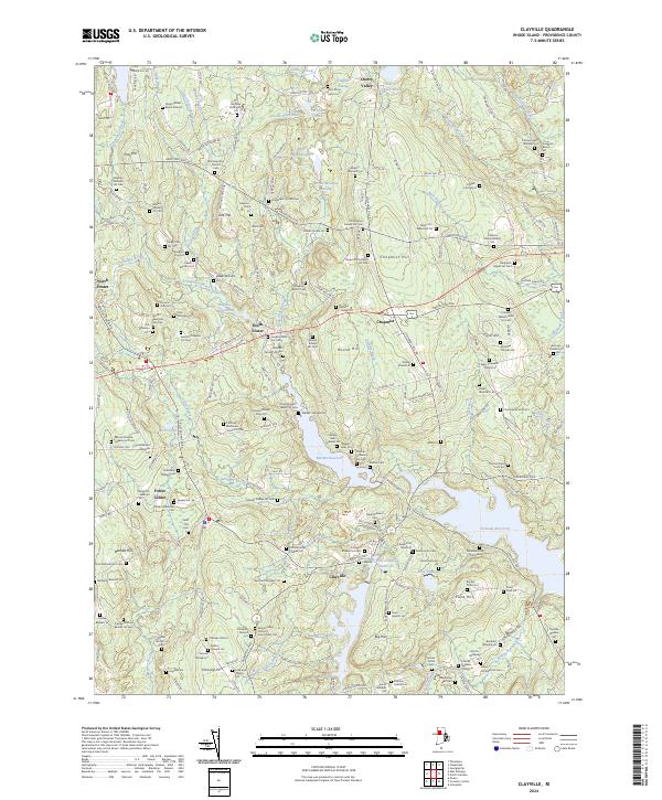 2024 Clayville2024 Print · USGSProvidence County in the mid-2020s remains a landscape of historic family farmsteads and quiet reservoirs. Genealogists can locate dozens of ancestral burial plots like the Keech-Windsor Lot and Captain Dean Kimball Lot near Chopmist Hill.
 - 2024 Map of Coventry Center, 2024 Print
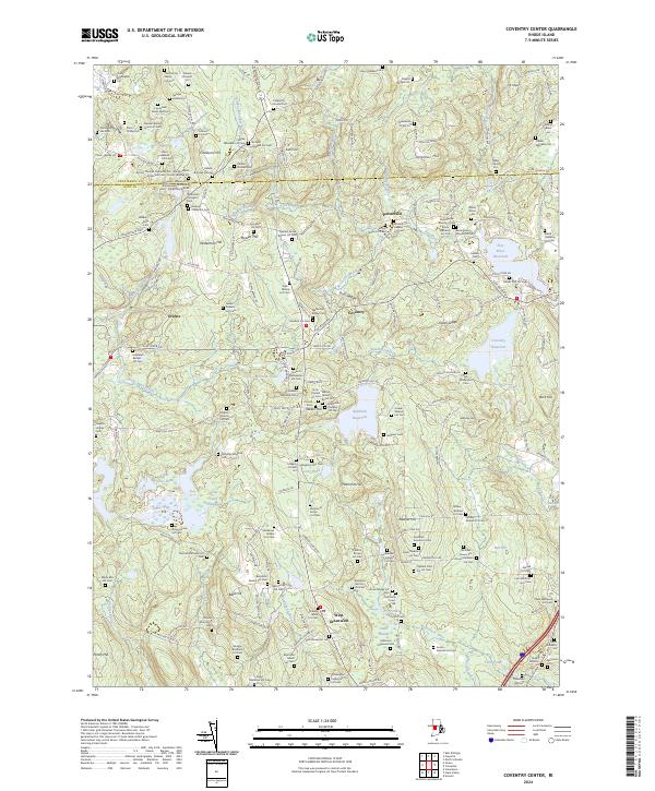 2024 Coventry Center2024 Print · USGSThe western Rhode Island interior comes into focus in this contemporary survey, where historic family homesteads meet modern water management. Genealogists can locate dozens of private burial sites like the Lieutenant James Wells Lot and Fenner Fry Lot near the Flat River Reservoir.
End of results
Showing maps 1-10 of 10
Top cities near Foster
- Warwick historical maps
- Cranston historical maps
- Woonsocket historical maps
- Coventry historical maps
- West Warwick historical maps
- Johnston historical maps
See more
Top neighborhoods of Foster
- South Foster historical maps
- North Foster historical maps
- Hopkins Mills historical maps
- Simmons Corner historical maps
- Moosup Valley historical maps
Frequently asked questions
- What are the different types of historical maps available for Foster?
- What is the oldest map of Foster?
- Where can I purchase historical maps of Foster for my home or office?
- Where can I download high-res historical maps of Foster?
- Are there historical topographic maps available for Foster?
- Is there historical aerial imagery available for Foster?
- Where are historical maps of Foster sourced from?