Old Maps of Oconee County, South Carolina
Explore 80 old maps of Oconee County, spanning from 1886 to today. These high-resolution historic maps reveal how streets, neighborhoods, landmarks, and natural features evolved over time — perfect for genealogy, metal detecting, research, and local history exploration.
What you can do with these maps:
- See how Oconee County changed over time: Compare historical maps to modern-day views to trace roads, homesites, rail lines & more.
- View detailed metadata: Each map includes creators, publishers, year, scale, and archive source.
- Overlay maps with satellite & LiDAR: Visualize the past alongside modern tools to explore terrain & human change.
- Trusted historical sources: Maps sourced from the USGS, Library of Congress, and other archives.
- Access maps your way: View online, download high-res files, or order prints for personal or research use.
Start exploring old maps of Oconee County to uncover forgotten places, hidden landmarks, and the deep history beneath your feet.
Oconee County, SC maps
(80)- 1886 Map of Walhalla
 1886 Walhalla1886 Print · USGSThe foothills of the Blue Ridge come alive in this late nineteenth-century survey of the Georgia and South Carolina borderlands. Genealogists and historians can trace the early rail networks through Walhalla and Toccoa, or locate family landmarks like Batchelor's Retreat and Mosley's Mill.
 - 1888 Map of Pickens
 1888 Pickens1888 Print · USGSThe South Carolina Piedmont comes alive in the late nineteenth century, showing the rural communities of Pickens and Anderson. Genealogists can trace family landmarks like Sutton's Mill, Six Mile Church, and river crossings at Cherry's Ferry.
 - 1891 Map of Cowee
 1891 Cowee1891 Print · USGSWestern North Carolina's high mountain reaches are captured here in the late nineteenth century as the railroad began to transform the region. Trace early transport routes like the Western North Carolina Railroad and Cowee Tunnel alongside old settlements at Franklin and Quallatown.
 - 1891 Map of Carnesville
 1891 Carnesville1891 Print · USGSNortheast Georgia in the late nineteenth century is documented here as a landscape of small river settlements and emerging rail towns. Genealogists can trace family roots through locations like Jewellville, Fort Lamar, and the river crossing at Braggs Fy.6 unique versions available
 - 1892 Map of Walhalla
 1892 Walhalla1892 Print · USGSThe tri-state border region of Georgia and the Carolinas comes alive in this late nineteenth-century survey. Genealogists and historians can trace family-named landmarks like Young Davis's or locate river crossings like Jenkins's Ferry and the Bachelors Retreat P.O.7 unique versions available
 - 1893 Map of Elberton
 1893 Elberton1893 Print · USGSThe Georgia-South Carolina borderlands come alive in the 1890s, centering on the river-and-rail economy of the Savannah Valley. Genealogists can trace family names and early community hubs through Browns Ferry, Coldwater Church, and Ruckersville.5 unique versions available
 - 1894 Map of Pickens
 1894 Pickens1894 Print · USGSNorthwest South Carolina in the late nineteenth century was a landscape of river-driven industry and emerging rail lines. Researchers can trace ancestral roots through family landmarks like Watson Mill, the community at Old Pickens, and the rural New Hope Church.6 unique versions available
 - 1896 Map of Walhalla
 1896 Walhalla1896 Print · USGSThe tri-state mountain country comes alive in this late 1800s survey of the Oconee and Habersham borderlands. Researchers can trace early river commerce and transit through Ramsey Ferry, the tracks of the Blue Ridge Railroad, and the industrial site of Mosley Mill.
 - 1897 Map of Cowee
 1897 Cowee1897 Print · USGSThe Great Smoky Mountains and Blue Ridge foothills appear here in the 1890s, when the railroad first began to penetrate the high gaps. Trace family roots and mountain industry through old settlements like Quallatown, Sylva, and the Cowee Tunnel engineering site.4 unique versions available
 - 1905 Map of Pisgah, 1956 Print
 1905 Pisgah1956 Print · USGSThe North Carolina high country around the turn of the century reveals a land of timber tracts and emerging mountain retreats. Genealogists and hikers can trace early routes to Buck Spring Lodge, follow the Southern RR tracks, and locate vanished settlements like Angeline and Calhoun.
 - 1906 Map of Pisgah, 1934 Print
 1906 Pisgah1934 Print · USGSThe Blue Ridge highlands at the turn of the century reveal a landscape of mountain river valleys and early timber frontiers. Genealogists and historians can trace family-named bridges and crossings like Graham Bridge or locate vanished settlements such as Grange and Retreat.2 unique versions available
 - 1907 Map of Cowee
 1907 Cowee1907 Print · USGSWestern North Carolina at the turn of the century shows a landscape of rail-connected river towns and high mountain gaps. Genealogists can trace early homesteads and industry through landmarks like West Mill, Roanes Mill, and the many settlements along the Southern Railway.5 unique versions available
 - 1935 Map of Cashiers
 1935 Cashiers1935 Print · USGSJackson County and the North Carolina-South Carolina border appear here in the mid-1930s as modern surveying techniques were first being applied. Researchers can trace early state infrastructure such as St Hy No 106 as it passes through the Nantahala National Forest.
 - 1935 Map of Reid
 1935 Reid1935 Print · USGSThe high ridges of Transylvania County are captured here in the mid-1930s as federal surveyors first mapped the area using aerial photography. Researchers can trace the early mountain roads like State No 28 near the settlement of Reid and the headwaters of Morton Creek.
 - 1946 Map of Reid, 1956 Print
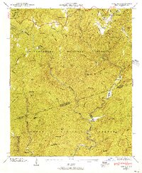 1946 Reid1956 Print · USGSThe high mountain country of the Blue Ridge is documented here in the mid-1940s, just as the national forests were maturing. Genealogists and hikers can trace the remote Oakland Cem, the tiny settlement of Cane Brake, and the old rail path of the Southern Railway.4 unique versions available
 - 1946 Map of Cashiers, 1957 Print
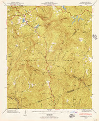 1946 Cashiers1957 Print · USGSJackson County high country comes alive in the mid-1940s, showcasing the intersection of the Blue Ridge and the Tennessee Divide. Genealogists and historians can locate family landmarks like Upper Zachary Cem, Montvale Sch, and the community of Grimshawes.5 unique versions available
 - 1947 Map of Reid
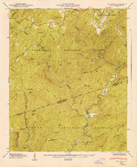 1947 Reid1947 Print · USGSThe Blue Ridge mountains at the North and South Carolina border are captured here in the late 1940s, showing a land defined by national forests and river gorges. Researchers can locate the Oakland Cem, trace the Thompson River, and find remote landmarks like Musterground Mtn.
 - 1947 Map of Cashiers
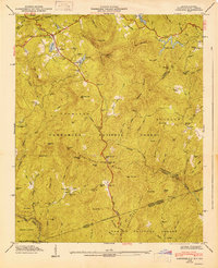 1947 Cashiers1947 Print · USGSThe Blue Ridge high country of Jackson County is meticulously detailed here in the late 1940s, centered on the Cashiers plateau. Genealogists can locate family sites like Upper Zachary Cem, the rural Montvale Sch, and the remote junction at Ellicott Rock.2 unique versions available
 - 1950 Map of La France, 1964 Print
 1950 La France1964 Print · USGSAnderson County's rural communities and river crossings are captured here at the start of the 1950s. Genealogists and local historians can trace family roots through numerous sites like Holly Springs Ch, Portman Dam, and the Blue Ridge RR.2 unique versions available
 - 1951 Map of La France
 1951 La France1951 Print · USGSAnderson County in the early fifties is captured here as a landscape of tight-knit rural communities and vital river crossings. Researchers can trace ancestral locations through numerous sites like Sandy Springs, Asbury Clark Memorial Ch, and Earles Bridge.2 unique versions available
 - 1951 Map of Clemson, 1952 Print
 1951 Clemson1952 Print · USGSThe foothills of South Carolina come to life in the early fifties, centered on the growing campus of Clemson Agricultural College. Researchers can trace the Southern rail line through Central or locate family landmarks like Lawrence Chapel and Mt Zion Cem.6 unique versions available
 - 1954 Map of Greenville, 1965 Print
 1954 Greenville1965 Print · USGSThe Upstate and Northeast Georgia are captured here during a decade of massive transformation as new reservoirs reshaped the Piedmont. Genealogists and hikers can trace the Appalachian Trail over Brasstown Bald or locate old community centers like Demorest, Westminster, and Royston.3 unique versions available
 - 1955 Map of Knoxville
 1955 Knoxville1955 Print · USGSThe Southern Appalachians and the Smoky Mountains are shown here at a peak of mid-century development and conservation. Genealogists and historians can trace the early road networks connecting Gatlinburg, Waynesville, and the Cherokee Indian Reservation across the high ridges.
 - 1957 Map of Tugaloo Lake, 1958 Print
 1957 Tugaloo Lake1958 Print · USGSThe river borders of Georgia and South Carolina come alive in the 1950s as they wind through the deep mountain forests of Rabun and Oconee counties. Researchers can trace the hydroelectric developments at Tugaloo Lake or locate family landmarks like Prather Bridge and Old Liberty Ch.4 unique versions available
 - 1957 Map of Rainy Mountain, 1958 Print
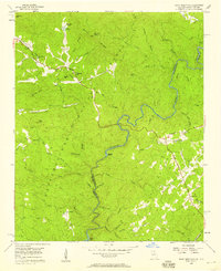 1957 Rainy Mountain1958 Print · USGSThe border between Georgia and South Carolina is defined by the winding Chattooga River during the late 1950s. Researchers can trace rural life and mountain genealogies through landmarks like Godfrey Cem, Longcreek, and the Rainy Mtn Camp.4 unique versions available
Showing maps 1-25 of 80
Top cities of Oconee County
- Seneca historical maps
- Walhalla historical maps
- Westminster historical maps
- West Union historical maps
- Salem historical maps
Frequently asked questions
- What are the different types of historical maps available for Oconee County?
- What is the oldest map of Oconee County?
- Where can I purchase historical maps of Oconee County for my home or office?
- Where can I download high-res historical maps of Oconee County?
- Are there historical topographic maps available for Oconee County?
- Is there historical aerial imagery available for Oconee County?
- Where are historical maps of Oconee County sourced from?