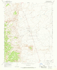
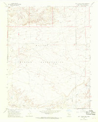
1960s Maps of Shiprock Agency
Explore 52 historic maps of Shiprock Agency from the 1960s. These maps offer a rare glimpse into what life looked like during the 1960s — showing old roads, neighborhoods, homes, and landmarks that have changed or disappeared over time.
Whether you're researching your family's past, planning a metal detecting trip, or studying how Shiprock Agency's landscape evolved across the 1960s, these high-resolution maps are a powerful tool for exploring the history of this region.
- Focus on a specific era: All maps on this page are from the 1960s, giving you a focused view of this time period.
- See what’s changed: Compare century-old streets, trails, and buildings to today's modern landscape using overlays and satellite layers.
- Research with precision: Use these maps for genealogy, historical research, land use analysis, or educational projects.
- View, download, or print: Maps are fully viewable online in high resolution, and can be downloaded or printed for your own records.
Start exploring Shiprock Agency's history through authentic maps from the 1960s. This is your window into the past.
Shiprock Agency maps
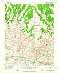
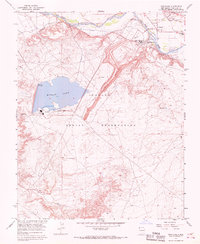
(52)- 1962 Map of Cortez
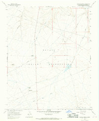
 1962 Cortez1962 Print · USGSThe Four Corners region comes alive in the early sixties, showing a landscape defined by reservation lands and federal forests. Trace the route of the Rio Grande Southern RR or locate the Uranium and vanadium mines near Monticello.
 - 1962 Map of Montezuma Creek, 1963 Print
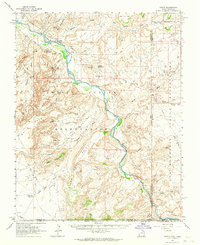
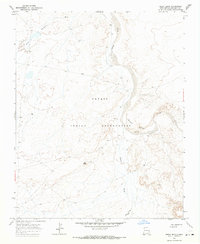
 1962 Montezuma Creek1963 Print · USGSSan Juan County at the height of the early 1960s oil boom shows a landscape of desert mesas and industrial growth along the river. Genealogists and historians can trace the Aneth Oil Field infrastructure, the Montezuma Creek Sch, and the remote settlement of Fiddlers Green.3 unique versions available
 - 1962 Map of Bluff, 1963 Print
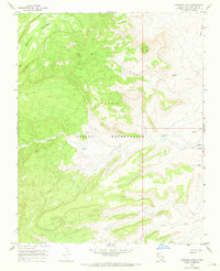
 1962 Bluff1963 Print · USGSThe high desert landscape around the San Juan River comes into focus in the early sixties, showing the settlement of Bluff and the surrounding mesas. Historians can trace the Mormon Road and locate numerous cliff dwellings and the St Christophers Mission.3 unique versions available
 - 1962 Map of Boundary Butte, 1964 Print
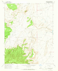
 1962 Boundary Butte1964 Print · USGSThe high desert of San Juan County during the early 1960s reveals a unique intersection of ancient history and modern industry. Researchers can trace the layout of the Tohonadla Oil Field and locate ancestral sites like Poncho House and various Cliff Dwellings.3 unique versions available
 - 1962 Map of Aneth, 1964 Print
 1962 Aneth1964 Print · USGSThe Four Corners region in the early sixties reveals a landscape where ancient history and modern industry meet along the San Juan River. Genealogists and historians can trace indigenous heritage and early infrastructure through features like the Aneth settlement, Cliff Dwellings, and the Navajo Trail.
 - 1962 Map of White Mesa Village, 1964 Print
 1962 White Mesa Village1964 Print · USGSThe Navajo Nation's high desert meets the industrial energy boom of the early sixties along the San Juan River. Researchers can trace tribal settlements like White Rock Village alongside oil industry outposts such as Aztec Camp, Morans Camp, and the Aneth Oil Field.2 unique versions available
 - 1963 Map of Waterflow, 1966 Print
 1963 Waterflow1966 Print · USGSJewett Valley and Waterflow sit along the San Juan River in the early sixties, caught between traditional irrigation and a growing energy economy. Researchers can trace local coal history at the Adamson Mines or locate family sites like the Jewett Valley Cem and Sacred Heart Academy.3 unique versions available
 - 1966 Map of Cortez
 1966 Cortez1966 Print · USGSThe Four Corners region in the mid-sixties reveals a landscape of high mesas, tribal lands, and archaeological preserves. Researchers can trace the ancient sites at Hovenweep National Monument, follow the Denver & Rio Grande Western Railroad, or locate old settlements like Ginger Hill and Yellow Jacket.
 - 1966 Map of Yellow Hill, 1968 Print
 1966 Yellow Hill1968 Print · USGSThe Navajo Nation in the mid-1960s reveals a high-desert landscape shaped by geology and water management. Trace the pathways of Dead Mans Wash and Pajarito Creek or locate landmarks like Yellow Hill and Big Gap Reservoir.3 unique versions available
 - 1966 Map of The Hogback North, 1968 Print
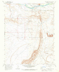 1966 The Hogback North1968 Print · USGSThe Navajo Nation in the mid-1960s was defined by its industrial resources and the towering ridge of The Hogback. Researchers can trace the legacy of energy extraction at the Hogback Oil Field or locate historic waterworks like the Fruitland Irrigation Canal.3 unique versions available
 - 1966 Map of Sulphur Spring, 1968 Print
 1966 Sulphur Spring1968 Print · USGSThe Navajo Nation in the mid-1960s reveals an environment shaped by both traditional landmarks and modern energy extraction. Researchers can trace early infrastructure like pipelines and oil wells near Sulphur Spring and the Chaco River.3 unique versions available
 - 1966 Map of Sheep Springs, 1969 Print
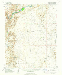
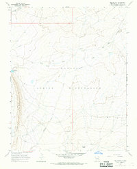
 1966 Sheep Springs1969 Print · USGSSan Juan County at the mid-century reveals the arid landscape of the Navajo Indian Reservation along the Route 666 corridor. Genealogists and researchers can trace the vicinity of Sheep Springs and the isolated Black House near Grey Mesa.2 unique versions available
 - 1966 Map of Tsin-nas-kid, 1969 Print
 1966 Tsin-nas-kid1969 Print · USGSSan Juan County was a landscape of remote desert washes and traditional Navajo lands in the mid-sixties. Researchers can trace historic water sources and landforms like Captain Tom Reservoir, Tsin-nas-kid, and To-dil-hil Wash.
 - 1966 Map of Sand Spring, 1969 Print
 1966 Sand Spring1969 Print · USGSThe high desert of the Navajo Nation in San Juan County was documented in detail during the mid-1960s. Genealogists and historians can trace seasonal water sources like Sand Spring and the extensive network of Shiprock Wash and Salt Wash.2 unique versions available
 - 1966 Map of Ship Rock, 1969 Print
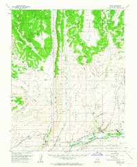
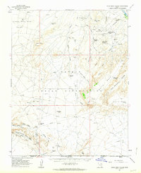
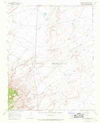
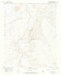
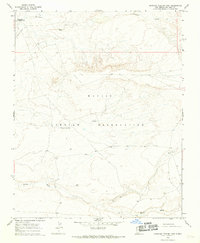
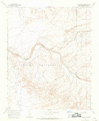
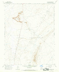
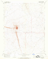 1966 Ship Rock1969 Print · USGSThe Navajo Nation high desert is captured here in the late sixties, centered on the unmistakable geological spire of Ship Rock. Researchers can trace the mid-century energy landscape across the Rattlesnake Oil Field and the volcanic Dike.3 unique versions available
 - 1966 Map of Newcomb NE, 1969 Print
 1966 Newcomb NE1969 Print · USGSThe Navajo Indian Reservation in the mid-1960s reveals a landscape of complex drainage systems and early mineral exploration. Trace the seasonal flow of the Chaco River and locate industrial markers like a lone Mine or Drill Hole.2 unique versions available
 - 1966 Map of Burnham Trading Post, 1969 Print
 1966 Burnham Trading Post1969 Print · USGSSan Juan County was a landscape of remote outposts and ephemeral desert washes during the mid-sixties. Researchers can locate the Burnham Trading Post, trace the Brimhall Wash, and identify local features like Tee-ni-di-tso or the secluded Landing Strip.2 unique versions available
 - 1966 Map of The Pillar 3 NE, 1969 Print
 1966 The Pillar 3 NE1969 Print · USGSThe high desert of San Juan County during the late sixties reveals a landscape defined by the Navajo Indian Reservation and industrial expansion. Researchers can trace the courses of the Chaco River and De-na-zin Wash alongside early energy infrastructure like several Mine sites and an extensive Pipeline.4 unique versions available
 - 1966 Map of Fruitland, 1969 Print
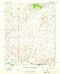
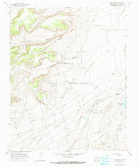
 1966 Fruitland1969 Print · USGSIn the mid-sixties, this San Juan County area shows the industrial rise of the Navajo Indian Reservation. Researchers can trace the massive Navajo Mine and Four Corners Powerplant alongside the Nenahnezad Indian Sch and Fruitland.3 unique versions available
 - 1966 Map of Great Bend, 1969 Print
 1966 Great Bend1969 Print · USGSSan Juan County in the mid-1960s was a landscape of remote desert plateaus and seasonal watercourses. Genealogists and historians can trace industrial footprints at Mines near Day Mesa or follow the winding Chaco River past the Great Bend.
 - 1966 Map of Sanostee West, 1969 Print
 1966 Sanostee West1969 Print · USGSThe Navajo Indian Reservation in the mid-1960s reveals a high-desert landscape of deep washes and prominent geological formations. Researchers can trace seasonal water patterns and land use through Sanostee Wash, Beautiful Mountain, and Rock Ridge.2 unique versions available
 - 1966 Map of Mitten Rock, 1969 Print
 1966 Mitten Rock1969 Print · USGSThe high desert of the Navajo Nation comes to life in the mid-1960s, showing the intersection of traditional landscapes and modern infrastructure. Researchers can trace the drainage of Salt Wash and Shiprock Wash or locate remote industrial sites like Big Gap Reservoir and several Drill Hole markers.3 unique versions available
 - 1966 Map of Table Mesa, 1969 Print
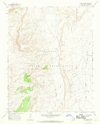
 1966 Table Mesa1969 Print · USGSSan Juan County was a hub of energy development in the mid-sixties, where industrial infrastructure met the high desert. Researchers can trace the layout of the Table Mesa Oil Field and find landmarks like Cathedral Cliff and Barber Peak.2 unique versions available
 - 1966 Map of Naschitti, 1969 Print
 1966 Naschitti1969 Print · USGSThe Navajo Nation's high-desert landscape comes to life in the late 1960s, showing the early infrastructure of the Naschitti community. Local historians can trace the course of the 666 highway and locate seasonal drainage points like Naschitti Wash and Salt Springs Wash.2 unique versions available
 - 1966 Map of Bisti Trading Post, 1969 Print
 1966 Bisti Trading Post1969 Print · USGSSan Juan County was a landscape of remote outposts and rising industry in the mid-sixties. Local researchers can trace the reach of the Navajo Indian Reservation, locate the isolated Bisti Trading Post, and identify early Mines along Hunter Wash.2 unique versions available
Showing maps 1-25 of 52
Top cities near Shiprock Agency
Top neighborhoods of Shiprock Agency
- Horse Mesa historical maps
- Beclabito historical maps
- Little Water historical maps
- Tselakai Dezza historical maps
- Twin Falls historical maps
- Rattlesnake historical maps
See more
Frequently asked questions
- What are the different types of historical maps available for Shiprock Agency?
- What is the oldest map of Shiprock Agency?
- Where can I purchase historical maps of Shiprock Agency for my home or office?
- Where can I download high-res historical maps of Shiprock Agency?
- Are there historical topographic maps available for Shiprock Agency?
- Is there historical aerial imagery available for Shiprock Agency?
- Where are historical maps of Shiprock Agency sourced from?