Old Maps of Allendale County, South Carolina for Genealogy
Trace your family roots with 57 historic maps of Allendale County. These high-res maps reveal old neighborhoods, homesites, landmarks, and streets — helping you uncover where your ancestors lived and how the area evolved over time.
- Explore historic neighborhoods: Identify where your relatives may have lived in the 1800s or 1900s.
- Compare maps over time: Trace the changes in streets, buildings, and landmarks for multi-generational research.
- Perfect for genealogy & ancestry research: Used by family historians and researchers to map out lineage and migration.
These maps are an incredible resource for exploring your personal connection to Allendale County's past.
Allendale County, SC maps
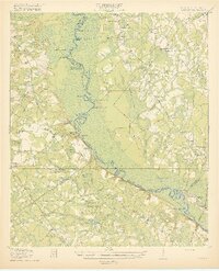
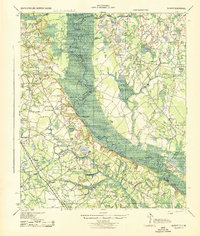
(57)- 1918 Map of Varnville
 1918 Varnville1918 Print · USGSCovers Allendale County, including Fairfax, Hampton, and other nearby areas4 unique versions available
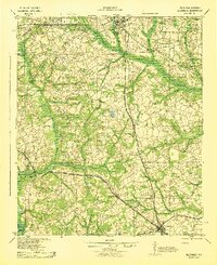
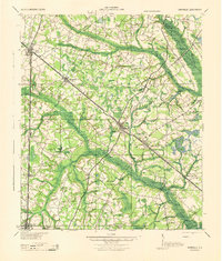
 - 1919 Map of Olar
 1919 Olar1919 Print · USGSCovers Allendale County, including Ehrhardt, Olar, and other nearby areas3 unique versions available
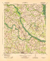
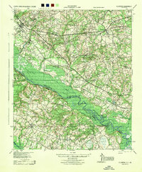
 - 1919 Map of Shirley
 1919 Shirley1919 Print · USGSCovers Allendale County, including Estill, Newington, and other nearby areas3 unique versions available
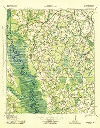
 - 1919 Map of Allendale
 1919 Allendale1919 Print · USGSCovers Allendale County, including Barnwell, Allendale, and other nearby areas4 unique versions available
 - 1920 Map of Ellenton
 1920 Ellenton1920 Print · USGSCovers Allendale County, including Girard, Millett, and other nearby areas
 - 1920 Map of Hilltonia
 1920 Hilltonia1920 Print · USGSCovers Allendale County, including Sylvania, Sardis, and other nearby areas4 unique versions available
 - 1920 Map of Peeples
 1920 Peeples1920 Print · USGSCovers Allendale County, including Allendale, Fairfax, and other nearby areas3 unique versions available
 - 1921 Map of Ellenton
 1921 Ellenton1921 Print · USGSCovers Allendale County, including Girard, Millett, and other nearby areas2 unique versions available
 - 1943 Map of Olar
 1943 Olar1943 Print · USGSCovers Allendale County, including Ehrhardt, Olar, and other nearby areas2 unique versions available
 - 1943 Map of Allendale
 1943 Allendale1943 Print · USGSCovers Allendale County, including Barnwell, Allendale, and other nearby areas
 - 1943 Map of Hilltonia
 1943 Hilltonia1943 Print · USGSCovers Allendale County, including Sylvania, Sardis, and other nearby areas
 - 1943 Map of Peeples
 1943 Peeples1943 Print · USGSCovers Allendale County, including Allendale, Fairfax, and other nearby areas
 - 1943 Map of Shirley
 1943 Shirley1943 Print · USGSCovers Allendale County, including Estill, Newington, and other nearby areas
 - 1943 Map of Augusta East
 1943 Augusta East1943 Print · USGSCovers Allendale County, including Augusta, Aiken, and other nearby areas
 - 1943 Map of Millen
 1943 Millen1943 Print · USGSCovers Allendale County, including Millen, Sylvania, and other nearby areas
 - 1944 Map of Varnville
 1944 Varnville1944 Print · USGSCovers Allendale County, including Fairfax, Hampton, and other nearby areas
 - 1944 Map of Ellenton
 1944 Ellenton1944 Print · USGSCovers Allendale County, including Girard, Millett, and other nearby areas
 - 1947 Map of Savannah
 1947 Savannah1947 Print · USGSCovers Allendale County, including Charleston, Savannah, and other nearby areas
 - 1948 Map of Savannah
 1948 Savannah1948 Print · USGSCovers Allendale County, including Charleston, Savannah, and other nearby areas
 - 1954 Map of Augusta
 1954 Augusta1954 Print · USGSCovers Allendale County, including Augusta, Columbia, and other nearby areas
 - 1957 Map of Augusta, 1966 Print
 1957 Augusta1966 Print · USGSCovers Allendale County, including Augusta, Columbia, and other nearby areas3 unique versions available
 - 1957 Map of Savannah, 1967 Print
 1957 Savannah1967 Print · USGSCovers Allendale County, including Charleston, Savannah, and other nearby areas4 unique versions available
 - 1958 Map of Augusta
 1958 Augusta1958 Print · USGSCovers Allendale County, including Augusta, Columbia, and other nearby areas
 - 1960 Map of Savannah
 1960 Savannah1960 Print · USGSCovers Allendale County, including Charleston, Savannah, and other nearby areas
 - 1961 Map of Augusta
 1961 Augusta1961 Print · USGSCovers Allendale County, including Augusta, Columbia, and other nearby areas2 unique versions available
Showing maps 1-25 of 57
Top cities of Allendale County
Frequently asked questions
- What are the different types of historical maps available for Allendale County?
- What is the oldest map of Allendale County?
- Where can I purchase historical maps of Allendale County for my home or office?
- Where can I download high-res historical maps of Allendale County?
- Are there historical topographic maps available for Allendale County?
- Is there historical aerial imagery available for Allendale County?
- Where are historical maps of Allendale County sourced from?