Old Maps of Allendale County, South Carolina for Academic Research
Study the evolution of Allendale County with 113 high-resolution historic maps. Whether you're teaching, researching, or modeling changes in land use, these maps provide essential visual documentation of urban, environmental, and geographic change.
- Analyze long-term change: Track patterns in development, transportation, and natural features.
- Ideal for environmental or urban studies: Support academic projects with primary historical map data.
- Use in the classroom or lab: Educators and researchers rely on these maps to bring historical context to life.
These maps are a powerful tool for teaching, research, and visualizing how Allendale County has changed over the decades.
Allendale County, SC maps
(113)- 1918 Map of Varnville
 1918 Varnville1918 Print · USGSCoastal South Carolina is depicted just after the Great War, showing a network of rail-dependent towns and timber operations. Genealogists can trace family roots through numerous local landmarks like Prince William Church, Hampton, and Harrison Sawmill.4 unique versions available
 - 1919 Map of Olar
 1919 Olar1919 Print · USGSBamberg and Barnwell counties are shown here just after the Great War, when the river swamps still dictated the path of travel. Genealogists can locate family sites near Hushes Old Mill, Savannah Creek Church, and Stony Bay School.3 unique versions available
 - 1919 Map of Shirley
 1919 Shirley1919 Print · USGSThe Savannah River borderlands in the years following the Great War reveal a landscape of active river landings, logging railroads, and tight-knit rural communities. You can trace early 20th-century family roots at Heavenly Rest Ch, Cypressvale School, and the busy Hudsons Ferry Landing.3 unique versions available
 - 1919 Map of Allendale
 1919 Allendale1919 Print · USGSThe South Carolina Lowcountry is captured here in the years following the Great War, when rail lines and rural parishes defined the social landscape. Researchers can trace ancestral locations through numerous sites like Jordan Church, Hickory Hill School, and Haygoods Mill.4 unique versions available
 - 1920 Map of Ellenton
 1920 Ellenton1920 Print · USGSThe Savannah River valley in the years following the Great War reveals a landscape of river landings and small rail towns. Genealogists can trace family footprints through rural sites like Ellenton, St Marys Church, and the Burton and Myers Store.
 - 1920 Map of Hilltonia
 1920 Hilltonia1920 Print · USGSScreven County and the Savannah River valley are captured here at the end of the Great War, showing a landscape defined by ferries and rail. Genealogists can trace family footprints at Lovetts Cemetery, Bascom School, and the riverfront at Burtons Ferry.4 unique versions available
 - 1920 Map of Peeples
 1920 Peeples1920 Print · USGSThe Savannah River lowcountry during the years following the Great War reveals a landscape of river landings and new highways. Genealogists can trace family roots through numerous sites like Virgin Mary Church, Buddenville School, and Solomons Crossroads.3 unique versions available
 - 1921 Map of Ellenton
 1921 Ellenton1921 Print · USGSThe Savannah River valley in the early 1920s reveals a lost network of riverside landings and agricultural rail stops. Genealogists can trace family footprints at Ellenton, Meyers Mill, and rural sites like Friendship Church or Bethesda School.2 unique versions available
 - 1943 Map of Olar
 1943 Olar1943 Print · USGSThe rural Lowcountry around Olar and Ehrhardt appears here during the early 1940s, showing a landscape shaped by river swamps and rail lines. Genealogists can trace family footprints across dozens of sites like Kearse Chapel, Rizers Chapel, and Folk Sch.2 unique versions available
 - 1943 Map of Allendale
 1943 Allendale1943 Print · USGSCoastal plain settlements and timberlands thrive along the Salkehatchie River in the early 1940s as rail lines connect rural communities. Genealogists can trace family-named landmarks and institutions like Chaney Grove Mill, Hercules School, and Siloam Ch.
 - 1943 Map of Hilltonia
 1943 Hilltonia1943 Print · USGSScreven County settlements and Savannah River landings are meticulously documented in this mid-century survey. Genealogists can trace family landmarks like Lovetts Cemetery, Rock Hill Sch, and Antioch Ch across the rural landscape.
 - 1943 Map of Peeples
 1943 Peeples1943 Print · USGSAllendale County and the Georgia borderlands come alive in the early 1940s, showing a landscape defined by river landings and rural crossroads. Genealogists and researchers can trace family-named sites like Solomons Crossroads, Buddenville Sch, and Barton along the historic rail lines.
 - 1943 Map of Shirley
 1943 Shirley1943 Print · USGSThe Savannah River valley during the early 1940s reveals a landscape of river landings and rail-side settlements. Genealogists can trace family roots through sites like Heavenly Rest Ch, Mizpah Sch, and the riverside Hudson Ferry Landing.
 - 1943 Map of Augusta East
 1943 Augusta East1943 Print · USGSThe Savannah River valley along the Georgia and South Carolina border is shown here in the early 1940s, just before significant regional changes. Genealogists can trace hundreds of rural landmarks, including Ellenton, the Downer Institute, and several mills like Hatchers Mill.
 - 1943 Map of Millen
 1943 Millen1943 Print · USGSEastern Georgia during the early 1940s is shown here as a network of rail-side towns and river landings. Genealogists and local historians can locate many rural landmarks including Habersham Sch, Lovetts Cemetery, and the river crossing at Burtons Ferry.
 - 1944 Map of Varnville
 1944 Varnville1944 Print · USGSHampton County was a bustling corridor of rail lines and rural community centers in the mid-1940s. Genealogists can trace family footprints through numerous local landmarks like Rock Hill Ch, Millville Sch, and the junction at Fairfax.
 - 1944 Map of Ellenton
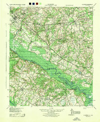 1944 Ellenton1944 Print · USGSIn the mid-1940s, this area of the Savannah River valley was a thriving agricultural landscape centered on Ellenton and Dunbarton. Genealogists can trace family footprints through sites like Bethesda Sch, Daisy May Ch, and the local Burton & Myers Store.
 - 1947 Map of Savannah
 1947 Savannah1947 Print · USGSCoastal Georgia and South Carolina are captured here in the mid-forties, showing the rail-and-river networks of the Lowcountry. Genealogists and researchers can trace old crossroads and river towns from Statesboro to Beaufort, alongside military sites like Camp Stewart and Parris Island.
 - 1948 Map of Savannah
 1948 Savannah1948 Print · USGSThe Georgia and South Carolina Lowcountry comes alive in this post-war survey of the coast and its river-fed hinterlands. Genealogists and historians can trace rail lines like the Central of Georgia RR and find established settlements such as Isle of Hope and Sylvania.
 - 1954 Map of Augusta
 1954 Augusta1954 Print · USGSThe Savannah River valley and South Carolina Midlands are captured here during a period of post-war growth. Researchers can trace the rail-and-river economy through the Southern RR corridor and locate historic settlements like Aiken, Orangeburg, and Sumter.
 - 1957 Map of Augusta, 1966 Print
 1957 Augusta1966 Print · USGSThe Savannah River and Santee basins are captured here during a period of massive military and industrial expansion in the late fifties. Genealogists can trace family footprints across Four Hole Swamp or near the Savannah River Plant.3 unique versions available
 - 1957 Map of Savannah, 1967 Print
 1957 Savannah1967 Print · USGSThe Lowcountry and Georgia coastal plain are shown here in the late fifties, prior to modern expansion. Researchers can trace the rail-and-river economy through the Central of Georgia lines and the Ogeechee River wetlands.4 unique versions available
 - 1958 Map of Augusta
 1958 Augusta1958 Print · USGSThe borderlands between Georgia and South Carolina come alive in the 1950s, showing the early footprint of the Savannah River Plant. Genealogists and historians can trace rail-dependent towns and rural landmarks from Orangeburg to the Fort Jackson Military Reservation.
 - 1960 Map of Savannah
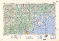 1960 Savannah1960 Print · USGSCoastal Georgia and the South Carolina Lowcountry are captured in the late fifties, showcasing the intricate web of islands and tidal rivers before modern expansion. Researchers can trace the rail lines of the Atlantic Coast Line or locate sites like Parris Island, Beaufort, and the Tybee Lighthouse.
 - 1961 Map of Augusta
 1961 Augusta1961 Print · USGSThe South Carolina lowcountry and CSRA appear here in the early sixties, during a period of massive military and industrial growth. Researchers can trace the development of the Savannah River Plant or locate legacy landmarks like Nelson Ferry and Magnolia Cemetery.2 unique versions available
Showing maps 1-25 of 113
Top cities of Allendale County
Frequently asked questions
- What are the different types of historical maps available for Allendale County?
- What is the oldest map of Allendale County?
- Where can I purchase historical maps of Allendale County for my home or office?
- Where can I download high-res historical maps of Allendale County?
- Are there historical topographic maps available for Allendale County?
- Is there historical aerial imagery available for Allendale County?
- Where are historical maps of Allendale County sourced from?