Old Maps of Anderson County, South Carolina for Hiking & Exploration
Hike through history with 65 historic maps of Anderson County. Explore old trails, ghost towns, and forgotten backroads — perfect for outdoor adventurers and local explorers.
- Rediscover forgotten places: Map out old mining camps, roads, and footpaths that no longer exist on modern maps.
- Layer with modern tools: Combine with LiDAR or satellite views to plan hikes through historical terrain.
- Made for exploration: Popular among hikers, overlanders, and local history lovers.
Use these maps to find adventure and explore the hidden past of Anderson County.
Anderson County, SC maps
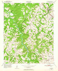
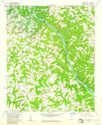
(65)- 1888 Map of Pickens
 1888 Pickens1888 Print · USGSThe South Carolina Piedmont comes alive in the late nineteenth century, showing the rural communities of Pickens and Anderson. Genealogists can trace family landmarks like Sutton's Mill, Six Mile Church, and river crossings at Cherry's Ferry.
 - 1892 Map of Abbeville
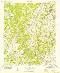
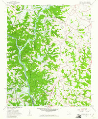
 1892 Abbeville1892 Print · USGSSouth Carolina’s Upstate during the late 1800s reveals a landscape defined by critical river crossings and the arrival of the steam era. Genealogists can trace family roots through localized sites like Smith Ferry, Maddox Mill, and the bustling rail hub of Greenwood.6 unique versions available
 - 1893 Map of Elberton
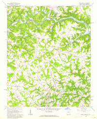
 1893 Elberton1893 Print · USGSThe Georgia-South Carolina borderlands come alive in the 1890s, centering on the river-and-rail economy of the Savannah Valley. Genealogists can trace family names and early community hubs through Browns Ferry, Coldwater Church, and Ruckersville.5 unique versions available
 - 1894 Map of Pickens
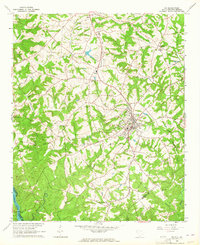
 1894 Pickens1894 Print · USGSNorthwest South Carolina in the late nineteenth century was a landscape of river-driven industry and emerging rail lines. Researchers can trace ancestral roots through family landmarks like Watson Mill, the community at Old Pickens, and the rural New Hope Church.6 unique versions available
 - 1935 Map of Greenville
 1935 Greenville1935 Print · USGSGreenville and its surrounding Piedmont communities are shown in detail during the mid-1930s as the textile and rail economy expanded. Researchers can find numerous local landmarks like Chick Springs, the Judson Cemetery, and Travelers Rest.
 - 1938 Map of Greenville
 1938 Greenville1938 Print · USGSGreenville and its surrounding textile communities thrive in the mid-1930s as a major Piedmont industrial and rail hub. Researchers can locate numerous rural landmarks like the Rosenwald Sch, trace the Southern RR, or find family sites near Saluda Lake.2 unique versions available
 - 1950 Map of La France, 1964 Print
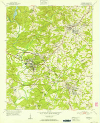
 1950 La France1964 Print · USGSAnderson County's rural communities and river crossings are captured here at the start of the 1950s. Genealogists and local historians can trace family roots through numerous sites like Holly Springs Ch, Portman Dam, and the Blue Ridge RR.2 unique versions available
 - 1951 Map of La France
 1951 La France1951 Print · USGSAnderson County in the early fifties is captured here as a landscape of tight-knit rural communities and vital river crossings. Researchers can trace ancestral locations through numerous sites like Sandy Springs, Asbury Clark Memorial Ch, and Earles Bridge.2 unique versions available
 - 1951 Map of Clemson, 1952 Print
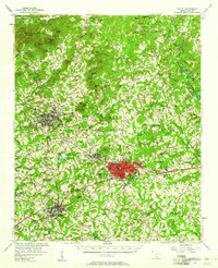
 1951 Clemson1952 Print · USGSThe foothills of South Carolina come to life in the early fifties, centered on the growing campus of Clemson Agricultural College. Researchers can trace the Southern rail line through Central or locate family landmarks like Lawrence Chapel and Mt Zion Cem.6 unique versions available
 - 1954 Map of Greenville, 1965 Print
 1954 Greenville1965 Print · USGSThe Upstate and Northeast Georgia are captured here during a decade of massive transformation as new reservoirs reshaped the Piedmont. Genealogists and hikers can trace the Appalachian Trail over Brasstown Bald or locate old community centers like Demorest, Westminster, and Royston.3 unique versions available
 - 1957 Map of Greenville, 1958 Print
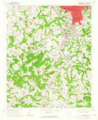
 1957 Greenville1958 Print · USGSGreenville in the late fifties is a thriving textile and education center surrounded by growing suburbs and military activity. Researchers can locate historic mill communities like Monaghan, the Furman University (Womens College), and the sprawling Donaldson Air Force Base.2 unique versions available
 - 1957 Map of Anderson, 1958 Print
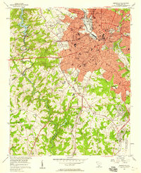
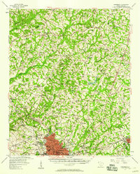 1957 Anderson1958 Print · USGSUpstate South Carolina during the late fifties centers on the growth of Anderson and its surrounding textile and agricultural communities. Genealogists and local historians can trace family roots through numerous rural landmarks like McElmoyle Sch, Willis Chapel, and Sandy Springs.2 unique versions available
 - 1957 Map of Easley, 1958 Print
 1957 Easley1958 Print · USGSIn the mid-1950s, the textile and rail corridor between Easley and Liberty hummed with Piedmont industry. Genealogists and local historians can trace family roots through numerous rural sites like Bruce-Hagood Cem, Dacusville, and the historic Pickensville settlement.2 unique versions available
 - 1957 Map of Williamston, 1958 Print
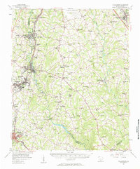 1957 Williamston1958 Print · USGSMid-century South Carolina comes into focus as textile towns and military installations expand across the Piedmont landscape. Genealogists can trace family roots through dozens of rural landmarks like McKelvey Crossroads, Standing Springs Ch, and Traynham Cem.2 unique versions available
 - 1957 Map of Greenville, 1959 Print
 1957 Greenville1959 Print · USGSGreenville and its industrial suburbs are captured during a period of rapid mid-century expansion and military prominence. Genealogists and historians can locate established mill communities like Monaghan, the sprawling Donaldson Air Force Base, and the campuses of Furman University and Bob Jones University.
 - 1958 Map of Greenville
 1958 Greenville1958 Print · USGSThe Piedmont and Blue Ridge foothills come alive in this mid-century survey of the Upstate and Northeast Georgia. Trace the regional rail-and-river economy through the Southern Railway corridors and early reservoir developments like Lake Sidney Lanier.
 - 1958 Map of Fair Play, 1963 Print
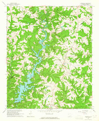
 1958 Fair Play1963 Print · USGSThe Oconee and Anderson county border is captured here during the late fifties as the rising waters of the Hartwell Reservoir began to alter the landscape. Genealogists can trace local landmarks like Old Hephzibah Ch, Fork Sch, and the rural community at Earles Grove.4 unique versions available
 - 1959 Map of Hartwell Dam, 1961 Print
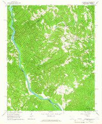
 1959 Hartwell Dam1961 Print · USGSThe Savannah River borderlands are captured here during the late fifties as the new Hartwell Dam began to reshape the valley. Genealogists can locate numerous country churches like Cokesbury Ch and Sardis Ch, or trace the old roads around Montevideo.4 unique versions available
 - 1959 Map of Hartwell NE, 1961 Print
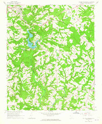
 1959 Hartwell NE1961 Print · USGSIn the late fifties, the rising Hartwell Reservoir began to reshape the borderlands of Anderson County. Genealogists and historians can trace the rural landscape of Andersonville and Holland Store, or locate legacy sites like Evergreen Ch and New Hope Ch before they were altered by the new shoreline.4 unique versions available
 - 1960 Map of Reed Creek, 1963 Print
 1960 Reed Creek1963 Print · USGSThe Georgia and South Carolina border is caught in a moment of transition during the 1960s as the Hartwell Reservoir fills the valley. Researchers can trace old family landmarks and rural congregations like Sharon Ch, Cleveland Cem, and the community of Maretts.3 unique versions available
 - 1964 Map of Iva
 1964 Iva1964 Print · USGSUpper South Carolina in the mid-sixties reveals a landscape of railroad towns and country congregations along the Georgia border. Genealogists can trace family footprints through numerous rural landmarks like Goodhope Cem, Barnes Station, and Pleasant Grove Ch.3 unique versions available
 - 1964 Map of Antreville, 1965 Print
 1964 Antreville1965 Print · USGSThe rural border of Abbeville and Anderson counties is captured here in the mid-sixties, centered on the winding waters of Secession Lake. Genealogists can locate numerous landmarks including the Antreville School, Hall-Cromer Cem, and Shiloh Ch.
 - 1964 Map of Lowndesville, 1965 Print
 1964 Lowndesville1965 Print · USGSThe South Carolina and Georgia borderlands near the Savannah River are captured here in the mid-1960s. Genealogists can trace family roots through numerous sites like Old McCalla Cemetery, Smyrna Church, and the Atlantic Coast Line rail corridor.3 unique versions available
 - 1964 Map of Saylors Crossroads, 1965 Print
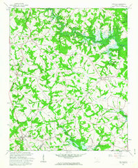
 1964 Saylors Crossroads1965 Print · USGSAnderson County's rural heartland is captured here in the mid-sixties, showing a landscape shaped by the Rocky River and the waters of Broadway Lake. Genealogists and local historians can trace the foundations of Saylors Crossroads or locate rural landmarks like New Mount Pleasant Ch and McFall Cem.2 unique versions available
 - 1964 Map of Anderson South, 1965 Print
 1964 Anderson South1965 Print · USGSThe southern fringes of ANDERSON and the surrounding Piedmont countryside are captured in the early sixties as suburban growth met traditional rural life. Researchers can trace family sites near Silverbrook Cemetery or follow the rails to historic stops like Deans and Starr.3 unique versions available
Showing maps 1-25 of 65
Top cities of Anderson County
- Anderson historical maps
- Belton historical maps
- Williamston historical maps
- Honea Path historical maps
- Pendleton historical maps
- Iva historical maps
See more
Frequently asked questions
- What are the different types of historical maps available for Anderson County?
- What is the oldest map of Anderson County?
- Where can I purchase historical maps of Anderson County for my home or office?
- Where can I download high-res historical maps of Anderson County?
- Are there historical topographic maps available for Anderson County?
- Is there historical aerial imagery available for Anderson County?
- Where are historical maps of Anderson County sourced from?