Old Maps of Beaufort, South Carolina for Academic Research
Study the evolution of Beaufort with 53 high-resolution historic maps. Whether you're teaching, researching, or modeling changes in land use, these maps provide essential visual documentation of urban, environmental, and geographic change.
- Analyze long-term change: Track patterns in development, transportation, and natural features.
- Ideal for environmental or urban studies: Support academic projects with primary historical map data.
- Use in the classroom or lab: Educators and researchers rely on these maps to bring historical context to life.
These maps are a powerful tool for teaching, research, and visualizing how Beaufort has changed over the decades.
Beaufort, SC maps
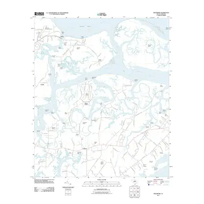
(53)- 1918 Map of Green Pond
 1918 Green Pond1918 Print · USGSThe South Carolina Lowcountry is captured here just as the First World War ended, showing a landscape defined by the winding Combahee and Ashepoo rivers. Researchers can trace historic family routes along the Old Savannah and Charleston Road and locate rural landmarks like Combahee Ferry and First African Church.4 unique versions available
 - 1918 Map of Yemassee
 1918 Yemassee1918 Print · USGSCoastal South Carolina at the end of the Great War reveals a landscape of tidal rivers and emerging rail junctions. Genealogists can trace family locations across Grahams Neck or near historic sites like Pocotaligo, Sheldon, and the logging camps around Gilmania.4 unique versions available
 - 1920 Map of Okatie
 1920 Okatie1920 Print · USGSThe South Carolina Lowcountry is captured here in the years following the Great War, showing a landscape defined by tidal rivers and strategic rail lines. Trace family roots and historical sites through Honey Hill Civil War Entrenchment, Grahamville, and Cherry Point Landing.
 - 1942 Map of Okatie
 1942 Okatie1942 Print · USGSCoastal South Carolina at the height of the Second World War shows a landscape of tidal marshes and strategic river landings. Genealogists and historians can trace family locations through named sites like Grahamville, Old House, and the Civil War Entrenchment north of Ridgeland.
 - 1943 Map of Yemassee
 1943 Yemassee1943 Print · USGSThe South Carolina Lowcountry in the early 1940s is defined by its massive tidal rivers and the vital rail junctions at Yemassee. Genealogists and historians can trace old community lines near McPhersonville, Mt Nevo Ch, and the coastal reaches of Seabrook.3 unique versions available
 - 1943 Map of Green Pond
 1943 Green Pond1943 Print · USGSThe Lowcountry river systems of South Carolina are captured here in the 1940s as they wind toward the Atlantic. Genealogists and historians can trace old community ties at First African Ch or locate the Old Fort and rail stops at Ashepoo Siding.2 unique versions available
 - 1944 Map of Fort Fremont
 1944 Fort Fremont1944 Print · USGSCoastal South Carolina during the Second World War shows a strategic shoreline defined by naval history and sea island life. Researchers can trace the layout of the Marine Barracks, locate family-named points like Sams Pt, or find the rail terminus at Port Royal.
 - 1947 Map of Savannah
 1947 Savannah1947 Print · USGSCoastal Georgia and South Carolina are captured here in the mid-forties, showing the rail-and-river networks of the Lowcountry. Genealogists and researchers can trace old crossroads and river towns from Statesboro to Beaufort, alongside military sites like Camp Stewart and Parris Island.
 - 1948 Map of Savannah
 1948 Savannah1948 Print · USGSThe Georgia and South Carolina Lowcountry comes alive in this post-war survey of the coast and its river-fed hinterlands. Genealogists and historians can trace rail lines like the Central of Georgia RR and find established settlements such as Isle of Hope and Sylvania.
 - 1956 Map of Frogmore, 1957 Print
 1956 Frogmore1957 Print · USGSCoastal Beaufort County in the mid-fifties is a labyrinth of tidal marsh and island life. Genealogists can trace family heritage through numerous landmarks like Penn Community Services, Brick Ch, and the Scottsville Cem.3 unique versions available
 - 1956 Map of Parris Island, 1957 Print
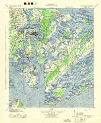
 1956 Parris Island1957 Print · USGSThe Lowcountry landscape of the mid-fifties is captured here, centering on the military operations of Parris Island and the neighboring islands. Genealogists and historians can trace the foundations of the Marine Recruit Depot alongside coastal landmarks like Fort Fremont and the Elliot Cem.5 unique versions available
 - 1957 Map of Savannah, 1967 Print
 1957 Savannah1967 Print · USGSThe Lowcountry and Georgia coastal plain are shown here in the late fifties, prior to modern expansion. Researchers can trace the rail-and-river economy through the Central of Georgia lines and the Ogeechee River wetlands.4 unique versions available
 - 1958 Map of Beaufort, 1960 Print
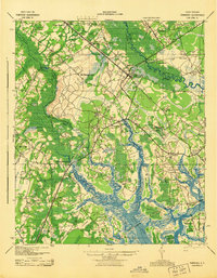
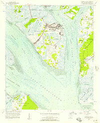
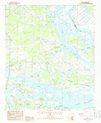
 1958 Beaufort1960 Print · USGSPort Royal Island and Beaufort are shown during a period of significant military and maritime activity in the late fifties. Genealogists and historians can trace family-named sites like Rose Hill Cem and Hazel Farm, or locate the Ruins (Fort Frederick) along the Beaufort River.5 unique versions available
 - 1959 Map of Fort Fremont
 1959 Fort Fremont1959 Print · USGSThe South Carolina Sea Islands are captured here in the mid-twentieth century, emphasizing the deep connection between the tides and local settlement. Genealogists and historians can trace the rail lines to Beaufort Sta, locate the grounds of Ft Fremont, and explore the layout of Parris Island.
 - 1960 Map of Savannah
 1960 Savannah1960 Print · USGSCoastal Georgia and the South Carolina Lowcountry are captured in the late fifties, showcasing the intricate web of islands and tidal rivers before modern expansion. Researchers can trace the rail lines of the Atlantic Coast Line or locate sites like Parris Island, Beaufort, and the Tybee Lighthouse.
 - 1961 Map of Savannah
 1961 Savannah1961 Print · USGSThe Georgia and South Carolina Lowcountry comes alive in this mid-century survey of coastal marshes, barrier islands, and river networks. Genealogists and historians can trace the paths of the Seaboard Air Line RR, locate family sites near Isle of Hope, or study the grounds of Fort Stewart Military Reservation.2 unique versions available
 - 1962 Map of Laurel Bay, 1964 Print
 1962 Laurel Bay1964 Print · USGSCoastal Beaufort County is captured in the early sixties as a mix of traditional river life and expanding military infrastructure. Researchers can trace family sites like Salvesbarg Cem, old school locations such as Broad River Sch, and the layout of Laurel Bay.2 unique versions available
 - 1978 Map of Beaufort
 1978 Beaufort1978 Print · USGSCoastal South Carolina and Georgia come to life in this detailed bathymetric study from the late seventies, featuring the intricate Sea Islands and the Savannah River mouth. Researchers can trace military history at Parris Island or locate inland settlements like Switzerland and Old Sheldon.2 unique versions available
 - 1986 Map of Walterboro
 1986 Walterboro1986 Print · USGSThe South Carolina Lowcountry in the mid-eighties remains a world of expansive wetlands and historic river crossings. Genealogists and historians can trace the rural communities and landmarks of Colleton and Charleston counties, from the Baptist Church at Adams Run to the coastal reaches of Edisto Beach State Park.
 - 1988 Map of Dale
 1988 Dale1988 Print · USGSCoastal Beaufort County in the late eighties is defined by the labyrinthine waterways and islands between the Combahee and Coosaw rivers. Genealogists and local historians can trace the Old RR Grade and find early sites at Dale, Lobeco, and Keans Neck.
 - 1988 Map of Sheldon
 1988 Sheldon1988 Print · USGSThe Beaufort and Jasper County border in the late eighties is a mosaic of tidal rivers and historic necks. Genealogists and historians can trace the intricate shorelines of Scotts Neck and Seabrook Island, or locate inland points like Sheldon and Gardens Corner.
 - 1990 Map of Walterboro
 1990 Walterboro1990 Print · USGSCoastal South Carolina and its dense river networks are documented here in the early nineties as the Charleston suburbs expanded westward. Genealogists and historians can trace old community hubs like Clubhouse Crossroads, the site of Givhans Ferry, and several Strip Mines north of the Stono River.
 - 1998 Map of Beaufort, 1999 Print
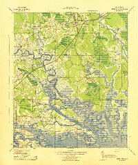
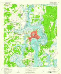
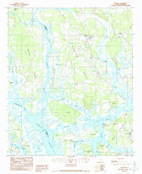
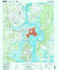 1998 Beaufort1999 Print · USGSThe Beaufort riverfront and surrounding Sea Islands come to life in this detailed late-century survey of the South Carolina coast. Researchers can trace the grounds of the Beaufort National Cemetery and locate historical landmarks like the Ruins (Fort Frederick) and Mather Sch.
 - 2011 Map of Dale, 2011 Print
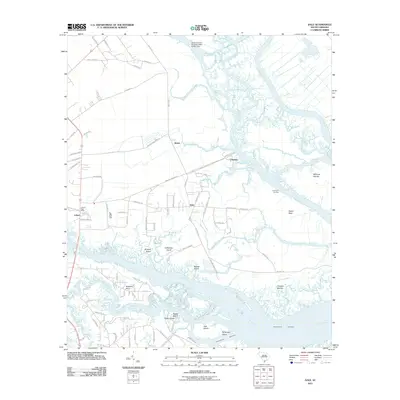 2011 Dale2011 Print · USGSCovers Beaufort, including Chisolms, Briars, and other nearby areas
 - 2011 Map of Frogmore, 2011 Print
 2011 Frogmore2011 Print · USGSCovers Beaufort, including Ashdale, Wilkins, and other nearby areas
Showing maps 1-25 of 53
Top cities near Beaufort
- Hilton Head Island historical maps
- Port Royal historical maps
- Bluffton historical maps
- Hardeeville historical maps
Top neighborhoods of Beaufort
- Mink Point Plantation historical maps
- Waterford Place historical maps
- The Point historical maps
- Beaufort Historic District historical maps
Frequently asked questions
- What are the different types of historical maps available for Beaufort?
- What is the oldest map of Beaufort?
- Where can I purchase historical maps of Beaufort for my home or office?
- Where can I download high-res historical maps of Beaufort?
- Are there historical topographic maps available for Beaufort?
- Is there historical aerial imagery available for Beaufort?
- Where are historical maps of Beaufort sourced from?