Old Maps of Pritchardville, South Carolina for Hiking & Exploration
Hike through history with 14 historic maps of Pritchardville. Explore old trails, ghost towns, and forgotten backroads — perfect for outdoor adventurers and local explorers.
- Rediscover forgotten places: Map out old mining camps, roads, and footpaths that no longer exist on modern maps.
- Layer with modern tools: Combine with LiDAR or satellite views to plan hikes through historical terrain.
- Made for exploration: Popular among hikers, overlanders, and local history lovers.
Use these maps to find adventure and explore the hidden past of Pritchardville.
Pritchardville, SC maps
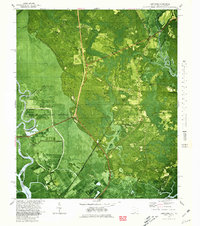
(14)- 1942 Map of Savannah
 1942 Savannah1942 Print · USGSCoastal Georgia and the South Carolina borderlands come alive in this wartime survey of the Savannah riverfront. Genealogists and historians can trace industrial housing at Port Wentworth Colored Village, river landmarks like Fort Jackson, and the footprint of the Ogeechee Canal.
 - 1947 Map of Savannah
 1947 Savannah1947 Print · USGSCoastal Georgia and South Carolina are captured here in the mid-forties, showing the rail-and-river networks of the Lowcountry. Genealogists and researchers can trace old crossroads and river towns from Statesboro to Beaufort, alongside military sites like Camp Stewart and Parris Island.
 - 1948 Map of Savannah
 1948 Savannah1948 Print · USGSThe Georgia and South Carolina Lowcountry comes alive in this post-war survey of the coast and its river-fed hinterlands. Genealogists and historians can trace rail lines like the Central of Georgia RR and find established settlements such as Isle of Hope and Sylvania.
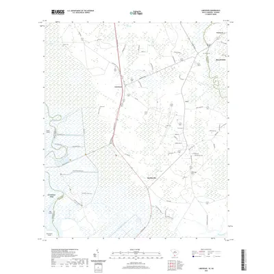
 - 1955 Map of Limehouse, 1957 Print
 1955 Limehouse1957 Print · USGSJasper County and the Savannah River marshes are captured here in the mid-fifties, showing a landscape of coastal wetlands and rural hamlets. Genealogists can locate family landmarks like Williams Cem and Allen Cem, or trace the rail routes of the Atlantic Coast Line.2 unique versions available
 - 1957 Map of Savannah, 1967 Print
 1957 Savannah1967 Print · USGSThe Lowcountry and Georgia coastal plain are shown here in the late fifties, prior to modern expansion. Researchers can trace the rail-and-river economy through the Central of Georgia lines and the Ogeechee River wetlands.4 unique versions available
 - 1960 Map of Savannah
 1960 Savannah1960 Print · USGSCoastal Georgia and the South Carolina Lowcountry are captured in the late fifties, showcasing the intricate web of islands and tidal rivers before modern expansion. Researchers can trace the rail lines of the Atlantic Coast Line or locate sites like Parris Island, Beaufort, and the Tybee Lighthouse.
 - 1961 Map of Savannah
 1961 Savannah1961 Print · USGSThe Georgia and South Carolina Lowcountry comes alive in this mid-century survey of coastal marshes, barrier islands, and river networks. Genealogists and historians can trace the paths of the Seaboard Air Line RR, locate family sites near Isle of Hope, or study the grounds of Fort Stewart Military Reservation.2 unique versions available
 - 1980 Map of Limehouse
 1980 Limehouse1980 Print · USGSJasper County tidelands and the edges of the Savannah riverfront appear here in the early eighties. Genealogists can trace local roots through sites like Chisolm Cem, Jonesville Ch, and the landings at Cook Landing.2 unique versions available
 - 1981 Map of Savannah, 1982 Print
 1981 Savannah1982 Print · USGSCoastal Georgia and the South Carolina borderlands are captured here in the early eighties, showing the region's complex network of riverine islands and military installations. Researchers can trace the rail lines of the Central of Georgia and explore sites like Fort Stewart Military Reservation and Garden City.
 - 2011 Map of Limehouse, 2011 Print
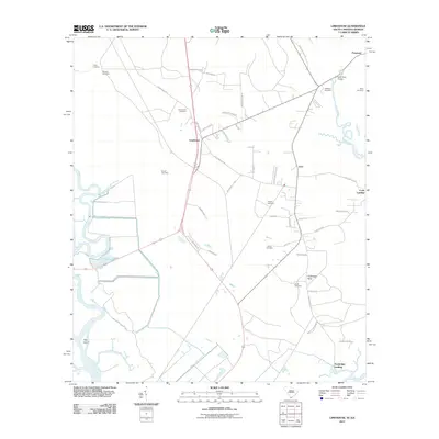 2011 Limehouse2011 Print · USGSCovers Pritchardville, including Bluffton, Hardeeville, and other nearby areas
 - 2014 Map of Limehouse, 2014 Print
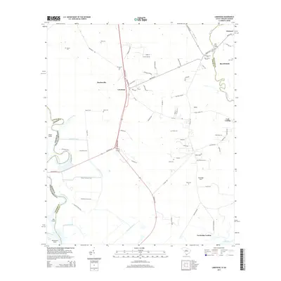 2014 Limehouse2014 Print · USGSCovers Pritchardville, including Bluffton, Hardeeville, and other nearby areas
 - 2017 Map of Limehouse, 2017 Print
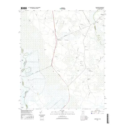 2017 Limehouse2017 Print · USGSCovers Pritchardville, including Bluffton, Hardeeville, and other nearby areas
 - 2020 Map of Limehouse, 2020 Print
 2020 Limehouse2020 Print · USGSCovers Pritchardville, including Bluffton, Hardeeville, and other nearby areas
 - 2024 Map of Limehouse, 2024 Print
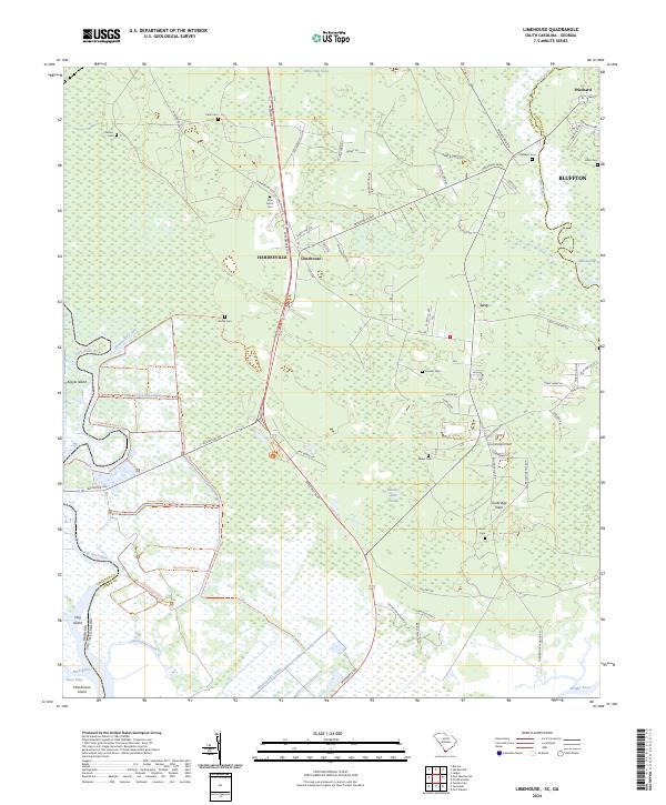 2024 Limehouse2024 Print · USGSCoastal Jasper County is captured in this modern survey, revealing the intersection of expanding communities and protected wetlands. Researchers can locate numerous small family burial sites like Pelot Cem, New Garret Cem, and Hardy Cem near the historic crossroads of Limehouse.
End of results
Showing maps 1-14 of 14
Top cities near Pritchardville
- Savannah historical maps
- Hilton Head Island historical maps
- Pooler historical maps
- Beaufort historical maps
- Port Royal historical maps
- Garden City historical maps
See more
Frequently asked questions
- What are the different types of historical maps available for Pritchardville?
- What is the oldest map of Pritchardville?
- Where can I purchase historical maps of Pritchardville for my home or office?
- Where can I download high-res historical maps of Pritchardville?
- Are there historical topographic maps available for Pritchardville?
- Is there historical aerial imagery available for Pritchardville?
- Where are historical maps of Pritchardville sourced from?