Old Maps of Black Creek, South Carolina for Genealogy
Trace your family roots with 16 historic maps of Black Creek. These high-res maps reveal old neighborhoods, homesites, landmarks, and streets — helping you uncover where your ancestors lived and how the area evolved over time.
- Explore historic neighborhoods: Identify where your relatives may have lived in the 1800s or 1900s.
- Compare maps over time: Trace the changes in streets, buildings, and landmarks for multi-generational research.
- Perfect for genealogy & ancestry research: Used by family historians and researchers to map out lineage and migration.
These maps are an incredible resource for exploring your personal connection to Black Creek's past.
Black Creek, SC maps
(16)- 1920 Map of Eutawville
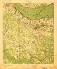
 1920 Eutawville1920 Print · USGSCoastal South Carolina comes to life in the years following the Great War, showing a landscape defined by the Santee River and Four Hole Swamp. Genealogists can trace family roots through numerous local landmarks like Black Creek Church, Unity School, and the settlement at Holly Hill.
 - 1921 Map of Eutawville
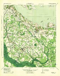
 1921 Eutawville1921 Print · USGSCoastal South Carolina comes to life in this early twentieth-century survey of the Santee River lowlands and the growing railroad towns of the coastal plain. Genealogists can trace the location of community anchors like Gerizim Church, the Eutaw Springs Battle Monument, and Nelsons Ferry.3 unique versions available
 - 1943 Map of Eutawville, 1944 Print
 1943 Eutawville1944 Print · USGSCoastal South Carolina during the mid-forties shows a landscape of historic battlefields and newly formed reservoirs. Genealogists and historians can trace family church and school sites like Gerizim Ch and Stutz Sch or locate the Eutaw Battle Monument.
 - 1954 Map of Augusta
 1954 Augusta1954 Print · USGSThe Savannah River valley and South Carolina Midlands are captured here during a period of post-war growth. Researchers can trace the rail-and-river economy through the Southern RR corridor and locate historic settlements like Aiken, Orangeburg, and Sumter.
 - 1957 Map of Augusta, 1966 Print
 1957 Augusta1966 Print · USGSThe Savannah River and Santee basins are captured here during a period of massive military and industrial expansion in the late fifties. Genealogists can trace family footprints across Four Hole Swamp or near the Savannah River Plant.3 unique versions available
 - 1958 Map of Augusta
 1958 Augusta1958 Print · USGSThe borderlands between Georgia and South Carolina come alive in the 1950s, showing the early footprint of the Savannah River Plant. Genealogists and historians can trace rail-dependent towns and rural landmarks from Orangeburg to the Fort Jackson Military Reservation.
 - 1961 Map of Augusta
 1961 Augusta1961 Print · USGSThe South Carolina lowcountry and CSRA appear here in the early sixties, during a period of massive military and industrial growth. Researchers can trace the development of the Savannah River Plant or locate legacy landmarks like Nelson Ferry and Magnolia Cemetery.2 unique versions available
 - 1962 Map of Augusta
 1962 Augusta1962 Print · USGSThe South Carolina and Georgia borderlands are seen here in the early sixties, showing the rise of the Savannah River Plant and the expansion of Fort Jackson. Researchers can trace old rail lines like the Southern Railway and find landmarks such as St. Pauls Church or the Santee Canal.
 - 1979 Map of Sandridge, 1980 Print
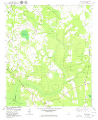 1979 Sandridge1980 Print · USGSThe rural Lowcountry at the meeting of three counties is captured here in the late seventies. Genealogists and local historians can locate many family-named landmarks and country churches, including Joiner Cem, Tugtown, and Ebenezer Ch.
 - 1985 Map of Saint George, 1986 Print
 1985 Saint George1986 Print · USGSThe South Carolina Lowcountry in the mid-eighties shows a landscape defined by the great reservoirs and the meandering Edisto River. Researchers can trace the rail corridors of the Southern Railway and find rural settlements like Harleyville, Smoaks, and Grover.
 - 1990 Map of Saint George
 1990 Saint George1990 Print · USGSThe South Carolina Lowcountry in the early nineties reveals a complex network of river systems and massive reservoirs. Genealogists and local historians can trace the development of inland settlements like St George and Branchville or explore the wetlands of Four Hole Swamp.
 - 2011 Map of Sandridge, 2011 Print
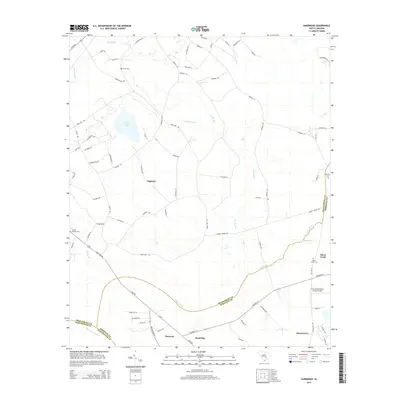
 2011 Sandridge2011 Print · USGSCovers Black Creek, including Hussertown, Sandridge, and other nearby areas
 - 2014 Map of Sandridge, 2014 Print
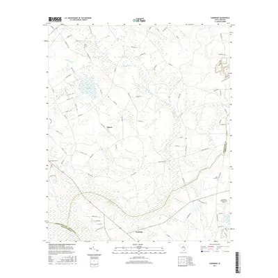
 2014 Sandridge2014 Print · USGSCovers Black Creek, including Hussertown, Sandridge, and other nearby areas
 - 2017 Map of Sandridge, 2017 Print
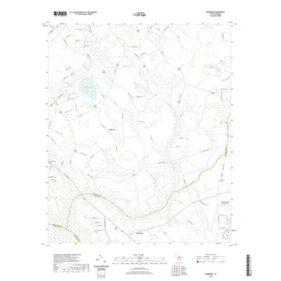
 2017 Sandridge2017 Print · USGSCovers Black Creek, including Hussertown, Sandridge, and other nearby areas
 - 2020 Map of Sandridge, 2020 Print
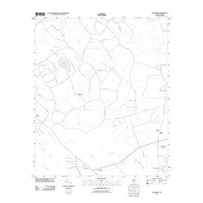
 2020 Sandridge2020 Print · USGSCovers Black Creek, including Hussertown, Sandridge, and other nearby areas
 - 2024 Map of Sandridge, 2024 Print
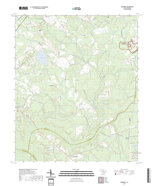 2024 Sandridge2024 Print · USGSThe Lowcountry borderlands of Orangeburg and Berkeley counties are detailed here in the 2020s. Researchers can locate family landmarks like Joyner Cem and Lovely Hill Church among the unique wetlands of Toney Bay and Four Hole Swamp.
End of results
Showing maps 1-16 of 16
Top cities near Black Creek
- Goose Creek historical maps
- Moncks Corner historical maps
- Ridgeville historical maps
- Holly Hill historical maps
- Santee historical maps
- Harleyville historical maps
See more
Frequently asked questions
- What are the different types of historical maps available for Black Creek?
- What is the oldest map of Black Creek?
- Where can I purchase historical maps of Black Creek for my home or office?
- Where can I download high-res historical maps of Black Creek?
- Are there historical topographic maps available for Black Creek?
- Is there historical aerial imagery available for Black Creek?
- Where are historical maps of Black Creek sourced from?