Old Maps of Hanahan, South Carolina for Hiking & Exploration
Hike through history with 31 historic maps of Hanahan. Explore old trails, ghost towns, and forgotten backroads — perfect for outdoor adventurers and local explorers.
- Rediscover forgotten places: Map out old mining camps, roads, and footpaths that no longer exist on modern maps.
- Layer with modern tools: Combine with LiDAR or satellite views to plan hikes through historical terrain.
- Made for exploration: Popular among hikers, overlanders, and local history lovers.
Use these maps to find adventure and explore the hidden past of Hanahan.
Hanahan, SC maps
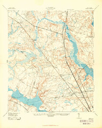
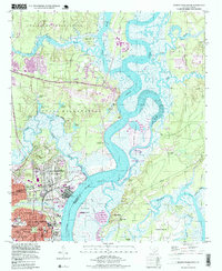
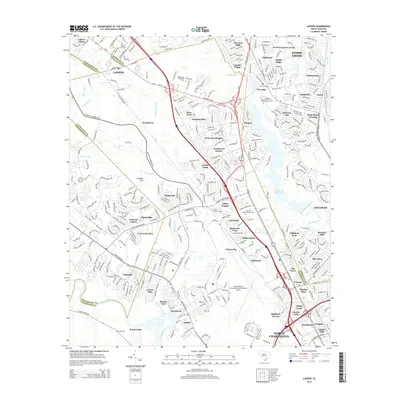
(31)- 1919 Map of Ladson
 1919 Ladson1919 Print · USGSThe South Carolina lowcountry is captured here just after the Great War, showing a landscape of riverfront estates and rail-connected settlements. Researchers can trace the grounds of Magnolia Gardens or locate rural centers like Ladson and Otranto.2 unique versions available
 - 1919 Map of Melgrove
 1919 Melgrove1919 Print · USGSThe South Carolina lowcountry emerges in detail during the post-WWI era as industry begins to touch the Cooper River. Genealogists can trace early neighborhood footprints in North Charleston or locate rural landmarks like St.Johns Church and Redbank Landing.3 unique versions available
 - 1920 Map of Ravenels
 1920 Ravenels1920 Print · USGSThe Ashley River and its surrounding swamps were the heart of this Lowcountry landscape just after the First World War. Researchers can trace the footprints of Old Dorchester, the operations at Bula Mines, and the unique Tyler Tea Farm.3 unique versions available
 - 1940 Map of Melgrove
 1940 Melgrove1940 Print · USGSThe South Carolina lowcountry near Charleston appears here just before the mid-century industrial boom. Researchers can locate community anchors like St Johns Ch, the No 6 School, and the rail stop at Inness Sta along the SOUTHERN line.
 - 1943 Map of Ladson
 1943 Ladson1943 Print · USGSBerkeley and Dorchester counties come into focus during the early war years, revealing a landscape of historic river estates and new military infrastructure. Genealogists and historians can trace family-named sites like Windsor Hill and Ararat, or locate local landmarks like Goose Creek Ch and Magnolia Gardens.2 unique versions available
 - 1944 Map of Ravenels
 1944 Ravenels1944 Print · USGSCoastal South Carolina just before the war's end reveals a landscape of tidal rivers and deep-rooted settlements. Trace the footprints of the past at Old Dorchester, locate family homesteads near Poppenheim Crossing, or find long-vanished industry at the Bula Mines.
 - 1947 Map of Savannah
 1947 Savannah1947 Print · USGSCoastal Georgia and South Carolina are captured here in the mid-forties, showing the rail-and-river networks of the Lowcountry. Genealogists and researchers can trace old crossroads and river towns from Statesboro to Beaufort, alongside military sites like Camp Stewart and Parris Island.
 - 1948 Map of James Island
 1948 James Island1948 Print · USGSThe South Carolina coast around the harbor city appeared in this postwar period as a network of naval defenses and established sea island communities. Trace the roads and waterways connecting Charleston to Fort Sumter, Mt Pleasant, and the Isle of Palms.2 unique versions available
 - 1948 Map of Savannah
 1948 Savannah1948 Print · USGSThe Georgia and South Carolina Lowcountry comes alive in this post-war survey of the coast and its river-fed hinterlands. Genealogists and historians can trace rail lines like the Central of Georgia RR and find established settlements such as Isle of Hope and Sylvania.
 - 1957 Map of Savannah, 1967 Print
 1957 Savannah1967 Print · USGSThe Lowcountry and Georgia coastal plain are shown here in the late fifties, prior to modern expansion. Researchers can trace the rail-and-river economy through the Central of Georgia lines and the Ogeechee River wetlands.4 unique versions available
 - 1958 Map of North Charleston, 1959 Print
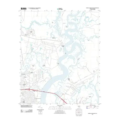
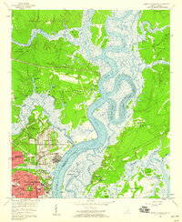 1958 North Charleston1959 Print · USGSNorth Charleston in the late fifties shows a booming industrial and military hub defined by its riverfront access. Researchers can trace the mid-century development of Park Circle, the massive Port Terminal, and community cornerstones like the Orphanage and Oak Terrace Sch.4 unique versions available
 - 1958 Map of Ladson, 1959 Print
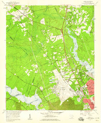 1958 Ladson1959 Print · USGSCoastal South Carolina is captured here in a moment of rapid military and industrial growth during the late fifties. You can trace the expansion of North Charleston and the Charleston Air Force Base alongside historic riverfront landmarks like Magnolia Gardens.4 unique versions available
 - 1960 Map of Savannah
 1960 Savannah1960 Print · USGSCoastal Georgia and the South Carolina Lowcountry are captured in the late fifties, showcasing the intricate web of islands and tidal rivers before modern expansion. Researchers can trace the rail lines of the Atlantic Coast Line or locate sites like Parris Island, Beaufort, and the Tybee Lighthouse.
 - 1961 Map of Savannah
 1961 Savannah1961 Print · USGSThe Georgia and South Carolina Lowcountry comes alive in this mid-century survey of coastal marshes, barrier islands, and river networks. Genealogists and historians can trace the paths of the Seaboard Air Line RR, locate family sites near Isle of Hope, or study the grounds of Fort Stewart Military Reservation.2 unique versions available
 - 1968 Map of James Island
 1968 James Island1968 Print · USGSThe South Carolina Lowcountry in the late sixties shows a transition between its historic coastal defenses and modern expansion. Trace the harbor landscape from Charleston to the barrier islands, finding landmarks like Fort Sumter, Fort Moultrie, and Carolina Skyways.
 - 1969 Map of James Island, 1971 Print
 1969 James Island1971 Print · USGSThe South Carolina coast and Charleston Harbor are documented here in the late sixties, showing a landscape defined by naval history and barrier island growth. Genealogists and historians can trace the footprint of Scanlonville, Folly Beach, and the historic Ft Moultrie.2 unique versions available
 - 1986 Map of James Island
 1986 James Island1986 Print · USGSCharleston and its surrounding sea islands are captured in the mid-1980s, showcasing a region defined by maritime heritage and rapid coastal expansion. Genealogists and historians can trace established neighborhoods like Scanlonville, landmarks such as Fort Sumter, and the era's infrastructure including the Grace Mem Br.
 - 1986 Map of Walterboro
 1986 Walterboro1986 Print · USGSThe South Carolina Lowcountry in the mid-eighties remains a world of expansive wetlands and historic river crossings. Genealogists and historians can trace the rural communities and landmarks of Colleton and Charleston counties, from the Baptist Church at Adams Run to the coastal reaches of Edisto Beach State Park.
 - 1990 Map of Walterboro
 1990 Walterboro1990 Print · USGSCoastal South Carolina and its dense river networks are documented here in the early nineties as the Charleston suburbs expanded westward. Genealogists and historians can trace old community hubs like Clubhouse Crossroads, the site of Givhans Ferry, and several Strip Mines north of the Stono River.
 - 1990 Map of James Island
 1990 James Island1990 Print · USGSCoastal South Carolina in the early nineties reveals a landscape where historic harbor defenses and naval installations meet expanding suburban reaches. Trace the evolution of waterfront communities from Folly Beach to Mount Pleasant, and locate maritime landmarks like the USS Yorktown State Park or the Lighthouse on Morris Island.
 - 1998 Map of North Charleston, 1999 Print
 1998 North Charleston1999 Print · USGSNorth Charleston and the surrounding river reaches are shown here in the late nineties, balancing heavy military presence with growing suburban neighborhoods. Trace the industrial waterfront at the Port Terminal and locate community anchors like Park Circle and St Johns Ch.
 - 2011 Map of North Charleston, 2011 Print
 2011 North Charleston2011 Print · USGSCovers Hanahan, including Charleston, North Charleston, and other nearby areas
 - 2011 Map of Ladson, 2011 Print
 2011 Ladson2011 Print · USGSCovers Hanahan, including North Charleston, Summerville, and other nearby areas
 - 2014 Map of North Charleston, 2014 Print
 2014 North Charleston2014 Print · USGSCovers Hanahan, including Charleston, North Charleston, and other nearby areas
 - 2014 Map of Ladson, 2014 Print
 2014 Ladson2014 Print · USGSCovers Hanahan, including North Charleston, Summerville, and other nearby areas
Showing maps 1-25 of 31
Top cities near Hanahan
- Charleston historical maps
- North Charleston historical maps
- Mount Pleasant historical maps
- Summerville historical maps
- Goose Creek historical maps
- Hollywood historical maps
See more
Top neighborhoods of Hanahan
- Highland Park historical maps
- The Farms historical maps
- Gold Cup Springs historical maps
- Belvedere historical maps
- Berkeley Hills historical maps
- Dominion Hills historical maps
See more
Frequently asked questions
- What are the different types of historical maps available for Hanahan?
- What is the oldest map of Hanahan?
- Where can I purchase historical maps of Hanahan for my home or office?
- Where can I download high-res historical maps of Hanahan?
- Are there historical topographic maps available for Hanahan?
- Is there historical aerial imagery available for Hanahan?
- Where are historical maps of Hanahan sourced from?