Old Maps of Hunters Woods, Berkeley County for Hiking & Exploration
Hike through history with 23 historic maps of Hunters Woods. Explore old trails, ghost towns, and forgotten backroads — perfect for outdoor adventurers and local explorers.
- Rediscover forgotten places: Map out old mining camps, roads, and footpaths that no longer exist on modern maps.
- Layer with modern tools: Combine with LiDAR or satellite views to plan hikes through historical terrain.
- Made for exploration: Popular among hikers, overlanders, and local history lovers.
Use these maps to find adventure and explore the hidden past of Hunters Woods.
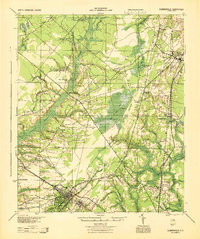
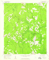
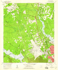
Hunters Woods, Berkeley County maps
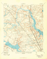
(23)- 1919 Map of Ladson
 1919 Ladson1919 Print · USGSCovers Hunters Woods, including North Charleston, Summerville, and other nearby areas
 - 1919 Map of Summerville
 1919 Summerville1919 Print · USGSCovers Hunters Woods, including Summerville, Goose Creek, and other nearby areas
 - 1920 Map of Ravenels
 1920 Ravenels1920 Print · USGSCovers Hunters Woods, including Charleston, North Charleston, and other nearby areas2 unique versions available
 - 1920 Map of Summerville
 1920 Summerville1920 Print · USGSCovers Hunters Woods, including Summerville, Goose Creek, and other nearby areas2 unique versions available
 - 1943 Map of Ladson
 1943 Ladson1943 Print · USGSCovers Hunters Woods, including North Charleston, Summerville, and other nearby areas2 unique versions available
 - 1944 Map of Ravenels
 1944 Ravenels1944 Print · USGSCovers Hunters Woods, including Charleston, North Charleston, and other nearby areas
 - 1944 Map of Summerville
 1944 Summerville1944 Print · USGSCovers Hunters Woods, including Summerville, Goose Creek, and other nearby areas
 - 1947 Map of Savannah
 1947 Savannah1947 Print · USGSCovers Hunters Woods, including Charleston, Savannah, and other nearby areas
 - 1948 Map of Savannah
 1948 Savannah1948 Print · USGSCovers Hunters Woods, including Charleston, Savannah, and other nearby areas
 - 1954 Map of Augusta
 1954 Augusta1954 Print · USGSCovers Hunters Woods, including Augusta, Columbia, and other nearby areas
 - 1957 Map of Mount Holly, 1959 Print
 1957 Mount Holly1959 Print · USGSCovers Hunters Woods, including Goose Creek, Beverly Hills, and other nearby areas4 unique versions available
 - 1957 Map of Augusta, 1966 Print
 1957 Augusta1966 Print · USGSCovers Hunters Woods, including Augusta, Columbia, and other nearby areas3 unique versions available
 - 1957 Map of Savannah, 1967 Print
 1957 Savannah1967 Print · USGSCovers Hunters Woods, including Charleston, Savannah, and other nearby areas4 unique versions available
 - 1958 Map of Augusta
 1958 Augusta1958 Print · USGSCovers Hunters Woods, including Augusta, Columbia, and other nearby areas
 - 1958 Map of Ladson, 1959 Print
 1958 Ladson1959 Print · USGSCovers Hunters Woods, including North Charleston, Summerville, and other nearby areas4 unique versions available
 - 1960 Map of Savannah
 1960 Savannah1960 Print · USGSCovers Hunters Woods, including Charleston, Savannah, and other nearby areas
 - 1961 Map of Augusta
 1961 Augusta1961 Print · USGSCovers Hunters Woods, including Augusta, Columbia, and other nearby areas2 unique versions available
 - 1961 Map of Savannah
 1961 Savannah1961 Print · USGSCovers Hunters Woods, including Charleston, Savannah, and other nearby areas2 unique versions available
 - 1962 Map of Augusta
 1962 Augusta1962 Print · USGSCovers Hunters Woods, including Augusta, Columbia, and other nearby areas
 - 1985 Map of Saint George, 1986 Print
 1985 Saint George1986 Print · USGSCovers Hunters Woods, including Summerville, Goose Creek, and other nearby areas
 - 1986 Map of Walterboro
 1986 Walterboro1986 Print · USGSCovers Hunters Woods, including Charleston, North Charleston, and other nearby areas
 - 1990 Map of Walterboro
 1990 Walterboro1990 Print · USGSCovers Hunters Woods, including Charleston, North Charleston, and other nearby areas
 - 1990 Map of Saint George
 1990 Saint George1990 Print · USGSCovers Hunters Woods, including Summerville, Goose Creek, and other nearby areas
End of results
Showing maps 1-23 of 23
Frequently asked questions
- What are the different types of historical maps available for Hunters Woods?
- What is the oldest map of Hunters Woods?
- Where can I purchase historical maps of Hunters Woods for my home or office?
- Where can I download high-res historical maps of Hunters Woods?
- Are there historical topographic maps available for Hunters Woods?
- Is there historical aerial imagery available for Hunters Woods?
- Where are historical maps of Hunters Woods sourced from?