Old Maps of Hunters Woods, Berkeley County for Metal Detecting
Plan your next treasure hunt with 23 historic maps of Hunters Woods. Find old homesites, ghost towns, trails, and gathering spots that may be lost to time — perfect for identifying promising metal detecting locations.
- Locate forgotten sites: Uncover places like long-lost settlements, abandoned rail lines, or gathering spots.
- Plan better hunts: Use map overlays combined with LiDAR or satellite views to narrow in on historically rich areas.
- Made for detectorists: Thousands of hobbyists use these maps to discover relics, coins, and hidden history.
Use these historic maps to boost your research and find new opportunities beneath the surface of Hunters Woods.
Hunters Woods, Berkeley County maps
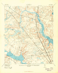
(23)- 1919 Map of Ladson
 1919 Ladson1919 Print · USGSCovers Hunters Woods, including North Charleston, Summerville, and other nearby areas
 - 1919 Map of Summerville
 1919 Summerville1919 Print · USGSCovers Hunters Woods, including Summerville, Goose Creek, and other nearby areas
 - 1920 Map of Ravenels
 1920 Ravenels1920 Print · USGSCovers Hunters Woods, including Charleston, North Charleston, and other nearby areas2 unique versions available
 - 1920 Map of Summerville
 1920 Summerville1920 Print · USGSCovers Hunters Woods, including Summerville, Goose Creek, and other nearby areas2 unique versions available
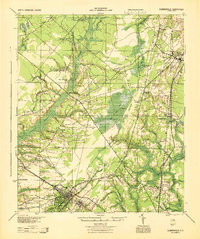
 - 1943 Map of Ladson
 1943 Ladson1943 Print · USGSCovers Hunters Woods, including North Charleston, Summerville, and other nearby areas2 unique versions available
 - 1944 Map of Ravenels
 1944 Ravenels1944 Print · USGSCovers Hunters Woods, including Charleston, North Charleston, and other nearby areas
 - 1944 Map of Summerville
 1944 Summerville1944 Print · USGSCovers Hunters Woods, including Summerville, Goose Creek, and other nearby areas
 - 1947 Map of Savannah
 1947 Savannah1947 Print · USGSCovers Hunters Woods, including Charleston, Savannah, and other nearby areas
 - 1948 Map of Savannah
 1948 Savannah1948 Print · USGSCovers Hunters Woods, including Charleston, Savannah, and other nearby areas
 - 1954 Map of Augusta
 1954 Augusta1954 Print · USGSCovers Hunters Woods, including Augusta, Columbia, and other nearby areas
 - 1957 Map of Mount Holly, 1959 Print
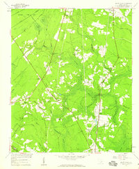 1957 Mount Holly1959 Print · USGSCovers Hunters Woods, including Goose Creek, Beverly Hills, and other nearby areas4 unique versions available
 - 1957 Map of Augusta, 1966 Print
 1957 Augusta1966 Print · USGSCovers Hunters Woods, including Augusta, Columbia, and other nearby areas3 unique versions available
 - 1957 Map of Savannah, 1967 Print
 1957 Savannah1967 Print · USGSCovers Hunters Woods, including Charleston, Savannah, and other nearby areas4 unique versions available
 - 1958 Map of Augusta
 1958 Augusta1958 Print · USGSCovers Hunters Woods, including Augusta, Columbia, and other nearby areas
 - 1958 Map of Ladson, 1959 Print
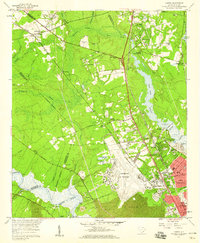 1958 Ladson1959 Print · USGSCovers Hunters Woods, including North Charleston, Summerville, and other nearby areas4 unique versions available
 - 1960 Map of Savannah
 1960 Savannah1960 Print · USGSCovers Hunters Woods, including Charleston, Savannah, and other nearby areas
 - 1961 Map of Augusta
 1961 Augusta1961 Print · USGSCovers Hunters Woods, including Augusta, Columbia, and other nearby areas2 unique versions available
 - 1961 Map of Savannah
 1961 Savannah1961 Print · USGSCovers Hunters Woods, including Charleston, Savannah, and other nearby areas2 unique versions available
 - 1962 Map of Augusta
 1962 Augusta1962 Print · USGSCovers Hunters Woods, including Augusta, Columbia, and other nearby areas
 - 1985 Map of Saint George, 1986 Print
 1985 Saint George1986 Print · USGSCovers Hunters Woods, including Summerville, Goose Creek, and other nearby areas
 - 1986 Map of Walterboro
 1986 Walterboro1986 Print · USGSCovers Hunters Woods, including Charleston, North Charleston, and other nearby areas
 - 1990 Map of Walterboro
 1990 Walterboro1990 Print · USGSCovers Hunters Woods, including Charleston, North Charleston, and other nearby areas
 - 1990 Map of Saint George
 1990 Saint George1990 Print · USGSCovers Hunters Woods, including Summerville, Goose Creek, and other nearby areas
End of results
Showing maps 1-23 of 23
Frequently asked questions
- What are the different types of historical maps available for Hunters Woods?
- What is the oldest map of Hunters Woods?
- Where can I purchase historical maps of Hunters Woods for my home or office?
- Where can I download high-res historical maps of Hunters Woods?
- Are there historical topographic maps available for Hunters Woods?
- Is there historical aerial imagery available for Hunters Woods?
- Where are historical maps of Hunters Woods sourced from?