Old Maps of Cherokee County, South Carolina for Hiking & Exploration
Hike through history with 125 historic maps of Cherokee County. Explore old trails, ghost towns, and forgotten backroads — perfect for outdoor adventurers and local explorers.
- Rediscover forgotten places: Map out old mining camps, roads, and footpaths that no longer exist on modern maps.
- Layer with modern tools: Combine with LiDAR or satellite views to plan hikes through historical terrain.
- Made for exploration: Popular among hikers, overlanders, and local history lovers.
Use these maps to find adventure and explore the hidden past of Cherokee County.
Cherokee County, SC maps
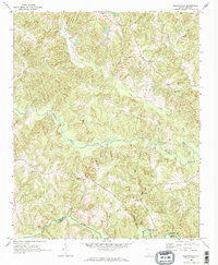
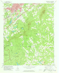
(125)- 1906 Map of Kings Mountain, 1970 Print
 1906 Kings Mountain1970 Print · USGSThe North and South Carolina borderlands come alive in this early century survey of the Kings Mountain vicinity. Genealogists can locate family landmarks including Lincoln Academy, Bordens Ferry, and Pleasant Hill Church.
 - 1907 Map of Sharon
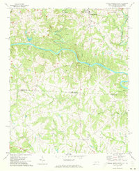
 1907 Sharon1907 Print · USGSUpstate South Carolina at the turn of the century shows a region deeply connected by river ferries and new rail lines. Genealogists can trace early homesteads near Sharon, Hickory Grove, and the historic Pinckney Ferry on the Broad River.3 unique versions available
 - 1908 Map of Kings Mountain
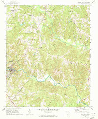
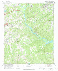
 1908 Kings Mountain1908 Print · USGSThe Carolina borderlands come alive in the first decade of the 1900s, centered on the landmark Kings Mountain Battleground and its namesake ridge. Genealogists can trace family roots through numerous rural churches and schools, including Ramah Church, Beersheba Church, and the Lincoln Academy.6 unique versions available
 - 1909 Map of Gaffney
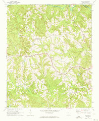
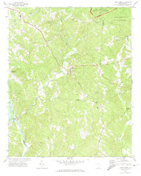
 1909 Gaffney1909 Print · USGSCherokee County at the turn of the century centers on the growing textile and rail hubs of Gaffney and Blacksburg. Researchers can trace early river transport at Stacy Ferry or locate ancestral roots at Providence Church and the Sarratt School.4 unique versions available
 - 1941 Map of Spartanburg
 1941 Spartanburg1941 Print · USGSSouth Carolina’s Piedmont and Sandhills regions are shown here during the mid-century peak of the rail era. Researchers can trace the sprawling Fort Jackson Military Reservation and the industrial growth of hubs like Spartanburg and Rock Hill.
 - 1947 Map of Spartanburg, 1969 Print
 1947 Spartanburg1969 Print · USGSSpartanburg and its surrounding mill towns are captured here in the late 1940s, a period defined by rail commerce and military presence. Researchers can trace family roots through numerous local landmarks like Hammett Grove Ch, Glenn Springs, and the sprawling grounds of Camp Croft.
 - 1949 Map of Spartanburg
 1949 Spartanburg1949 Print · USGSSpartanburg and its surrounding mill villages are captured here during the post-war industrial era. Genealogists can trace family roots through numerous rural landmarks like Hammett Grove Ch, Stone Station, and the sprawling grounds of Camp Croft.
 - 1953 Map of Spartanburg, 1966 Print
 1953 Spartanburg1966 Print · USGSMid-century South Carolina comes into focus through this survey of the Piedmont and the Sand Hills at a time of significant reservoir expansion. Researchers can trace the legacy of industrial transit and resource extraction from the Haile Gold Mine to the rail hubs of the Seaboard Air Line.4 unique versions available
 - 1953 Map of Charlotte, 1968 Print
 1953 Charlotte1968 Print · USGSThe North Carolina Piedmont and South Carolina borderlands are shown in detail during a period of significant growth and reservoir development. Trace the rail corridors of the Southern Railway or find family roots in towns like China Grove, Misenheimer, and Lincolnton.3 unique versions available
 - 1954 Map of Charlotte
 1954 Charlotte1954 Print · USGSThe North Carolina Piedmont in the mid-1950s shows a region of rapid growth and industrial expansion centered around Charlotte. Trace the era's infrastructure through the Southern railroad lines and locate significant landmarks like the Charlotte Naval Ammunition Depot and Lake Norman.2 unique versions available
 - 1959 Map of Cowpens, 1961 Print
 1959 Cowpens1961 Print · USGSThe borderlands of the Carolinas are shown here in the late fifties, featuring a mix of textile mill towns and rural farming communities. Researchers can trace family roots through numerous local landmarks like Cannons Camp Ground, Gaffney Chapel, and Cooley Springs.2 unique versions available
 - 1960 Map of Charlotte
 1960 Charlotte1960 Print · USGSMid-century North Carolina and South Carolina meet in this 1960 survey of the Piedmont's industrial and textile heartland. Trace the growth of Charlotte alongside historic landmarks like Kings Mountain National Military Park and the Charlotte Naval Ammunition Depot.2 unique versions available
 - 1960 Map of Spartanburg
 1960 Spartanburg1960 Print · USGSThe South Carolina Piedmont and North Carolina borderlands come alive in this mid-century survey of the region between Spartanburg and Columbia. Researchers can trace the Seaboard Air Line railroad and explore landmarks like Anderson Quarry, Lake Murray, and Mount Croghan.2 unique versions available
 - 1962 Map of Charlotte
 1962 Charlotte1962 Print · USGSThe North Carolina Piedmont in the early sixties showcases a landscape transformed by massive reservoirs and industrial growth. Researchers can trace the development of Lake Norman, locate the Charlotte Naval Ammunition Depot, or find family landmarks like Wesley Chapel and Brown & Norcott Mills.
 - 1963 Map of Spartanburg
 1963 Spartanburg1963 Print · USGSMid-century South Carolina comes alive in this survey, showing the rail-linked corridor between the Upstate and the Midlands. Genealogists can trace family lands near old hubs like Union and Lancaster, or along the banks of the Broad River and Pee Dee River.
 - 1964 Map of Spartanburg
 1964 Spartanburg1964 Print · USGSMid-century South Carolina comes alive in this survey of the Piedmont and Upcountry, stretching from the Blue Ridge foothills to the Sandhills. Genealogists and historians can trace the rail-and-river economy through Monarch Mills, Glenn Springs, and the Southern Railway corridor.
 - 1968 Map of Wilkinsville, 1973 Print
 1968 Wilkinsville1973 Print · USGSThe rural communities of the South Carolina Upstate are captured here in the late sixties, showing a landscape defined by small settlements and winding waterways. Researchers can trace family roots through landmarks like El Bethel Ch, Gowdeysville, and Saratt.3 unique versions available
 - 1969 Map of Pacolet Mills, 1972 Print
 1969 Pacolet Mills1972 Print · USGSThe industrial and rural landscape of South Carolina's upstate comes alive in this late-sixties survey of the river country. Genealogists and local researchers can trace the community life of Pacolet Mills or locate landmarks like Whig Hill Cem and Knuckles Chapel.2 unique versions available
 - 1969 Map of Kelton, 1973 Print
 1969 Kelton1973 Print · USGSThe rural uplands of Union County are captured here in the late sixties as the Southern railroad linked small communities. Genealogists can locate family landmarks like Haney Cem, Wesley Chapel, and the Kelly Pinckney Sch.
 - 1969 Map of Jonesville, 1973 Print
 1969 Jonesville1973 Print · USGSJonesville and the surrounding Union County countryside are captured here in the late sixties, a period of transition for the rural Southern landscape. Genealogists can locate family landmarks like Littlejohn Com, Fosters Chapel, and the Cedar Grove Ch Cem.
 - 1971 Map of Kings Mountain, 1973 Print
 1971 Kings Mountain1973 Print · USGSThe foothills of the Carolinas come into focus during the early seventies as the industrial growth of Kings Mountain meets the preserved heights of the state and military parks. Researchers can trace the legacy of rural congregations and local landmarks like Pisgah Cem, Camp Rotary, and The Pinnacle.
 - 1971 Map of Boiling Springs South, 1973 Print
 1971 Boiling Springs South1973 Print · USGSThe Carolina borderlands come into focus in the early 1970s, as the Broad River carves through the rural landscape of Cleveland and Cherokee counties. Genealogists can trace family footprints at Gardner-Webb College, Mt Pleasant Ch, and Grassy Pond.3 unique versions available
 - 1971 Map of Blacksburg South, 1974 Print
 1971 Blacksburg South1974 Print · USGSCherokee County at the start of the seventies reveals a landscape of river-dependent industry and scattered rural communities. Genealogists can trace family roots through sites like Old McKowns Mtn Church, Cashion Crossroads, and Mountain View Cemetery.
 - 1971 Map of Blacksburg North, 1974 Print
 1971 Blacksburg North1974 Print · USGSThe Carolina borderlands come into focus in the early 1970s as the river-driven industry of the Piedmont matures. Researchers can trace family-named landmarks and rural centers like Patterson Springs, Old Falls Chapel, and the Stice Shoals Dam.
 - 1971 Map of Kings Creek, 1974 Print
 1971 Kings Creek1974 Print · USGSCherokee and York counties appear in the early seventies as a landscape of timbered parks, small rural junctions, and river industry. Genealogists can locate family landmarks like Oak Grove Ch, Mt Sinai Ch, and the community of Kings Creek.3 unique versions available
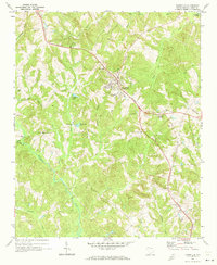
Showing maps 1-25 of 125
Top cities of Cherokee County
Frequently asked questions
- What are the different types of historical maps available for Cherokee County?
- What is the oldest map of Cherokee County?
- Where can I purchase historical maps of Cherokee County for my home or office?
- Where can I download high-res historical maps of Cherokee County?
- Are there historical topographic maps available for Cherokee County?
- Is there historical aerial imagery available for Cherokee County?
- Where are historical maps of Cherokee County sourced from?