1970s Maps of Brocks Mill, South Carolina
Explore 2 historic maps of Brocks Mill from the 1970s. These maps offer a rare glimpse into what life looked like during the 1970s — showing old roads, neighborhoods, homes, and landmarks that have changed or disappeared over time.
Whether you're researching your family's past, planning a metal detecting trip, or studying how Brocks Mill's landscape evolved across the 1970s, these high-resolution maps are a powerful tool for exploring the history of this region.
- Focus on a specific era: All maps on this page are from the 1970s, giving you a focused view of this time period.
- See what’s changed: Compare century-old streets, trails, and buildings to today's modern landscape using overlays and satellite layers.
- Research with precision: Use these maps for genealogy, historical research, land use analysis, or educational projects.
- View, download, or print: Maps are fully viewable online in high resolution, and can be downloaded or printed for your own records.
Start exploring Brocks Mill's history through authentic maps from the 1970s. This is your window into the past.
Brocks Mill, SC maps
(2)- 1971 Map of Morven East, 1973 Print
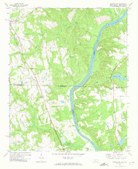 1971 Morven East1973 Print · USGSThe North Carolina and South Carolina borderlands meet along the river in the early 1970s. Genealogists can trace family footprints through rural landmarks like Old Sneedsboro, Galilee Ch, and the mills at Brocks Mill and Everetts Mill.2 unique versions available
 - 1976 Map of Morven East, 1978 Print
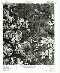 1976 Morven East1978 Print · USGSAnson County and the borderlands of the Carolinas are captured in the mid-1970s as the Pee Dee River winds through rural farmland. Local historians can trace the footprints of established settlements like Morven and Mc Farlan alongside Everetts Lake.
End of results
Showing maps 1-2 of 2
Top cities near Brocks Mill
- Rockingham historical maps
- Wadesboro historical maps
- Cheraw historical maps
- Polkton historical maps
- Cordova historical maps
- Chesterfield historical maps
See more
Frequently asked questions
- What are the different types of historical maps available for Brocks Mill?
- What is the oldest map of Brocks Mill?
- Where can I purchase historical maps of Brocks Mill for my home or office?
- Where can I download high-res historical maps of Brocks Mill?
- Are there historical topographic maps available for Brocks Mill?
- Is there historical aerial imagery available for Brocks Mill?
- Where are historical maps of Brocks Mill sourced from?