1980s Maps of Greenville County, South Carolina
Explore 20 historic maps of Greenville County from the 1980s. These maps offer a rare glimpse into what life looked like during the 1980s — showing old roads, neighborhoods, homes, and landmarks that have changed or disappeared over time.
Whether you're researching your family's past, planning a metal detecting trip, or studying how Greenville County's landscape evolved across the 1980s, these high-resolution maps are a powerful tool for exploring the history of this region.
- Focus on a specific era: All maps on this page are from the 1980s, giving you a focused view of this time period.
- See what’s changed: Compare century-old streets, trails, and buildings to today's modern landscape using overlays and satellite layers.
- Research with precision: Use these maps for genealogy, historical research, land use analysis, or educational projects.
- View, download, or print: Maps are fully viewable online in high resolution, and can be downloaded or printed for your own records.
Start exploring Greenville County's history through authentic maps from the 1980s. This is your window into the past.
Greenville County, SC maps
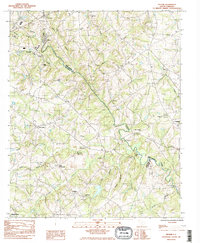
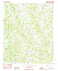
(20)- 1983 Map of Fork Shoals
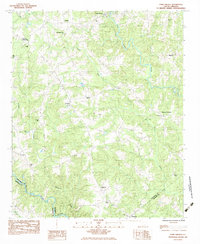 1983 Fork Shoals1983 Print · USGSThe rural Piedmont region comes alive in this early 1980s survey of the crossroads and riverbanks south of Greenville. Genealogists can trace family roots through sites like Lickville Ch, McKelvey Crossroads, and the Cooley Cem along the Reedy River.
 - 1983 Map of Belton East
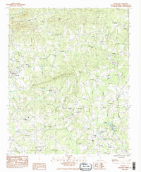
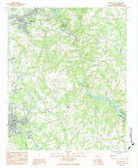 1983 Belton East1983 Print · USGSUpstate South Carolina in the early eighties reveals a landscape of river-powered industry and deep-rooted rural communities. Researchers can trace family landmarks and transport hubs like the Pelzer Mills Dam, Cheddar, and Cedar Grove Sch.
 - 1983 Map of Simpsonville
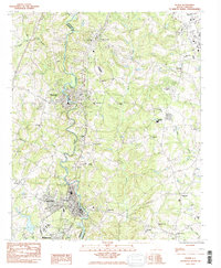
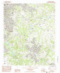
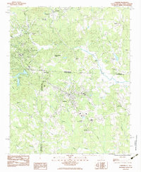
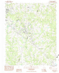
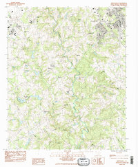 1983 Simpsonville1983 Print · USGSSimpsonville and the surrounding Greenville County countryside are shown here in the early eighties as suburban growth meets rural traditions. Genealogists can locate family sites like Cureton Cem or historic congregations at Standing Springs Ch and Antioch Ch.2 unique versions available
 - 1983 Map of Slater
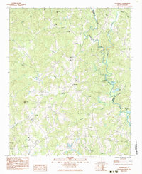
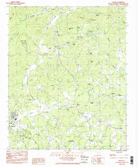 1983 Slater1983 Print · USGSUpper Greenville County in the early eighties shows a landscape of river-valley towns and mountain ridges. Researchers can trace local heritage through dozens of country churches like Cool Springs Ch and landmarks like the Riverside Speedway.2 unique versions available
 - 1983 Map of Pelham
 1983 Pelham1983 Print · USGSGreenville and Spartanburg counties met along the Enoree River in the early 1980s, before suburban sprawl significantly altered the landscape. Genealogists can trace early local congregations at Old Pilgrim Ch and family sites like Vaughan Cem.2 unique versions available
 - 1983 Map of Pelzer
 1983 Pelzer1983 Print · USGSThe Saluda River corridor in the early 1980s reveals the industrial and community ties between Anderson and Greenville counties. Local historians can trace numerous rural landmarks, including Bessie Pond Ch, the Seaboard Southern rail lines, and the growth of West Pelzer.2 unique versions available
 - 1983 Map of Campobello
 1983 Campobello1983 Print · USGSThe Greenville and Spartanburg borderlands appear here in the early 1980s, centered on the railroad town of Campobello. Genealogists and local historians can trace rural family landmarks like Pleasant Grove Cemetery and old country churches including Motlow Creek Church and Mt View Church.
 - 1983 Map of Saluda
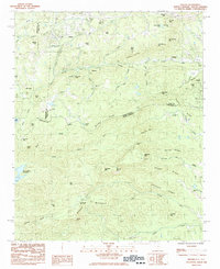 1983 Saluda1983 Print · USGSCrossing the Blue Ridge escarpment in the 1980s, this area shows the historic rail and mountain corridor between North and South Carolina. Genealogists can trace local landmarks like Friendship Ch, Mountain Hill Ch, and the high peak of Glassy Mountain.2 unique versions available
 - 1983 Map of Hickory Tavern
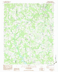
 1983 Hickory Tavern1983 Print · USGSLaurens County rural life is captured in the early 1980s, centered on the crossroads of Hickory Tavern. Genealogists and local historians can trace family locations near Dials Ch, Henderson, and the waters of Tumbling Shoals.
 - 1983 Map of Tigerville
 1983 Tigerville1983 Print · USGSTigerville and the upper Tyger River valley are captured in the early 1980s as the rural Greenville County landscape began to modernize. Genealogists and historians can locate the Campbell Covered Bridge, North Greenville Jr College, and numerous family-named landmarks like Berrys Millpond.2 unique versions available
 - 1983 Map of Mauldin
 1983 Mauldin1983 Print · USGSGreenville County was entering a period of rapid suburban expansion in the early eighties. Researchers can trace the evolution of local neighborhoods from Greenville to Mauldin, locating landmarks like Bob Jones University and the Donaldson Center Airport.2 unique versions available
 - 1983 Map of Dacusville
 1983 Dacusville1983 Print · USGSDacusville and the surrounding Piedmont hills are captured here in the early eighties, showing a landscape of family-named ridges and rural congregations. Researchers can trace local heritage at sites like Nine Forks Ch, Hunts Memorial Ch, and the settlement at Doddies.
 - 1983 Map of Landrum
 1983 Landrum1983 Print · USGSThe foothills of the Carolinas come alive in this early 1980s survey of the borderlands between North and South Carolina. Trace the rail-and-road corridor through Landrum and Tryon, or locate family landmarks like Fellowship Ch, Oak Grove Ch, and Burnt Chimney Corner.
 - 1983 Map of Fountain Inn
 1983 Fountain Inn1983 Print · USGSThe Upstate's growth and rural roots are visible here in the early eighties as residential expansion begins to surround traditional farming communities. Trace family history and local land use at Old Shady Oak Ch, the SEABOARD rail line, and Gaylord Crossroads.
 - 1983 Map of Greenville
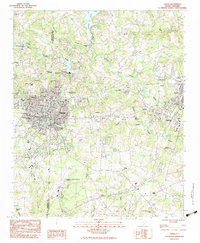
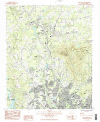
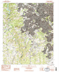 1983 Greenville1983 Print · USGSGreenville and its surrounding textile and rail suburbs are captured here in the early eighties. Researchers can trace family history through dozens of landmarks like Sirrine Stadium, the Judson Cem, and the Donaldson Center Airport.2 unique versions available
 - 1983 Map of Greer
 1983 Greer1983 Print · USGSThe industrial and rail corridor of the South Carolina Upstate comes into focus here in the early eighties. Researchers can trace textile heritage and community roots through Victor Mills, Apalache, and old landmarks like Woods Chapel.
 - 1983 Map of Paris Mountain
 1983 Paris Mountain1983 Print · USGSThe northern Greenville suburbs and the gateway to the mountains are captured here in the early eighties. Genealogists and historians can trace the footprint of Furman University and local congregations at Ebenezer Ch and St Lukes Ch.3 unique versions available
 - 1983 Map of Taylors
 1983 Taylors1983 Print · USGSGreenville County enters a period of rapid suburban transition in the early eighties as residential tracts expand toward the Enoree River. Genealogists and local historians can trace family sites at Jackson Grove Ch Cem, the Southern Bleachery, and Chick Springs.
 - 1984 Map of Greenville
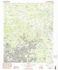
 1984 Greenville1984 Print · USGSThe South Carolina Upstate undergoes rapid suburban growth in the mid-eighties as modern interstates begin to reshape the landscape. Researchers can trace historic rail lines like the Greenville and Northern Railway and locate local landmarks such as Clemson University and Paris Mountain State Park.
 - 1986 Map of Hendersonville
 1986 Hendersonville1986 Print · USGSThe Blue Ridge foothills of North and South Carolina are documented here in the mid-eighties as modern highways began to reshape mountain travel. Local historians can trace the paths of the Southern Railway through Hendersonville or locate landmarks like Looking Glass Rock and Inman Mills.2 unique versions available
End of results
Showing maps 1-20 of 20
Top cities of Greenville County
- Greenville historical maps
- Mauldin historical maps
- Simpsonville historical maps
- Wade Hampton historical maps
- Travelers Rest historical maps
- Tigerville historical maps
Frequently asked questions
- What are the different types of historical maps available for Greenville County?
- What is the oldest map of Greenville County?
- Where can I purchase historical maps of Greenville County for my home or office?
- Where can I download high-res historical maps of Greenville County?
- Are there historical topographic maps available for Greenville County?
- Is there historical aerial imagery available for Greenville County?
- Where are historical maps of Greenville County sourced from?