1900s (20th Century) Maps of Greenville County, South Carolina
Explore 70 historic maps of Greenville County from the 1900s (20th Century). These maps offer a rare glimpse into what life looked like during the 1900s — showing old roads, neighborhoods, homes, and landmarks that have changed or disappeared over time.
Whether you're researching your family's past, planning a metal detecting trip, or studying how Greenville County's landscape evolved across the 1900s, these high-resolution maps are a powerful tool for exploring the history of this region.
- Focus on a specific era: All maps on this page are from the 1900s, giving you a focused view of this time period.
- See what’s changed: Compare century-old streets, trails, and buildings to today's modern landscape using overlays and satellite layers.
- Research with precision: Use these maps for genealogy, historical research, land use analysis, or educational projects.
- View, download, or print: Maps are fully viewable online in high resolution, and can be downloaded or printed for your own records.
Start exploring Greenville County's history through authentic maps from the 1900s. This is your window into the past.
Greenville County, SC maps
(70)- 1905 Map of Pisgah, 1956 Print
 1905 Pisgah1956 Print · USGSThe North Carolina high country around the turn of the century reveals a land of timber tracts and emerging mountain retreats. Genealogists and hikers can trace early routes to Buck Spring Lodge, follow the Southern RR tracks, and locate vanished settlements like Angeline and Calhoun.
 - 1906 Map of Pisgah, 1934 Print
 1906 Pisgah1934 Print · USGSThe Blue Ridge highlands at the turn of the century reveal a landscape of mountain river valleys and early timber frontiers. Genealogists and historians can trace family-named bridges and crossings like Graham Bridge or locate vanished settlements such as Grange and Retreat.2 unique versions available
 - 1907 Map of Saluda
 1907 Saluda1907 Print · USGSNorth Carolina's mountain frontier meets the South Carolina foothills in this 1900s survey of the Blue Ridge. Genealogists and researchers can trace the early rail network through Saluda and locate old landmarks like Rockcliff PO and Pleasant Grove Church.3 unique versions available
 - 1935 Map of Brevard
 1935 Brevard1935 Print · USGSBrevard and the French Broad River valley are shown here in the mid-1930s as the region balanced traditional mountain farming with new hydroelectric and recreational development. Genealogists and local historians can trace family-named sites like Breeses Mill, Gillespie Cem, and rural schools including Holden Sch.
 - 1935 Map of Eastatoe Gap
 1935 Eastatoe Gap1935 Print · USGSThe Blue Ridge mountain crest and state borderlands are captured in this mid-1930s survey of the French Broad River headwaters. Genealogists and hikers can trace historic crossings at Eastatoe Gap, locate the Middle Fork Ch, and find the Fire Tower on Sassafras Mtn.
 - 1935 Map of Standingstone Mtn.
 1935 Standingstone Mtn.1935 Print · USGSThe Blue Ridge mountain borderlands are captured here in the mid-1930s as modern utility lines began to cross the wilderness. Genealogists and hikers can trace the original paths to Holly Springs Ch, the waters of Triple Falls, and the high ridges of Standingstone Mtn.
 - 1935 Map of Greer
 1935 Greer1935 Print · USGSThe industrial textile hubs and rural communities of the South Carolina Piedmont thrive along the rail lines during the mid-thirties. Genealogists and local historians can trace family locations near Victor Mills, Hanson Academy, and numerous country churches like Woods Chapel.
 - 1935 Map of Greenville
 1935 Greenville1935 Print · USGSGreenville and its surrounding Piedmont communities are shown in detail during the mid-1930s as the textile and rail economy expanded. Researchers can find numerous local landmarks like Chick Springs, the Judson Cemetery, and Travelers Rest.
 - 1935 Map of Table Rock
 1935 Table Rock1935 Print · USGSThe Carolina borderlands and the upper reaches of the French Broad River are captured here in the mid-1930s. Genealogists and researchers can trace family-named watercourses like Bradley Creek and Cantrell Creek near Dunns Rock.
 - 1935 Map of Zirconia
 1935 Zirconia1935 Print · USGSHenderson County in the mid-1930s is shown here in an early aerial-photograph survey of the high ridge lines. Genealogists and hikers can trace old mountain trails near Mt Olivet Ch, the peaks of McAlpine Mtn, and the community at Gem.
 - 1938 Map of Greenville
 1938 Greenville1938 Print · USGSGreenville and its surrounding textile communities thrive in the mid-1930s as a major Piedmont industrial and rail hub. Researchers can locate numerous rural landmarks like the Rosenwald Sch, trace the Southern RR, or find family sites near Saluda Lake.2 unique versions available
 - 1938 Map of Greer
 1938 Greer1938 Print · USGSUpstate South Carolina during the mid-1930s was a landscape of bustling textile centers and quiet rural crossroads. Genealogists and historians can trace family roots through numerous local landmarks like Woods Chapel, Jackson Mill, and the CCC Camp near Switzer.3 unique versions available
 - 1945 Map of Brevard, 1956 Print
 1945 Brevard1956 Print · USGSBrevard and the French Broad River valley are shown in the mid-1940s as a hub of mountain industry and education. Genealogists and historians can trace family plots at Gillespie Cem, visit the campus of Brevard College, or locate old landmarks like Breese Mill.2 unique versions available
 - 1946 Map of Eastatoe Gap
 1946 Eastatoe Gap1946 Print · USGSThe high ridges of the Carolinas met here during the mid-twentieth century as timber and water shaped the local economy. Researchers can locate remote mountain churches like Old Toxaway Ch, the community of Rocky Bottom, and the Lookout Tower atop Sassafras Mtn.4 unique versions available
 - 1946 Map of Standingstone Mtn., 1947 Print
 1946 Standingstone Mtn.1947 Print · USGSThe Carolina borderlands come to life in the mid-1940s, showing a landscape of high peaks and river gaps at the Blue Ridge Divide. Researchers can locate family landmarks like Thomas Cem and several community churches including Friendship Ch and Gap Creek Ch.3 unique versions available
 - 1946 Map of Brevard, 1947 Print
 1946 Brevard1947 Print · USGSBrevard and the high mountain gaps of the Blue Ridge are captured here in the mid-1940s as a landscape of rural schools, summer camps, and river valleys. Genealogists can locate family-named cemeteries like Gillespie Cem and Glazener Cem or trace the early campus of Brevard College.2 unique versions available
 - 1946 Map of Zirconia, 1957 Print
 1946 Zirconia1957 Print · USGSThe Blue Ridge and Saluda Mountains come together at the Carolina state line during the mid-1940s. Local researchers can trace family landmarks like Pace Cem, the Fall Creek Sch, and the numerous recreational sites surrounding Lake Summit.4 unique versions available
 - 1946 Map of Table Rock, 1965 Print
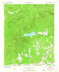 1946 Table Rock1965 Print · USGSPickens County and the Blue Ridge escarpment are documented here in the mid-1940s, showing the early infrastructure of Table Rock State Park. Researchers can trace old mountain schoolhouses like Rock Sch and family burial sites at Cassell Cems.5 unique versions available
 - 1947 Map of Eastatoe Gap
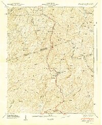 1947 Eastatoe Gap1947 Print · USGSThe South Carolina and North Carolina borderlands meet in the late 1940s at this crossroads of three national forests. Researchers can locate the Rocky Bottom Sch, find ancestors at Masters Cem, and trace the path of the Memorial Highway through the gap.
 - 1947 Map of Table Rock
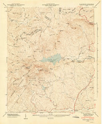 1947 Table Rock1947 Print · USGSPickens County and the Blue Ridge escarpment appear here just after the war, showing the mountain landscape before modern development. Genealogists can locate family landmarks like Cassell Cems or trace rural education at Rock Sch and New Town Sch.2 unique versions available
 - 1947 Map of Zirconia
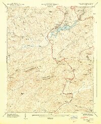 1947 Zirconia1947 Print · USGSCrossing the state line between Henderson and Greenville counties in the late 1940s, this area showcases a landscape of high peaks and hydroelectric development. Researchers can locate family landmarks such as Page Cem, Fall Creek Sch, and the old station at Zirconia.2 unique versions available
 - 1954 Map of Zirconia
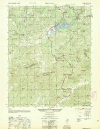 1954 Zirconia1954 Print · USGSThe Carolina borderlands come alive in the mid-fifties, showing the intersection of the Saluda Mountains and the Green River. Researchers can trace old family burial grounds like Page Cem, visit the settlement at Tuxedo, or locate historic landmarks like the Corbin Mtn Lookout Tower.
 - 1954 Map of Greenville, 1965 Print
 1954 Greenville1965 Print · USGSThe Upstate and Northeast Georgia are captured here during a decade of massive transformation as new reservoirs reshaped the Piedmont. Genealogists and hikers can trace the Appalachian Trail over Brasstown Bald or locate old community centers like Demorest, Westminster, and Royston.3 unique versions available
 - 1955 Map of Knoxville
 1955 Knoxville1955 Print · USGSThe Southern Appalachians and the Smoky Mountains are shown here at a peak of mid-century development and conservation. Genealogists and historians can trace the early road networks connecting Gatlinburg, Waynesville, and the Cherokee Indian Reservation across the high ridges.
 - 1957 Map of Fountain Inn, 1958 Print
 1957 Fountain Inn1958 Print · USGSThe South Carolina upstate's rural textile and transit corridor is captured here in the late fifties, following the rail line through Fountain Inn and Gray Court. Genealogists can trace family landmarks and rural life at Hickory Tavern, Knighton Chapel, and Bryson High Sch.
Showing maps 1-25 of 70
Top cities of Greenville County
- Greenville historical maps
- Mauldin historical maps
- Simpsonville historical maps
- Wade Hampton historical maps
- Travelers Rest historical maps
- Tigerville historical maps
Frequently asked questions
- What are the different types of historical maps available for Greenville County?
- What is the oldest map of Greenville County?
- Where can I purchase historical maps of Greenville County for my home or office?
- Where can I download high-res historical maps of Greenville County?
- Are there historical topographic maps available for Greenville County?
- Is there historical aerial imagery available for Greenville County?
- Where are historical maps of Greenville County sourced from?