Old Maps of Weston, South Carolina for Metal Detecting
Plan your next treasure hunt with 16 historic maps of Weston. Find old homesites, ghost towns, trails, and gathering spots that may be lost to time — perfect for identifying promising metal detecting locations.
- Locate forgotten sites: Uncover places like long-lost settlements, abandoned rail lines, or gathering spots.
- Plan better hunts: Use map overlays combined with LiDAR or satellite views to narrow in on historically rich areas.
- Made for detectorists: Thousands of hobbyists use these maps to discover relics, coins, and hidden history.
Use these historic maps to boost your research and find new opportunities beneath the surface of Weston.
Weston, SC maps
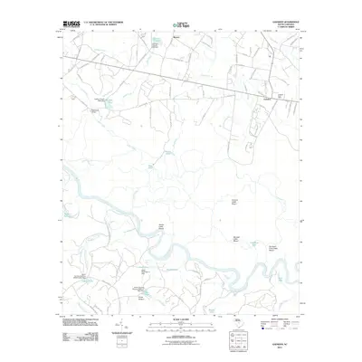
(16)- 1948 Map of Hopkins
 1948 Hopkins1948 Print · USGSRichland and Calhoun counties are captured here just after the war, showing the expansion of federal military sites into the rural South Carolina landscape. Genealogists can locate family-named landmarks like Coughmans Pond and dozens of country schools including Lower Richland High Sch and Hopkins Sch.3 unique versions available
 - 1953 Map of Gadsden, 1957 Print
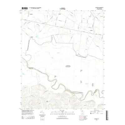
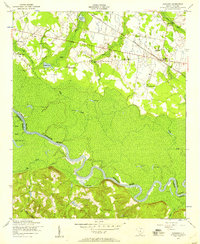 1953 Gadsden1957 Print · USGSThe rural lowcountry of Richland and Calhoun Counties comes into focus in the early fifties, following the Congaree River. Genealogists can trace old family sites near Gadsden, Weston, and local landmarks like Zion Pilgrim Church and the Clayton School.
 - 1954 Map of Augusta
 1954 Augusta1954 Print · USGSThe Savannah River valley and South Carolina Midlands are captured here during a period of post-war growth. Researchers can trace the rail-and-river economy through the Southern RR corridor and locate historic settlements like Aiken, Orangeburg, and Sumter.
 - 1957 Map of Augusta, 1966 Print
 1957 Augusta1966 Print · USGSThe Savannah River and Santee basins are captured here during a period of massive military and industrial expansion in the late fifties. Genealogists can trace family footprints across Four Hole Swamp or near the Savannah River Plant.3 unique versions available
 - 1958 Map of Augusta
 1958 Augusta1958 Print · USGSThe borderlands between Georgia and South Carolina come alive in the 1950s, showing the early footprint of the Savannah River Plant. Genealogists and historians can trace rail-dependent towns and rural landmarks from Orangeburg to the Fort Jackson Military Reservation.
 - 1961 Map of Augusta
 1961 Augusta1961 Print · USGSThe South Carolina lowcountry and CSRA appear here in the early sixties, during a period of massive military and industrial growth. Researchers can trace the development of the Savannah River Plant or locate legacy landmarks like Nelson Ferry and Magnolia Cemetery.2 unique versions available
 - 1962 Map of Augusta
 1962 Augusta1962 Print · USGSThe South Carolina and Georgia borderlands are seen here in the early sixties, showing the rise of the Savannah River Plant and the expansion of Fort Jackson. Researchers can trace old rail lines like the Southern Railway and find landmarks such as St. Pauls Church or the Santee Canal.
 - 1972 Map of Gadsden, 1974 Print
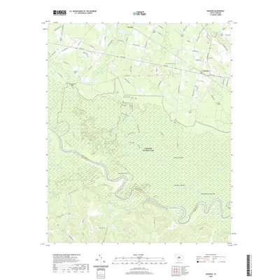
 1972 Gadsden1974 Print · USGSRichland and Calhoun counties are defined by the winding Congaree River in this early 1970s survey. Genealogists and local historians can locate many rural landmarks including Mt Moriah Ch, Gadsden Sch, and the SOUTHERN railroad line.3 unique versions available
 - 1986 Map of Sumter
 1986 Sumter1986 Print · USGSMid-South Carolina in the mid-eighties reveals a landscape of massive river bottomlands and significant military installations. Genealogists and historians can trace the rural networks around Fort Motte, Lone Star, and Sardinia alongside Lake Marion.
 - 1990 Map of Sumter
 1990 Sumter1990 Print · USGSCentral South Carolina's river systems and military landscapes are captured here during the late twentieth century. Genealogists and historians can trace the growth of Sumter or locate rural communities such as Wedgefield and Kingville near the Congaree River.
 - 1994 Map of Gadsden, 1999 Print
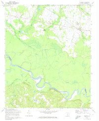
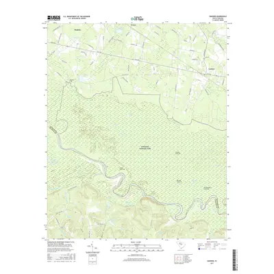
 1994 Gadsden1999 Print · USGSRichland County's river-bottom wilderness and rural communities are captured here in the mid-1990s. Researchers can locate numerous family-named landmarks and local institutions like Zion Pilgrim Ch, Gadsden Sch, and the oxbows of the Congaree River.
 - 2011 Map of Gadsden, 2011 Print
 2011 Gadsden2011 Print · USGSCovers Weston, including Gadsden, Richland County, and other nearby areas
 - 2014 Map of Gadsden, 2014 Print
 2014 Gadsden2014 Print · USGSCovers Weston, including Gadsden, Richland County, and other nearby areas
 - 2017 Map of Gadsden, 2017 Print
 2017 Gadsden2017 Print · USGSCovers Weston, including Gadsden, Richland County, and other nearby areas
 - 2020 Map of Gadsden, 2020 Print
 2020 Gadsden2020 Print · USGSCovers Weston, including Gadsden, Richland County, and other nearby areas
 - 2024 Map of Gadsden, 2024 Print
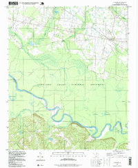
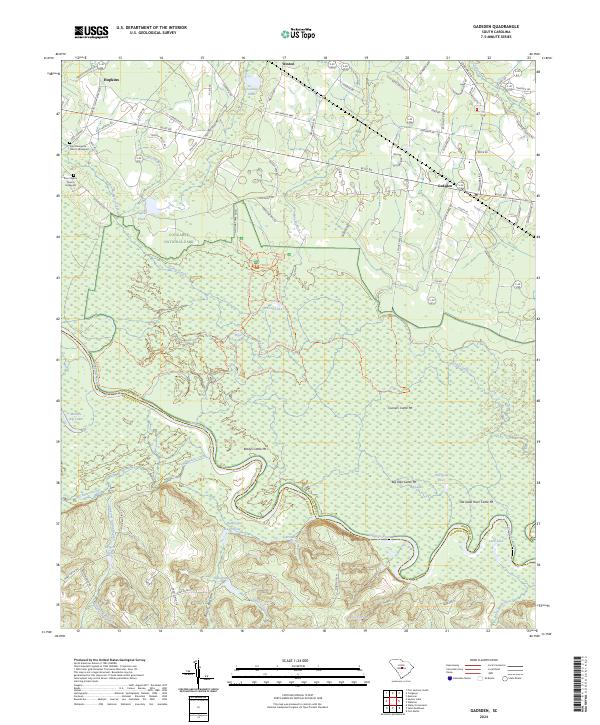 2024 Gadsden2024 Print · USGSRichland County's riverfront and the deep floodplains of the Congaree are meticulously detailed in this recent survey. Genealogists and historians can locate the Zion Pilgrim Church Graveyard or trace the unusual cattle mounds like Old Dead River Cattle Mt near the Congaree River.
End of results
Showing maps 1-16 of 16
Top cities near Weston
- Columbia historical maps
- Cayce historical maps
- Forest Acres historical maps
- Saint Matthews historical maps
- Arcadia Lakes historical maps
- Eastover historical maps
Frequently asked questions
- What are the different types of historical maps available for Weston?
- What is the oldest map of Weston?
- Where can I purchase historical maps of Weston for my home or office?
- Where can I download high-res historical maps of Weston?
- Are there historical topographic maps available for Weston?
- Is there historical aerial imagery available for Weston?
- Where are historical maps of Weston sourced from?