Old Maps of Saluda County, South Carolina for Academic Research
Study the evolution of Saluda County with 123 high-resolution historic maps. Whether you're teaching, researching, or modeling changes in land use, these maps provide essential visual documentation of urban, environmental, and geographic change.
- Analyze long-term change: Track patterns in development, transportation, and natural features.
- Ideal for environmental or urban studies: Support academic projects with primary historical map data.
- Use in the classroom or lab: Educators and researchers rely on these maps to bring historical context to life.
These maps are a powerful tool for teaching, research, and visualizing how Saluda County has changed over the decades.
Saluda County, SC maps
(123)- 1892 Map of Mc Cormick
 1892 Mc Cormick1892 Print · USGSThe Savannah River borderlands in the 1890s reveal a network of historic ferries and early mills connecting Georgia and South Carolina. Genealogists can trace family roots through landmarks like Dunn Chapel, Searle Mill, and the crossings at Barksdale Ferry.5 unique versions available
 - 1904 Map of Columbia
 1904 Columbia1904 Print · USGSRichland and Fairfield counties at the turn of the century are defined by their river-and-rail corridors and rural church communities. Genealogists can trace family footprints across Broad River ferries, the Southern R.R., and landmarks like The Old Brick Church or Winnsboro.2 unique versions available
 - 1912 Map of Mc Cormick, 1913 Print
 1912 Mc Cormick1913 Print · USGSThe Georgia and South Carolina borderlands come alive in the 1890s, centered on the rail junction at Mc Cormick and the Savannah River. Genealogists can trace family footprints across numerous river crossings like Fury Ferry and through rural centers such as Appling and Sharon Church.
 - 1941 Map of Spartanburg
 1941 Spartanburg1941 Print · USGSSouth Carolina’s Piedmont and Sandhills regions are shown here during the mid-century peak of the rail era. Researchers can trace the sprawling Fort Jackson Military Reservation and the industrial growth of hubs like Spartanburg and Rock Hill.
 - 1953 Map of Athens, 1966 Print
 1953 Athens1966 Print · USGSGeorgia's Piedmont and Savannah River borderlands come alive in this mid-century survey of the region surrounding Athens and Augusta. Trace the rail-and-river economy through the Georgia RR and landmarks like the Fort Gordon Military Reservation.3 unique versions available
 - 1953 Map of Spartanburg, 1966 Print
 1953 Spartanburg1966 Print · USGSMid-century South Carolina comes into focus through this survey of the Piedmont and the Sand Hills at a time of significant reservoir expansion. Researchers can trace the legacy of industrial transit and resource extraction from the Haile Gold Mine to the rail hubs of the Seaboard Air Line.4 unique versions available
 - 1954 Map of Augusta
 1954 Augusta1954 Print · USGSThe Savannah River valley and South Carolina Midlands are captured here during a period of post-war growth. Researchers can trace the rail-and-river economy through the Southern RR corridor and locate historic settlements like Aiken, Orangeburg, and Sumter.
 - 1957 Map of Augusta, 1966 Print
 1957 Augusta1966 Print · USGSThe Savannah River and Santee basins are captured here during a period of massive military and industrial expansion in the late fifties. Genealogists can trace family footprints across Four Hole Swamp or near the Savannah River Plant.3 unique versions available
 - 1958 Map of Augusta
 1958 Augusta1958 Print · USGSThe borderlands between Georgia and South Carolina come alive in the 1950s, showing the early footprint of the Savannah River Plant. Genealogists and historians can trace rail-dependent towns and rural landmarks from Orangeburg to the Fort Jackson Military Reservation.
 - 1958 Map of Athens
 1958 Athens1958 Print · USGSNorth-central Georgia and the Savannah River valley are captured in the late fifties, showing the region as the new reservoirs were filling. Researchers can trace historic rail lines like the Georgia RR and locate rural landmarks such as Social Circle, Graves Mountain, and the Fort Gordon Military Reservation.
 - 1959 Map of Athens
 1959 Athens1959 Print · USGSNortheast Georgia and the South Carolina borderlands appear here in the mid-fifties, during a decade of infrastructure growth. Genealogists and historians can trace the rail-and-river geography of towns like Social Circle, the sprawl of Fort Gordon Military Reservation, and the newly formed Clark Hill Reservoir.
 - 1960 Map of Spartanburg
 1960 Spartanburg1960 Print · USGSThe South Carolina Piedmont and North Carolina borderlands come alive in this mid-century survey of the region between Spartanburg and Columbia. Researchers can trace the Seaboard Air Line railroad and explore landmarks like Anderson Quarry, Lake Murray, and Mount Croghan.2 unique versions available
 - 1961 Map of Augusta
 1961 Augusta1961 Print · USGSThe South Carolina lowcountry and CSRA appear here in the early sixties, during a period of massive military and industrial growth. Researchers can trace the development of the Savannah River Plant or locate legacy landmarks like Nelson Ferry and Magnolia Cemetery.2 unique versions available
 - 1962 Map of Augusta
 1962 Augusta1962 Print · USGSThe South Carolina and Georgia borderlands are seen here in the early sixties, showing the rise of the Savannah River Plant and the expansion of Fort Jackson. Researchers can trace old rail lines like the Southern Railway and find landmarks such as St. Pauls Church or the Santee Canal.
 - 1963 Map of Athens
 1963 Athens1963 Print · USGSGeorgia's Piedmont and the Savannah River valley are captured in the early sixties as major reservoirs and military installations reshaped the landscape. Researchers can trace the development of Clark Hill Reservoir, locate the Fort Gordon Military Reservation, and find historic towns like Social Circle and Eatonton.
 - 1963 Map of Spartanburg
 1963 Spartanburg1963 Print · USGSMid-century South Carolina comes alive in this survey, showing the rail-linked corridor between the Upstate and the Midlands. Genealogists can trace family lands near old hubs like Union and Lancaster, or along the banks of the Broad River and Pee Dee River.
 - 1964 Map of Spartanburg
 1964 Spartanburg1964 Print · USGSMid-century South Carolina comes alive in this survey of the Piedmont and Upcountry, stretching from the Blue Ridge foothills to the Sandhills. Genealogists and historians can trace the rail-and-river economy through Monarch Mills, Glenn Springs, and the Southern Railway corridor.
 - 1964 Map of Ridge Spring, 1965 Print
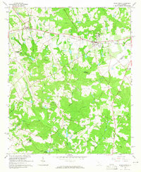 1964 Ridge Spring1965 Print · USGSRidge Spring and the surrounding tri-county area are captured here in the mid-1960s, a landscape shaped by the SOUTHERN railroad and deep-rooted rural communities. Genealogists and historians can trace numerous family landmarks, including Yonce Cem, Spann Ch, and the historical path of the Old Plank Road.2 unique versions available
 - 1964 Map of Monetta, 1965 Print
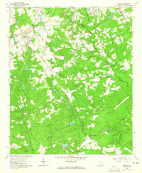 1964 Monetta1965 Print · USGSMonetta and its surrounding farmsteads are captured in the mid-sixties at the junction of three South Carolina counties. Researchers can trace old family lines through Monetta Cemetery and the Kneece settlement, or locate mid-century landmarks like the Drive-in Theater.2 unique versions available
 - 1964 Map of Emory, 1965 Print
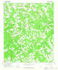 1964 Emory1965 Print · USGSSaluda County in the mid-sixties presents a detailed view of South Carolina's rural landscape as it balanced tradition with new infrastructure. Genealogists and local historians can trace old homesteads near Richland, historic burials at Richland Springs Cem, and the path of the Old Railroad Grade.2 unique versions available
 - 1964 Map of Owdoms, 1965 Print
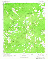 1964 Owdoms1965 Print · USGSEdgefield and Saluda counties appear here in the mid-1960s, showing a quiet landscape of timber and traditional farmsteads. Researchers can trace family roots at Dorn Cem or find local landmarks like the Southern Gold Mine and McKendree Ch.2 unique versions available
 - 1964 Map of Saluda South, 1965 Print
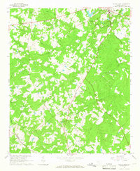 1964 Saluda South1965 Print · USGSSouth Carolina's Piedmont countryside south of the county seat is captured in the mid-1960s, showing a transition from traditional agriculture to modern land use. Genealogists can trace family landmarks like Wright Cem and Cedar Grove Ch, or follow the path of the Old Railroad Grade.2 unique versions available
 - 1964 Map of Batesburg, 1965 Print
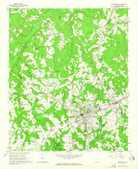 1964 Batesburg1965 Print · USGSBatesburg and Leesville are shown in detail during the early 1960s as they prospered along the Southern Railway corridor. Genealogists can trace countless family sites like Mitchell Cem, Bouknight Cem, and rural landmarks such as Holston Crossroads.2 unique versions available
 - 1964 Map of Johnston, 1966 Print
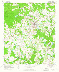 1964 Johnston1966 Print · USGSEdgefield and Saluda counties are shown in the mid-1960s as the regional rail and agricultural economy transitioned. Genealogists can locate family-named sites such as Holmes Cem, Warren Cem, and the historic Shaws Creek Ch.2 unique versions available
 - 1965 Map of Limestone, 1967 Print
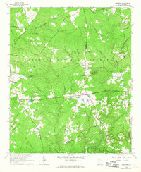 1965 Limestone1967 Print · USGSThe rural crossroads of the South Carolina piedmont are preserved here in the mid-1960s, showing the intersection of five different counties. Genealogists and researchers can trace family landmarks and historic travel routes like Martintown Road, Sullivan Crossroads, and Bailey Bethel Ch.
Showing maps 1-25 of 123
Top cities of Saluda County
Frequently asked questions
- What are the different types of historical maps available for Saluda County?
- What is the oldest map of Saluda County?
- Where can I purchase historical maps of Saluda County for my home or office?
- Where can I download high-res historical maps of Saluda County?
- Are there historical topographic maps available for Saluda County?
- Is there historical aerial imagery available for Saluda County?
- Where are historical maps of Saluda County sourced from?