Old Maps of Saluda County, South Carolina for Genealogy
Trace your family roots with 55 historic maps of Saluda County. These high-res maps reveal old neighborhoods, homesites, landmarks, and streets — helping you uncover where your ancestors lived and how the area evolved over time.
- Explore historic neighborhoods: Identify where your relatives may have lived in the 1800s or 1900s.
- Compare maps over time: Trace the changes in streets, buildings, and landmarks for multi-generational research.
- Perfect for genealogy & ancestry research: Used by family historians and researchers to map out lineage and migration.
These maps are an incredible resource for exploring your personal connection to Saluda County's past.
Saluda County, SC maps
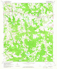
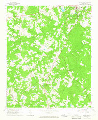
(55)- 1892 Map of Mc Cormick
 1892 Mc Cormick1892 Print · USGSCovers Saluda County, including Augusta, North Augusta, and other nearby areas5 unique versions available
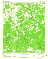
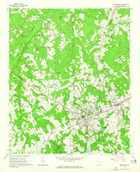
 - 1904 Map of Columbia
 1904 Columbia1904 Print · USGSCovers Saluda County, including Columbia, Lexington, and other nearby areas2 unique versions available
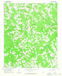
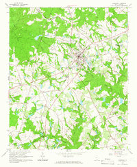
 - 1912 Map of Mc Cormick, 1913 Print
 1912 Mc Cormick1913 Print · USGSCovers Saluda County, including Augusta, North Augusta, and other nearby areas
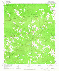
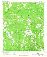
 - 1941 Map of Spartanburg
 1941 Spartanburg1941 Print · USGSCovers Saluda County, including Columbia, Rock Hill, and other nearby areas
 - 1953 Map of Athens, 1966 Print
 1953 Athens1966 Print · USGSCovers Saluda County, including Augusta, Athens, and other nearby areas3 unique versions available
 - 1953 Map of Spartanburg, 1966 Print
 1953 Spartanburg1966 Print · USGSCovers Saluda County, including Columbia, Rock Hill, and other nearby areas4 unique versions available
 - 1954 Map of Augusta
 1954 Augusta1954 Print · USGSCovers Saluda County, including Augusta, Columbia, and other nearby areas
 - 1957 Map of Augusta, 1966 Print
 1957 Augusta1966 Print · USGSCovers Saluda County, including Augusta, Columbia, and other nearby areas3 unique versions available
 - 1958 Map of Augusta
 1958 Augusta1958 Print · USGSCovers Saluda County, including Augusta, Columbia, and other nearby areas
 - 1958 Map of Athens
 1958 Athens1958 Print · USGSCovers Saluda County, including Augusta, Athens, and other nearby areas
 - 1959 Map of Athens
 1959 Athens1959 Print · USGSCovers Saluda County, including Augusta, Athens, and other nearby areas
 - 1960 Map of Spartanburg
 1960 Spartanburg1960 Print · USGSCovers Saluda County, including Columbia, Rock Hill, and other nearby areas2 unique versions available
 - 1961 Map of Augusta
 1961 Augusta1961 Print · USGSCovers Saluda County, including Augusta, Columbia, and other nearby areas2 unique versions available
 - 1962 Map of Augusta
 1962 Augusta1962 Print · USGSCovers Saluda County, including Augusta, Columbia, and other nearby areas
 - 1963 Map of Athens
 1963 Athens1963 Print · USGSCovers Saluda County, including Augusta, Athens, and other nearby areas
 - 1963 Map of Spartanburg
 1963 Spartanburg1963 Print · USGSCovers Saluda County, including Columbia, Rock Hill, and other nearby areas
 - 1964 Map of Spartanburg
 1964 Spartanburg1964 Print · USGSCovers Saluda County, including Columbia, Rock Hill, and other nearby areas
 - 1964 Map of Ridge Spring, 1965 Print
 1964 Ridge Spring1965 Print · USGSCovers Saluda County, including Ridge Spring, Ward, and other nearby areas2 unique versions available
 - 1964 Map of Monetta, 1965 Print
 1964 Monetta1965 Print · USGSCovers Saluda County, including Chinquapin Falls, Jones Crossroads, and other nearby areas2 unique versions available
 - 1964 Map of Emory, 1965 Print
 1964 Emory1965 Print · USGSCovers Saluda County, including Speigner, Richland, and other nearby areas2 unique versions available
 - 1964 Map of Owdoms, 1965 Print
 1964 Owdoms1965 Print · USGSCovers Saluda County, including Owdoms, Meeting Street, and other nearby areas2 unique versions available
 - 1964 Map of Saluda South, 1965 Print
 1964 Saluda South1965 Print · USGSCovers Saluda County, including Saluda, Fruit Hill, and other nearby areas2 unique versions available
 - 1964 Map of Batesburg, 1965 Print
 1964 Batesburg1965 Print · USGSCovers Saluda County, including Hibernia, Holston Crossroads, and other nearby areas2 unique versions available
 - 1964 Map of Johnston, 1966 Print
 1964 Johnston1966 Print · USGSCovers Saluda County, including Johnston, Trenton, and other nearby areas2 unique versions available
 - 1965 Map of Limestone, 1967 Print
 1965 Limestone1967 Print · USGSCovers Saluda County, including Sheppard Crossroads, Pittsburg, and other nearby areas
Showing maps 1-25 of 55
Top cities of Saluda County
Frequently asked questions
- What are the different types of historical maps available for Saluda County?
- What is the oldest map of Saluda County?
- Where can I purchase historical maps of Saluda County for my home or office?
- Where can I download high-res historical maps of Saluda County?
- Are there historical topographic maps available for Saluda County?
- Is there historical aerial imagery available for Saluda County?
- Where are historical maps of Saluda County sourced from?