1950s Maps of Dalzell, South Carolina
Explore 7 historic maps of Dalzell from the 1950s. These maps offer a rare glimpse into what life looked like during the 1950s — showing old roads, neighborhoods, homes, and landmarks that have changed or disappeared over time.
Whether you're researching your family's past, planning a metal detecting trip, or studying how Dalzell's landscape evolved across the 1950s, these high-resolution maps are a powerful tool for exploring the history of this region.
- Focus on a specific era: All maps on this page are from the 1950s, giving you a focused view of this time period.
- See what’s changed: Compare century-old streets, trails, and buildings to today's modern landscape using overlays and satellite layers.
- Research with precision: Use these maps for genealogy, historical research, land use analysis, or educational projects.
- View, download, or print: Maps are fully viewable online in high resolution, and can be downloaded or printed for your own records.
Start exploring Dalzell's history through authentic maps from the 1950s. This is your window into the past.
Dalzell, SC maps
(7)- 1953 Map of Spartanburg, 1966 Print
 1953 Spartanburg1966 Print · USGSMid-century South Carolina comes into focus through this survey of the Piedmont and the Sand Hills at a time of significant reservoir expansion. Researchers can trace the legacy of industrial transit and resource extraction from the Haile Gold Mine to the rail hubs of the Seaboard Air Line.4 unique versions available
 - 1954 Map of Augusta
 1954 Augusta1954 Print · USGSThe Savannah River valley and South Carolina Midlands are captured here during a period of post-war growth. Researchers can trace the rail-and-river economy through the Southern RR corridor and locate historic settlements like Aiken, Orangeburg, and Sumter.
 - 1957 Map of Sumter West, 1958 Print
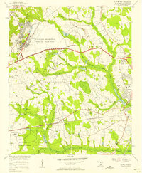 1957 Sumter West1958 Print · USGSSumter County in the late fifties shows a landscape of growing military facilities and traditional swamp-side agriculture. Researchers can find old family cemeteries and country churches like St Michaels Sch Reese Chapel and Bold Pilgrim Ch alongside the sprawling Shaw Air Force Base.3 unique versions available
 - 1957 Map of Ashwood, 1958 Print
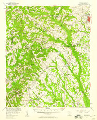 1957 Ashwood1958 Print · USGSThe rural landscapes of Lee and Sumter counties are captured here in the late fifties, during an era of significant agricultural and social transition. Researchers can trace the legacy of New Deal planning at Ashwood, locate family roots at Bethlehem Cems, or follow the Seaboard Air Line through Bishopville.2 unique versions available
 - 1957 Map of Sumter, 1959 Print
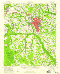 1957 Sumter1959 Print · USGSSumter at the close of the fifties is a bustling military and educational hub, marked by the expansion of Shaw Air Force Base. Genealogists and local historians can trace rural family churches like Bold Pilgrim Ch and old transport routes including Old Ferry Road.2 unique versions available
 - 1957 Map of Augusta, 1966 Print
 1957 Augusta1966 Print · USGSThe Savannah River and Santee basins are captured here during a period of massive military and industrial expansion in the late fifties. Genealogists can trace family footprints across Four Hole Swamp or near the Savannah River Plant.3 unique versions available
 - 1958 Map of Augusta
 1958 Augusta1958 Print · USGSThe borderlands between Georgia and South Carolina come alive in the 1950s, showing the early footprint of the Savannah River Plant. Genealogists and historians can trace rail-dependent towns and rural landmarks from Orangeburg to the Fort Jackson Military Reservation.
End of results
Showing maps 1-7 of 7
Top cities near Dalzell
- Sumter historical maps
- Lugoff historical maps
- Camden historical maps
- Bishopville historical maps
- Mayesville historical maps
Top neighborhoods of Dalzell
Frequently asked questions
- What are the different types of historical maps available for Dalzell?
- What is the oldest map of Dalzell?
- Where can I purchase historical maps of Dalzell for my home or office?
- Where can I download high-res historical maps of Dalzell?
- Are there historical topographic maps available for Dalzell?
- Is there historical aerial imagery available for Dalzell?
- Where are historical maps of Dalzell sourced from?