Old Maps of Dalzell, South Carolina for Genealogy
Trace your family roots with 30 historic maps of Dalzell. These high-res maps reveal old neighborhoods, homesites, landmarks, and streets — helping you uncover where your ancestors lived and how the area evolved over time.
- Explore historic neighborhoods: Identify where your relatives may have lived in the 1800s or 1900s.
- Compare maps over time: Trace the changes in streets, buildings, and landmarks for multi-generational research.
- Perfect for genealogy & ancestry research: Used by family historians and researchers to map out lineage and migration.
These maps are an incredible resource for exploring your personal connection to Dalzell's past.
Dalzell, SC maps
(30)- 1941 Map of Spartanburg
 1941 Spartanburg1941 Print · USGSSouth Carolina’s Piedmont and Sandhills regions are shown here during the mid-century peak of the rail era. Researchers can trace the sprawling Fort Jackson Military Reservation and the industrial growth of hubs like Spartanburg and Rock Hill.
 - 1946 Map of Sumter
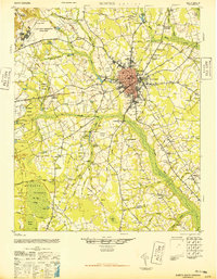 1946 Sumter1946 Print · USGSSumter and its surrounding lowlands were at a peak of rail and aviation development just after the war. Researchers can trace dozens of rural landmarks, from Pocalla Springs and Swan Lake to the sprawling Shaw Field.
 - 1953 Map of Spartanburg, 1966 Print
 1953 Spartanburg1966 Print · USGSMid-century South Carolina comes into focus through this survey of the Piedmont and the Sand Hills at a time of significant reservoir expansion. Researchers can trace the legacy of industrial transit and resource extraction from the Haile Gold Mine to the rail hubs of the Seaboard Air Line.4 unique versions available
 - 1954 Map of Augusta
 1954 Augusta1954 Print · USGSThe Savannah River valley and South Carolina Midlands are captured here during a period of post-war growth. Researchers can trace the rail-and-river economy through the Southern RR corridor and locate historic settlements like Aiken, Orangeburg, and Sumter.
 - 1957 Map of Sumter West, 1958 Print
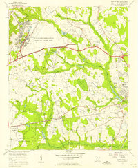 1957 Sumter West1958 Print · USGSSumter County in the late fifties shows a landscape of growing military facilities and traditional swamp-side agriculture. Researchers can find old family cemeteries and country churches like St Michaels Sch Reese Chapel and Bold Pilgrim Ch alongside the sprawling Shaw Air Force Base.3 unique versions available
 - 1957 Map of Ashwood, 1958 Print
 1957 Ashwood1958 Print · USGSThe rural landscapes of Lee and Sumter counties are captured here in the late fifties, during an era of significant agricultural and social transition. Researchers can trace the legacy of New Deal planning at Ashwood, locate family roots at Bethlehem Cems, or follow the Seaboard Air Line through Bishopville.2 unique versions available
 - 1957 Map of Sumter, 1959 Print
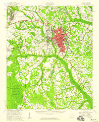 1957 Sumter1959 Print · USGSSumter at the close of the fifties is a bustling military and educational hub, marked by the expansion of Shaw Air Force Base. Genealogists and local historians can trace rural family churches like Bold Pilgrim Ch and old transport routes including Old Ferry Road.2 unique versions available
 - 1957 Map of Augusta, 1966 Print
 1957 Augusta1966 Print · USGSThe Savannah River and Santee basins are captured here during a period of massive military and industrial expansion in the late fifties. Genealogists can trace family footprints across Four Hole Swamp or near the Savannah River Plant.3 unique versions available
 - 1958 Map of Augusta
 1958 Augusta1958 Print · USGSThe borderlands between Georgia and South Carolina come alive in the 1950s, showing the early footprint of the Savannah River Plant. Genealogists and historians can trace rail-dependent towns and rural landmarks from Orangeburg to the Fort Jackson Military Reservation.
 - 1960 Map of Spartanburg
 1960 Spartanburg1960 Print · USGSThe South Carolina Piedmont and North Carolina borderlands come alive in this mid-century survey of the region between Spartanburg and Columbia. Researchers can trace the Seaboard Air Line railroad and explore landmarks like Anderson Quarry, Lake Murray, and Mount Croghan.2 unique versions available
 - 1961 Map of Augusta
 1961 Augusta1961 Print · USGSThe South Carolina lowcountry and CSRA appear here in the early sixties, during a period of massive military and industrial growth. Researchers can trace the development of the Savannah River Plant or locate legacy landmarks like Nelson Ferry and Magnolia Cemetery.2 unique versions available
 - 1961 Map of Sumter West, 1981 Print
 1961 Sumter West1981 Print · USGSPickens County mountain communities were adapting to the rising waters of the Keowee reservoir during the early sixties and seventies. Genealogists and historians can locate family landmarks like Nimmons Cem, the Holly Springs Sch, and Mt Bethel Ch.
 - 1962 Map of Augusta
 1962 Augusta1962 Print · USGSThe South Carolina and Georgia borderlands are seen here in the early sixties, showing the rise of the Savannah River Plant and the expansion of Fort Jackson. Researchers can trace old rail lines like the Southern Railway and find landmarks such as St. Pauls Church or the Santee Canal.
 - 1963 Map of Spartanburg
 1963 Spartanburg1963 Print · USGSMid-century South Carolina comes alive in this survey, showing the rail-linked corridor between the Upstate and the Midlands. Genealogists can trace family lands near old hubs like Union and Lancaster, or along the banks of the Broad River and Pee Dee River.
 - 1964 Map of Spartanburg
 1964 Spartanburg1964 Print · USGSMid-century South Carolina comes alive in this survey of the Piedmont and Upcountry, stretching from the Blue Ridge foothills to the Sandhills. Genealogists and historians can trace the rail-and-river economy through Monarch Mills, Glenn Springs, and the Southern Railway corridor.
 - 1986 Map of Camden South
 1986 Camden South1986 Print · USGSThe South Carolina midlands come into focus in the mid-eighties, showing the sprawling corridors between the Wateree and Lynches Rivers. Genealogists and historians can trace family roots through numerous mill sites and rural junctions like Boykin, Lucknow, and Hermitage Mill Pond.4 unique versions available
 - 1986 Map of Sumter
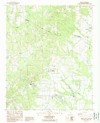
 1986 Sumter1986 Print · USGSMid-South Carolina in the mid-eighties reveals a landscape of massive river bottomlands and significant military installations. Genealogists and historians can trace the rural networks around Fort Motte, Lone Star, and Sardinia alongside Lake Marion.
 - 1988 Map of Dalzell
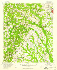
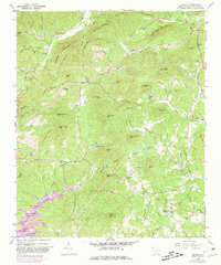
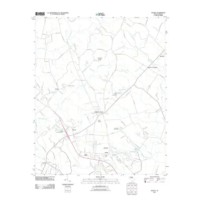
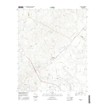
 1988 Dalzell1988 Print · USGSThe Sumter and Lee County line comes alive in the late 1980s, showing a landscape of crossroads settlements and low-country swamplands. Researchers can trace the Old RR Grade and locate family landmarks near Gaillard Crossroads, Borden, and Catchall.
 - 1990 Map of Sumter
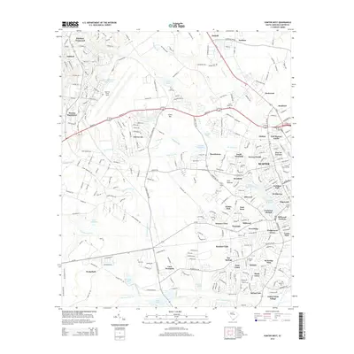
 1990 Sumter1990 Print · USGSCentral South Carolina's river systems and military landscapes are captured here during the late twentieth century. Genealogists and historians can trace the growth of Sumter or locate rural communities such as Wedgefield and Kingville near the Congaree River.
 - 2011 Map of Sumter West, 2011 Print
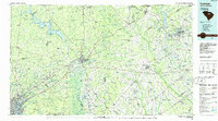
 2011 Sumter West2011 Print · USGSCovers Dalzell, including Sumter, Summer View, and other nearby areas
 - 2011 Map of Dalzell, 2011 Print
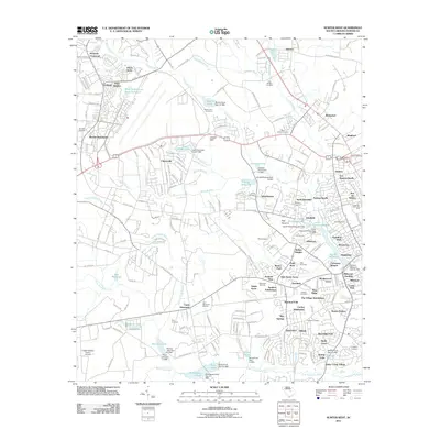
 2011 Dalzell2011 Print · USGSCovers Dalzell, including Burrows Crossroads, Borden, and other nearby areas
 - 2014 Map of Sumter West, 2014 Print
 2014 Sumter West2014 Print · USGSCovers Dalzell, including Sumter, Summer View, and other nearby areas
 - 2014 Map of Dalzell, 2014 Print
 2014 Dalzell2014 Print · USGSCovers Dalzell, including Burrows Crossroads, Borden, and other nearby areas
 - 2017 Map of Sumter West, 2017 Print
 2017 Sumter West2017 Print · USGSCovers Dalzell, including Sumter, Summer View, and other nearby areas
 - 2017 Map of Dalzell, 2017 Print
 2017 Dalzell2017 Print · USGSCovers Dalzell, including Burrows Crossroads, Borden, and other nearby areas
Showing maps 1-25 of 30
Top cities near Dalzell
- Sumter historical maps
- Lugoff historical maps
- Camden historical maps
- Bishopville historical maps
- Mayesville historical maps
Top neighborhoods of Dalzell
Frequently asked questions
- What are the different types of historical maps available for Dalzell?
- What is the oldest map of Dalzell?
- Where can I purchase historical maps of Dalzell for my home or office?
- Where can I download high-res historical maps of Dalzell?
- Are there historical topographic maps available for Dalzell?
- Is there historical aerial imagery available for Dalzell?
- Where are historical maps of Dalzell sourced from?