1980s Maps of Mayesville, South Carolina
Explore 2 historic maps of Mayesville from the 1980s. These maps offer a rare glimpse into what life looked like during the 1980s — showing old roads, neighborhoods, homes, and landmarks that have changed or disappeared over time.
Whether you're researching your family's past, planning a metal detecting trip, or studying how Mayesville's landscape evolved across the 1980s, these high-resolution maps are a powerful tool for exploring the history of this region.
- Focus on a specific era: All maps on this page are from the 1980s, giving you a focused view of this time period.
- See what’s changed: Compare century-old streets, trails, and buildings to today's modern landscape using overlays and satellite layers.
- Research with precision: Use these maps for genealogy, historical research, land use analysis, or educational projects.
- View, download, or print: Maps are fully viewable online in high resolution, and can be downloaded or printed for your own records.
Start exploring Mayesville's history through authentic maps from the 1980s. This is your window into the past.
Mayesville, SC maps
(2)- 1983 Map of Mayesville
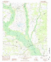 1983 Mayesville1983 Print · USGSMayesville and the surrounding wetlands of Sumter County are captured here in the early 1980s. Researchers can locate several community landmarks including the Salem Black River Ch, Mayewood Sch, and the SEABOARD SYSTEM rail corridor.2 unique versions available
 - 1986 Map of Sumter
 1986 Sumter1986 Print · USGSMid-South Carolina in the mid-eighties reveals a landscape of massive river bottomlands and significant military installations. Genealogists and historians can trace the rural networks around Fort Motte, Lone Star, and Sardinia alongside Lake Marion.
End of results
Showing maps 1-2 of 2
Top cities near Mayesville
- Sumter historical maps
- Bishopville historical maps
- Lamar historical maps
- Turbeville historical maps
- Lynchburg historical maps
Top neighborhoods of Mayesville
Frequently asked questions
- What are the different types of historical maps available for Mayesville?
- What is the oldest map of Mayesville?
- Where can I purchase historical maps of Mayesville for my home or office?
- Where can I download high-res historical maps of Mayesville?
- Are there historical topographic maps available for Mayesville?
- Is there historical aerial imagery available for Mayesville?
- Where are historical maps of Mayesville sourced from?