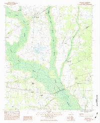
1983 Map of Mayesville
USGS Topo · Published 1983About this map
The town of Mayesville serves as the focal point of this Sumter County landscape, situated where the Seaboard System railroad cuts across a terrain defined by expansive drainage systems. The town’s history is reflected in several local landmarks, including the Mayesville Cem and Mayesville Black River Cem. Beyond the main settlement, the map documents smaller communities and rural crossroads such as Scottsville and McBride Corners.
Find a feature on this map
29 named features on this map. Tap any name to fly to it.
Don’t see what you’re looking for? This feature index may not catch every label — zoom into the map to look around manually.
Map Details
Editions of this 1983 Mayesville Map
2 editions found
Other maps of this area

1920 · Mayesville
USGS Topo · 1:48,000

1921 · Mayesville
USGS Topo · 1:62,500

1941 · Spartanburg
USGS Topo · 1:250,000

1943 · Mayesville
USGS Topo · 1:62,500

1946 · Sumter
USGS Topo · 1:62,500

1953 · Spartanburg
USGS Topo · 1:250,000

1954 · Augusta
USGS Topo · 1:250,000

1957 · Sumter East
USGS Topo · 1:24,000

1957 · Ashwood
USGS Topo · 1:62,500

1957 · Sumter
USGS Topo · 1:62,500
Featured Places
- Mayesville, SC
- Scottsville, SC
- Mayesville East Subdivision, Mayesville
- Brunsons Store, SC
- Sumter County, SC