2020s Maps of Belford Township, South Dakota
Explore 4 historic maps of Belford Township from the 2020s. These maps offer a rare glimpse into what life looked like during the 2020s — showing old roads, neighborhoods, homes, and landmarks that have changed or disappeared over time.
Whether you're researching your family's past, planning a metal detecting trip, or studying how Belford Township's landscape evolved across the 2020s, these high-resolution maps are a powerful tool for exploring the history of this region.
- Focus on a specific era: All maps on this page are from the 2020s, giving you a focused view of this time period.
- See what’s changed: Compare century-old streets, trails, and buildings to today's modern landscape using overlays and satellite layers.
- Research with precision: Use these maps for genealogy, historical research, land use analysis, or educational projects.
- View, download, or print: Maps are fully viewable online in high resolution, and can be downloaded or printed for your own records.
Start exploring Belford Township's history through authentic maps from the 2020s. This is your window into the past.
Belford Township, SD maps
(4)- 2021 Map of Storla SW, 2021 Print
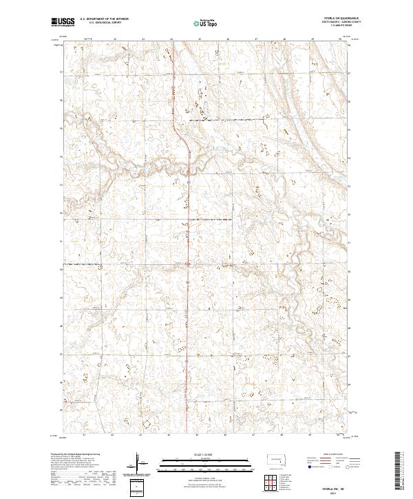 2021 Storla SW2021 Print · USGSAurora County's agricultural heartland is documented here in the early twenty-first century, showing the enduring township and range grid. Researchers can trace the meandering course of Firesteel Cr and its many smaller branches as they flow past rural thoroughfares like Co Rd 22 and 390th Ave.
 - 2021 Map of Fraser Dam, 2021 Print
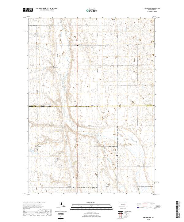 2021 Fraser Dam2021 Print · USGSSouth Dakota's prairie landscape is captured here in the early twenty-first century, showing the enduring agricultural grid across the Jerauld and Aurora county line. Trace family roots at Union Cem or Solberg Cem and locate landmarks like Fraser Dam.
 - 2021 Map of Storla, 2021 Print
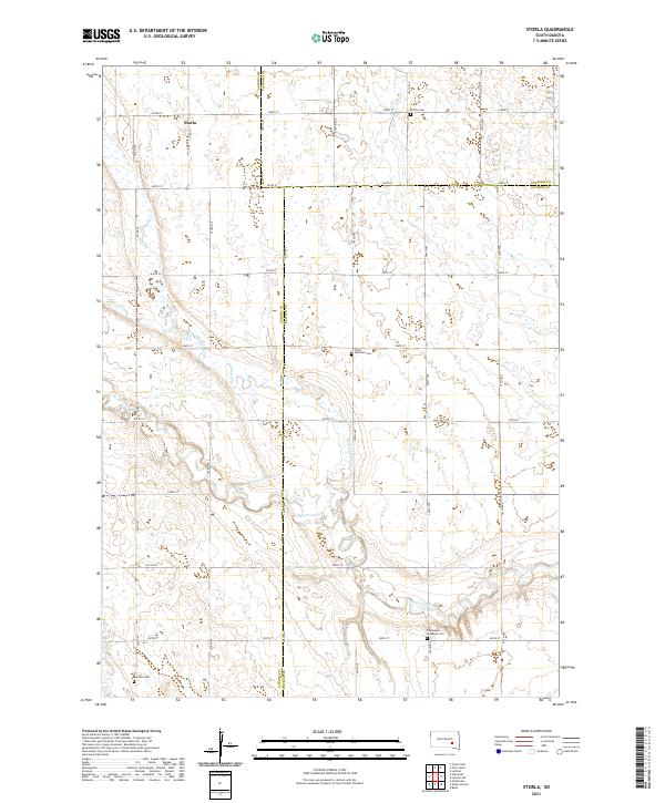 2021 Storla2021 Print · USGSAurora County's agricultural heartland is documented here in the early 2020s, showcasing the rural intersections where three counties meet. Genealogists can locate several family landmarks including Victor Lutheran Cem, Trinity Cem, and the settlement of Storla.
 - 2021 Map of Twin Lakes, 2021 Print
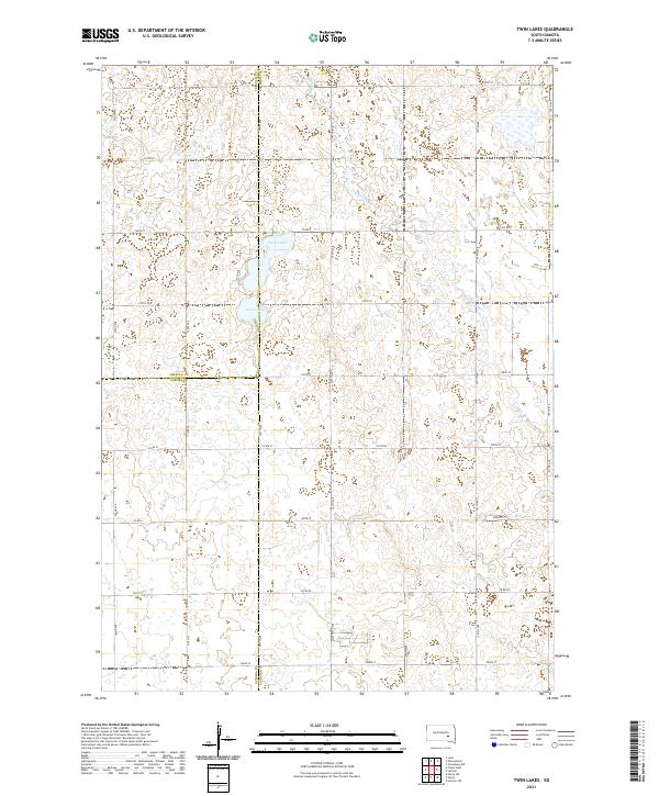 2021 Twin Lakes2021 Print · USGSThe prairie landscape at the junction of Sanborn, Jerauld, and Aurora counties is meticulously documented in this recent survey. Local historians can trace the hydrology of Twin Lakes and Grass Lake alongside rural routes like Co Rd 7.
End of results
Showing maps 1-4 of 4
Top cities near Belford Township
- Wessington Springs historical maps
- Woonsocket historical maps
- Plankinton historical maps
- Mount Vernon historical maps
- Lane historical maps
Top neighborhoods of Belford Township
Frequently asked questions
- What are the different types of historical maps available for Belford Township?
- What is the oldest map of Belford Township?
- Where can I purchase historical maps of Belford Township for my home or office?
- Where can I download high-res historical maps of Belford Township?
- Are there historical topographic maps available for Belford Township?
- Is there historical aerial imagery available for Belford Township?
- Where are historical maps of Belford Township sourced from?