1900s (20th Century) Maps of Big Course District, South Dakota
Explore 14 historic maps of Big Course District from the 1900s (20th Century). These maps offer a rare glimpse into what life looked like during the 1900s — showing old roads, neighborhoods, homes, and landmarks that have changed or disappeared over time.
Whether you're researching your family's past, planning a metal detecting trip, or studying how Big Course District's landscape evolved across the 1900s, these high-resolution maps are a powerful tool for exploring the history of this region.
- Focus on a specific era: All maps on this page are from the 1900s, giving you a focused view of this time period.
- See what’s changed: Compare century-old streets, trails, and buildings to today's modern landscape using overlays and satellite layers.
- Research with precision: Use these maps for genealogy, historical research, land use analysis, or educational projects.
- View, download, or print: Maps are fully viewable online in high resolution, and can be downloaded or printed for your own records.
Start exploring Big Course District's history through authentic maps from the 1900s. This is your window into the past.
Big Course District, SD maps
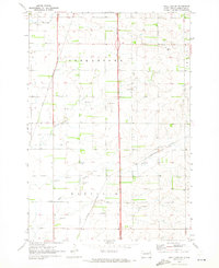
(14)- 1916 Map of Peever, 1954 Print
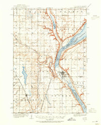 1916 Peever1954 Print · USGSCovers Big Course District, including Browns Valley, Peever, and other nearby areas
 - 1918 Map of Peever
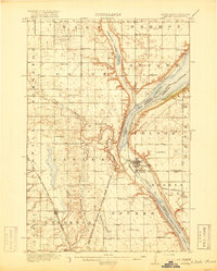 1918 Peever1918 Print · USGSCovers Big Course District, including Browns Valley, Peever, and other nearby areas4 unique versions available
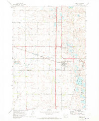
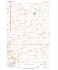
 - 1953 Map of Milbank, 1958 Print
 1953 Milbank1958 Print · USGSCovers Big Course District, including Milbank, Sisseton, and other nearby areas3 unique versions available
 - 1958 Map of Milbank
 1958 Milbank1958 Print · USGSCovers Big Course District, including Milbank, Sisseton, and other nearby areas
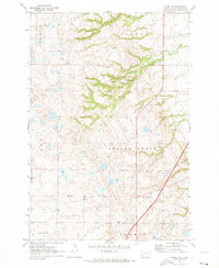
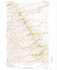
 - 1970 Map of Summit, 1973 Print
 1970 Summit1973 Print · USGSCovers Big Course District, including Summit, Enemy Swim District, and other nearby areas
 - 1970 Map of Summit NE, 1973 Print
 1970 Summit NE1973 Print · USGSCovers Big Course District, including Old Agency District, Spring Grove, and other nearby areas
 - 1970 Map of Still Lake SE, 1973 Print
 1970 Still Lake SE1973 Print · USGSCovers Big Course District, including Enemy Swim District, Germantown Township, and other nearby areas
 - 1970 Map of Marvin, 1973 Print
 1970 Marvin1973 Print · USGSCovers Big Course District, including Marvin, Roberts County, and other nearby areas
 - 1970 Map of Wilmot NW, 1973 Print
 1970 Wilmot NW1973 Print · USGSCovers Big Course District, including Old Agency District, Roberts County, and other nearby areas2 unique versions available
 - 1970 Map of Still Lake NE, 1973 Print
 1970 Still Lake NE1973 Print · USGSCovers Big Course District, including Enemy Swim District, Germantown Township, and other nearby areas
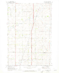
 - 1971 Map of Peever, 1974 Print
 1971 Peever1974 Print · USGSCovers Big Course District, including Peever, Old Agency District, and other nearby areas
 - 1985 Map of Webster
 1985 Webster1985 Print · USGSCovers Big Course District, including Webster, Waubay, and other nearby areas2 unique versions available
 - 1985 Map of Wheaton
 1985 Wheaton1985 Print · USGSCovers Big Course District, including Wheaton, Browns Valley, and other nearby areas2 unique versions available
 - 1985 Map of Milbank
 1985 Milbank1985 Print · USGSCovers Big Course District, including Milbank, Ortonville, and other nearby areas
End of results
Showing maps 1-14 of 14
Top cities near Big Course District
- Wilmot historical maps
- Summit historical maps
- South Shore historical maps
- Old Agency District historical maps
- Spring Grove historical maps
- Stockholm historical maps
See more
Top neighborhoods of Big Course District
Frequently asked questions
- What are the different types of historical maps available for Big Course District?
- What is the oldest map of Big Course District?
- Where can I purchase historical maps of Big Course District for my home or office?
- Where can I download high-res historical maps of Big Course District?
- Are there historical topographic maps available for Big Course District?
- Is there historical aerial imagery available for Big Course District?
- Where are historical maps of Big Course District sourced from?