2020s Maps of Big Course District, South Dakota
Explore 7 historic maps of Big Course District from the 2020s. These maps offer a rare glimpse into what life looked like during the 2020s — showing old roads, neighborhoods, homes, and landmarks that have changed or disappeared over time.
Whether you're researching your family's past, planning a metal detecting trip, or studying how Big Course District's landscape evolved across the 2020s, these high-resolution maps are a powerful tool for exploring the history of this region.
- Focus on a specific era: All maps on this page are from the 2020s, giving you a focused view of this time period.
- See what’s changed: Compare century-old streets, trails, and buildings to today's modern landscape using overlays and satellite layers.
- Research with precision: Use these maps for genealogy, historical research, land use analysis, or educational projects.
- View, download, or print: Maps are fully viewable online in high resolution, and can be downloaded or printed for your own records.
Start exploring Big Course District's history through authentic maps from the 2020s. This is your window into the past.
Big Course District, SD maps
(7)- 2021 Map of Peever, 2021 Print
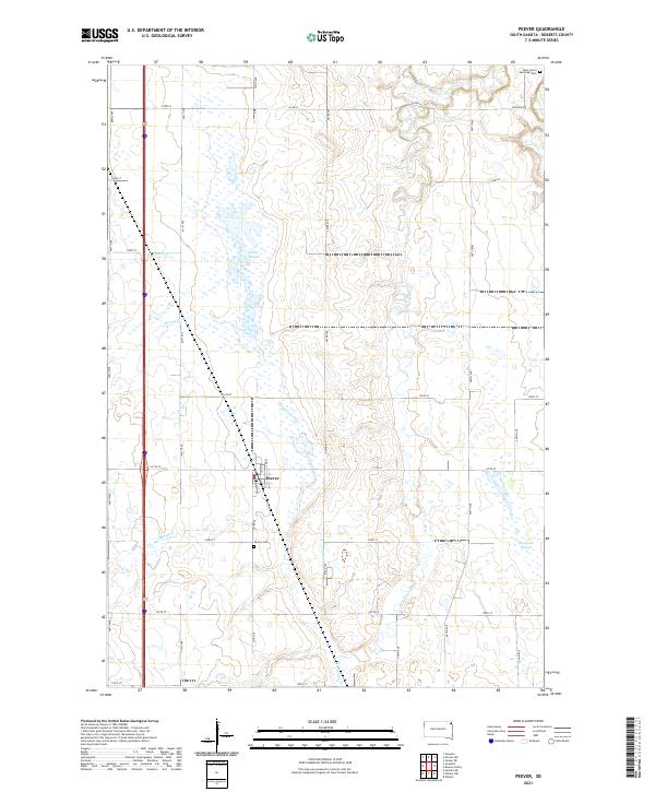 2021 Peever2021 Print · USGSThe town of Peever and its surrounding wetlands are mapped here in the early twenty-first century. Researchers can locate family sites near Peever Cem or trace the meandering paths of the Jorgenson River and Little Minnesota River across the Roberts County prairie.
 - 2021 Map of Wilmot NW, 2021 Print
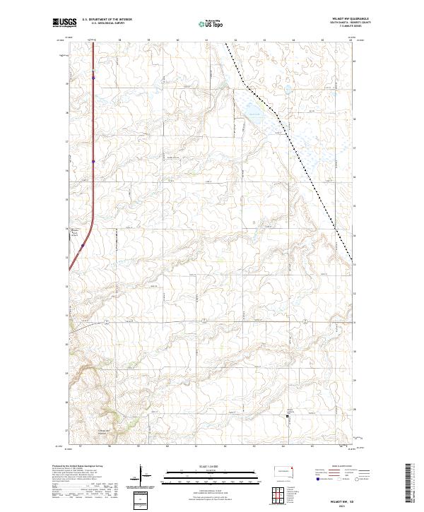 2021 Wilmot NW2021 Print · USGSThe high plateau of the Roberts County prairie is captured here in the early twenty-first century. Genealogists and local historians can trace family locations near Wilmot Lutheran Cem or locate regional landmarks like Whipple Ranch Airport.
 - 2021 Map of Marvin, 2021 Print
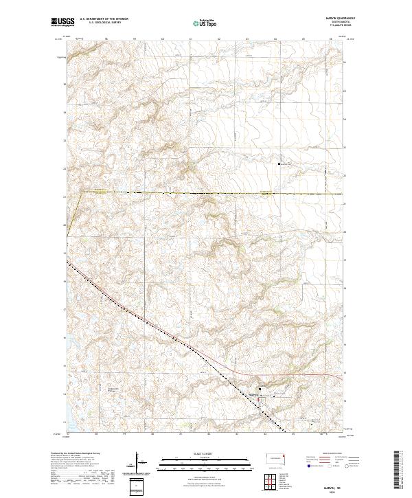 2021 Marvin2021 Print · USGSThe upland plateau of the Coteau des Prairies defines this contemporary study of the Marvin area. Researchers can locate several burial grounds, including Eastman Cem, Blue Cloud Abbey Cem, and the two Osceola cemeteries near the town center.
 - 2021 Map of Still Lake NE, 2021 Print
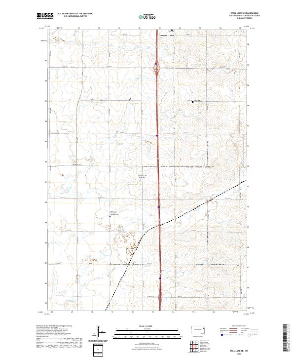
 2021 Still Lake NE2021 Print · USGSThe high prairie landscape along the Grant and Codington county line is captured here in the early twenty-first century. Genealogists and local historians can locate rural landmarks such as Mazeppa Cem, Klix Cem, and the winding Soo Cr.
 - 2021 Map of Still Lake SE, 2021 Print
 2021 Still Lake SE2021 Print · USGSIn the heart of the eastern South Dakota plains, this recent survey documents the enduring agricultural landscape and rural community hubs. Genealogists can locate several local burial sites, including the Klix Cem and Saint Lukes Lutheran Cem.
 - 2021 Map of Summit, 2021 Print
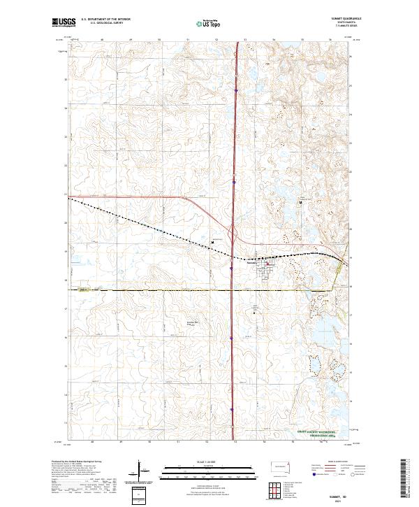 2021 Summit2021 Print · USGSThe high plateau of the Coteau des Prairies provides the backdrop for this look at the town of Summit and its surrounding prairie homesteads. Researchers can locate family sites near Hope Lutheran Cem or trace the early course of the Big Sioux River.
 - 2021 Map of Summit NE, 2021 Print
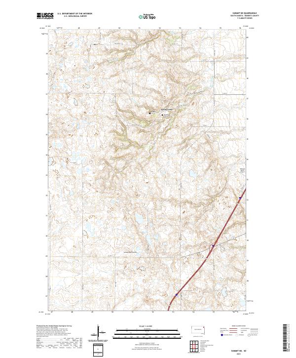 2021 Summit NE2021 Print · USGSRoberts County's prairie plateau is documented here in the early twenty-first century, showing a landscape shaped by glacial geology and tribal heritage. Researchers can locate the Old Ascension Cem, the settlement at Spring Grove, and natural landmarks like Big Coulee.
End of results
Showing maps 1-7 of 7
Top cities near Big Course District
- Wilmot historical maps
- Summit historical maps
- South Shore historical maps
- Old Agency District historical maps
- Spring Grove historical maps
- Stockholm historical maps
See more
Top neighborhoods of Big Course District
Frequently asked questions
- What are the different types of historical maps available for Big Course District?
- What is the oldest map of Big Course District?
- Where can I purchase historical maps of Big Course District for my home or office?
- Where can I download high-res historical maps of Big Course District?
- Are there historical topographic maps available for Big Course District?
- Is there historical aerial imagery available for Big Course District?
- Where are historical maps of Big Course District sourced from?