Old Maps of Bon Homme County, South Dakota for Metal Detecting
Plan your next treasure hunt with 105 historic maps of Bon Homme County. Find old homesites, ghost towns, trails, and gathering spots that may be lost to time — perfect for identifying promising metal detecting locations.
- Locate forgotten sites: Uncover places like long-lost settlements, abandoned rail lines, or gathering spots.
- Plan better hunts: Use map overlays combined with LiDAR or satellite views to narrow in on historically rich areas.
- Made for detectorists: Thousands of hobbyists use these maps to discover relics, coins, and hidden history.
Use these historic maps to boost your research and find new opportunities beneath the surface of Bon Homme County.
Bon Homme County, SD maps
(105)- 1898 Map of Olivet
 1898 Olivet1898 Print · USGSHutchinson County at the close of the nineteenth century was a landscape of emerging rail towns and river valley farmsteads. Trace the early expansion of the Chicago Milwaukee and St Paul RR near Olivet and Scotland.4 unique versions available
 - 1950 Map of Niobrara, 1952 Print
 1950 Niobrara1952 Print · USGSThe Missouri and Niobrara rivers converge here in the mid-twentieth century, just as the town of Niobrara prepared for major changes. Genealogists can locate many rural landmarks including Norwegian Cem, Wagner Sch, and the Chicago and North Western rail line.2 unique versions available
 - 1950 Map of Verdel, 1952 Print
 1950 Verdel1952 Print · USGSThe Missouri River borderlands of Knox County come to life in this mid-century survey of the Verdel area. Local historians can trace the paths of the Chicago and North Western railroad and locate rural landmarks like Clay Hill Sch or Cedar Hill Cem.4 unique versions available
 - 1955 Map of Sioux City, 1959 Print
 1955 Sioux City1959 Print · USGSThe Missouri River valley in the mid-fifties is captured here during a time of major engineering and social transition. Genealogists and historians can trace the foundations of Gavins Point Dam, tribal boundaries on the Santee Sioux Indian Reservation, and local landmarks like the Norfolk State Hospital.4 unique versions available
 - 1955 Map of Sioux Falls, 1967 Print
 1955 Sioux Falls1967 Print · USGSThe eastern South Dakota and western Minnesota borderlands come alive in the mid-fifties, showing the vital rail-to-river connections of the era. Genealogists can trace family footprints across townships like Madison and Pipestone, while following the paths of the Big Sioux River and the Chicago and North Western line.3 unique versions available
 - 1955 Map of Mitchell, 1973 Print
 1955 Mitchell1973 Print · USGSThe Missouri River valley undergoes a massive transformation in the mid-1950s as the Fort Randall Dam creates Lake Francis Case. You can trace the rail lines of the Chicago Milwaukee St Paul and Pacific through Mitchell or locate local landmarks like Butler Town Hall.2 unique versions available
 - 1955 Map of O'Neill, 1974 Print
 1955 O'Neill1974 Print · USGSNorth-central Nebraska in the 1950s reveals a vast cattle-ranching landscape transitioning from the Missouri River breaks to the iconic Sand Hills. Researchers can trace the path of the Chicago and North Western rail line and locate rural landmarks like the Dustin Post Office and St Johns Lake Ch.2 unique versions available
 - 1957 Map of Scotland, 1959 Print
 1957 Scotland1959 Print · USGSSoutheast South Dakota in the late fifties was a landscape of river-valley settlements and rural school districts. Genealogists and historians can trace the foundations of Scotland, locate Rose Hill Cem, and find vanished landmarks like Lakeview Sch or Maxwell Colony.2 unique versions available
 - 1958 Map of Sioux City
 1958 Sioux City1958 Print · USGSThe Missouri River valley in the late fifties was a bustling intersection of tribal lands, rail corridors, and river towns. Genealogists can trace family roots through specific rural sites like Daisy Valley School, St Johns Church and School, and Yankton State Hospital.
 - 1958 Map of Sioux Falls
 1958 Sioux Falls1958 Print · USGSThe tri-state borderlands of South Dakota, Minnesota, and Iowa are captured here during the mid-century peak of the regional rail network. Genealogists and historians can trace local landmarks like Augustana Academy, the St Marys Cem, and the path of the Illinois Central through Rock Rapids.
 - 1959 Map of O'Neill
 1959 O'Neill1959 Print · USGSNorth-central Nebraska in the late fifties is defined by the vast Sand Hills and the vital Chicago and North Western rail line. Genealogists and researchers can trace family roots through settlements like Atkinson, Bassett, and Stuart or follow the waters of the Niobrara River.2 unique versions available
 - 1959 Map of Sioux City
 1959 Sioux City1959 Print · USGSThe tri-state region surrounding the Missouri River is captured here in the late fifties, showing the convergence of Nebraska, South Dakota, and Iowa. Researchers can trace rural lineages through numerous country schoolhouses like Cemetery School and the many numbered Washington School districts.
 - 1959 Map of Mitchell
 1959 Mitchell1959 Print · USGSSouth Dakota’s river and rail corridors come alive in the late fifties as the Missouri River valley undergoes dramatic change. Genealogists and historians can trace family roots through numerous small towns and schools such as Academy, Stickney, and Gregory.2 unique versions available
 - 1969 Map of O'Neill
 1969 O'Neill1969 Print · USGSCentral Nebraska in the mid-fifties is defined here by the expansive Sand Hills and the winding Niobrara River. Trace the Chicago and North Western rail line through cattle towns like O'Neill and Ainsworth.
 - 1974 Map of Bon Homme Colony, 1979 Print
 1974 Bon Homme Colony1979 Print · USGSThe Missouri River and Lewis and Clark Lake define this borderland during the mid-seventies, spanning the South Dakota and Nebraska state line. Researchers can trace the Bon Homme Colony, locate the Holy Faith Cem, and explore the topography of the Santee Indian Reservation.
 - 1977 Map of Oak Hollow
 1977 Oak Hollow1977 Print · USGSHutchinson County farmland is captured in sharp aerial detail during the late seventies, showing the precise layout of local agriculture. Genealogists and historians can locate specific farmsteads and water features like Tripp Lake and the drainage of Oak Hollow.
 - 1977 Map of Niobrara
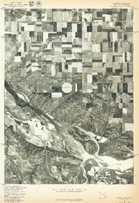 1977 Niobrara1977 Print · USGSThe Nebraska-South Dakota borderlands come into focus in the late seventies, showing the dramatic confluence of the Niobrara River and Missouri River. Researchers can trace the layout of Niobrara and the varied agricultural patterns near Perkins.
 - 1977 Map of Springfield, 1979 Print
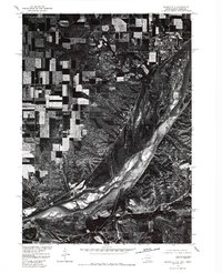 1977 Springfield1979 Print · USGSNear the South Dakota and Nebraska border in the late seventies, this aerial survey captures the town of Springfield perched above the river bluffs. Researchers can trace the mid-century channel of the Missouri River and examine the local layout of rural roads and homesteads.
 - 1978 Map of Tripp SE
 1978 Tripp SE1978 Print · USGSBon Homme County farm country is captured here in the late seventies, showing the transition between established townships. Genealogists can locate family burial sites at the Bohemian National Cem or trace rural education at Blaha Sch and Nedved Sch.
 - 1978 Map of Santee
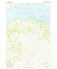 1978 Santee1978 Print · USGSThe Missouri River borderlands of Nebraska and South Dakota are captured here in the late seventies. Researchers can trace the Santee Indian Res Bdy and locate local landmarks like the Santee Recreation Area, Sand Islands, and several upland cemeteries.
 - 1978 Map of Kloucek Lake, 1979 Print
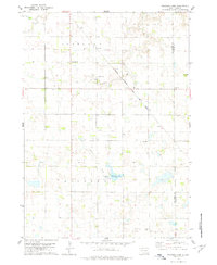 1978 Kloucek Lake1979 Print · USGSBon Homme and Yankton counties appear in the late 1970s as a well-ordered landscape of section-line roads and family farms. Researchers can trace the legacy of early settlers at Ebenezer Cem and Reform Cem, or follow the diagonal route of the Chicago Milwaukee St Paul and Pacific railroad.
 - 1978 Map of Oak Hollow, 1979 Print
 1978 Oak Hollow1979 Print · USGSHutchinson and Douglas counties meet along the Yankton Indian Reservation line in the late seventies. Family historians can locate rural landmarks like Oak Hollow Cem, Zion Cem, and the local Townhall near Tripp Lake.
 - 1978 Map of Tyndall, 1979 Print
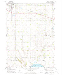 1978 Tyndall1979 Print · USGSTyndall and the surrounding Bon Homme County landscape are captured here during the late 1970s, as the railroad still connected these prairie townships. Researchers can locate vanished rural landmarks like Cottonwood Sch, the Bon Homme Cem, and early industry at the Sandpit.
 - 1978 Map of Haucks Lake, 1979 Print
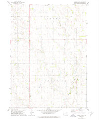 1978 Haucks Lake1979 Print · USGSBon Homme County in the late seventies reveals a landscape of prairie townships and agricultural tradition. Genealogists and local historians can trace rural roots at Danzig Ch Cem and identify former school sites like Dewald Sch or Hoff Sch.
 - 1978 Map of Kaylor, 1979 Print
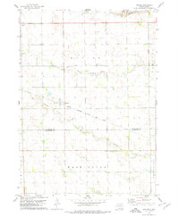 1978 Kaylor1979 Print · USGSThe rural landscape around the settlement of Kaylor in the late 1970s is defined by its rail-linked economy and creek-fed pastures. Genealogists and researchers can trace the locations of Dennewitz Cem and St Johns Cem near the Chicago Milwaukee St Paul and Pacific line.
Showing maps 1-25 of 105
Top cities of Bon Homme County
Frequently asked questions
- What are the different types of historical maps available for Bon Homme County?
- What is the oldest map of Bon Homme County?
- Where can I purchase historical maps of Bon Homme County for my home or office?
- Where can I download high-res historical maps of Bon Homme County?
- Are there historical topographic maps available for Bon Homme County?
- Is there historical aerial imagery available for Bon Homme County?
- Where are historical maps of Bon Homme County sourced from?