2020s Maps of Bath Township, South Dakota
Explore 4 historic maps of Bath Township from the 2020s. These maps offer a rare glimpse into what life looked like during the 2020s — showing old roads, neighborhoods, homes, and landmarks that have changed or disappeared over time.
Whether you're researching your family's past, planning a metal detecting trip, or studying how Bath Township's landscape evolved across the 2020s, these high-resolution maps are a powerful tool for exploring the history of this region.
- Focus on a specific era: All maps on this page are from the 2020s, giving you a focused view of this time period.
- See what’s changed: Compare century-old streets, trails, and buildings to today's modern landscape using overlays and satellite layers.
- Research with precision: Use these maps for genealogy, historical research, land use analysis, or educational projects.
- View, download, or print: Maps are fully viewable online in high resolution, and can be downloaded or printed for your own records.
Start exploring Bath Township's history through authentic maps from the 2020s. This is your window into the past.
Bath Township, SD maps
(4)- 2021 Map of Aberdeen East, 2021 Print
 2021 Aberdeen East2021 Print · USGSAberdeen and its rural outskirts are captured in detail during the early 2020s as the city expands into the James River Valley. Researchers can locate family sites at Saint Marys Cem, trace the campus of Northern State University, or follow the banks of Moccasin Creek.
 - 2021 Map of Bath, 2021 Print
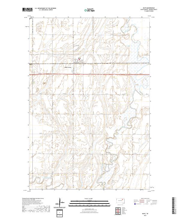 2021 Bath2021 Print · USGSThe rural prairie of Brown County comes alive in this contemporary record of its settlement and waterways. Genealogists and local historians can trace the area around Bath, locate the German Cem, and follow the serpentine James River through the heart of the township.
 - 2021 Map of Ordway, 2021 Print
 2021 Ordway2021 Print · USGSBrown County's rural landscape meets the growing northern edge of the prairie city in the early 2020s. Genealogists and local historians can trace the course of the Elm River as it winds past Ordway and the residential streets of Prairiewood Village.
 - 2021 Map of Columbia, 2021 Print
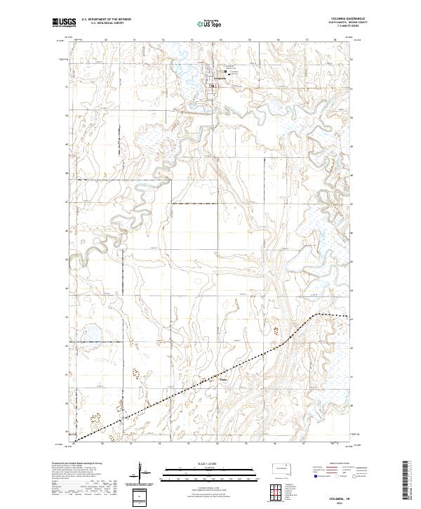 2021 Columbia2021 Print · USGSColumbia and the surrounding Brown County plains are documented here in the early 2020s, showcasing the winding confluence of the James River and Elm River. Researchers can locate family sites at the Columbia City Cem or trace the small settlement at Plana.
End of results
Showing maps 1-4 of 4
Top cities near Bath Township
- Aberdeen historical maps
- Bath historical maps
- Warner historical maps
- Ordway historical maps
- Columbia historical maps
- Westport historical maps
See more
Top neighborhoods of Bath Township
Frequently asked questions
- What are the different types of historical maps available for Bath Township?
- What is the oldest map of Bath Township?
- Where can I purchase historical maps of Bath Township for my home or office?
- Where can I download high-res historical maps of Bath Township?
- Are there historical topographic maps available for Bath Township?
- Is there historical aerial imagery available for Bath Township?
- Where are historical maps of Bath Township sourced from?