Old Maps of Athboy, Rock Creek District
Explore 9 old maps of Athboy, spanning from 1953 to today. These high-resolution historic maps reveal how streets, neighborhoods, landmarks, and natural features evolved over time — perfect for genealogy, metal detecting, research, and local history exploration.
What you can do with these maps:
- See how Athboy changed over time: Compare historical maps to modern-day views to trace roads, homesites, rail lines & more.
- View detailed metadata: Each map includes creators, publishers, year, scale, and archive source.
- Overlay maps with satellite & LiDAR: Visualize the past alongside modern tools to explore terrain & human change.
- Trusted historical sources: Maps sourced from the USGS, Library of Congress, and other archives.
- Access maps your way: View online, download high-res files, or order prints for personal or research use.
Start exploring old maps of Athboy to uncover forgotten places, hidden landmarks, and the deep history beneath your feet.
Athboy, Rock Creek District maps
(9)- 1953 Map of McIntosh, 1965 Print
 1953 McIntosh1965 Print · USGSThe north-central Dakota prairie is captured here during the mid-fifties, showing the vast Standing Rock Indian Reservation and the newly formed Oah E Reservoir. Genealogists and historians can trace the Chicago Milwaukee St Paul and Pacific rail line through stops like McIntosh, Walker, and Eagle Butte.3 unique versions available
 - 1958 Map of McIntosh
 1958 McIntosh1958 Print · USGSThe north-central Dakotas appear here in the mid-1950s as massive engineering projects and rail lines shaped the plains. Researchers can trace tribal lands within the Standing Rock Indian Reservation and locate local landmarks like the Keller Mine or the Virginia Siding.
 - 1972 Map of Black Horse Butte, 1975 Print
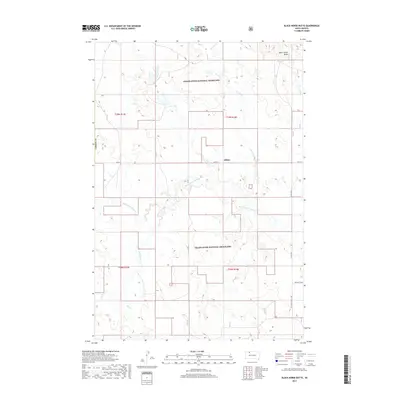
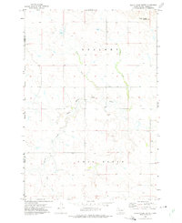 1972 Black Horse Butte1975 Print · USGSThe western edge of the Standing Rock Indian Reservation in the early seventies reveals a landscape of high plains and isolated settlements. Researchers can locate the community of Athboy and trace the drainage of Black Horse Butte Creek near Black Horse Butte.
 - 1980 Map of McIntosh, 1981 Print
 1980 McIntosh1981 Print · USGSThe northern plains of the Standing Rock Indian Reservation are shown here as they appeared in the early 1980s. You can trace the railroad history of Corson County along the Chicago Milwaukee St Paul and Pacific line, connecting settlements like Watauga and Morristown.
 - 1998 Map of Black Horse Butte, 2001 Print
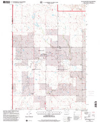 1998 Black Horse Butte2001 Print · USGSCorson County ranching life is preserved in this late nineties survey of the South Dakota prairie. Genealogists can trace family holdings like the F Schopp Ranch or D Dietterle Ranch near the Black Horse Butte Creek.
 - 2012 Map of Black Horse Butte, 2012 Print
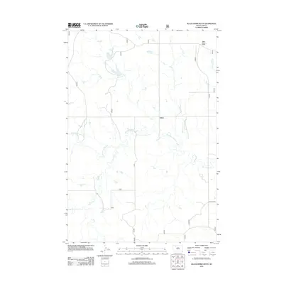 2012 Black Horse Butte2012 Print · USGSCovers Athboy, including Rock Creek District, Corson County, and other nearby areas
 - 2015 Map of Black Horse Butte, 2015 Print
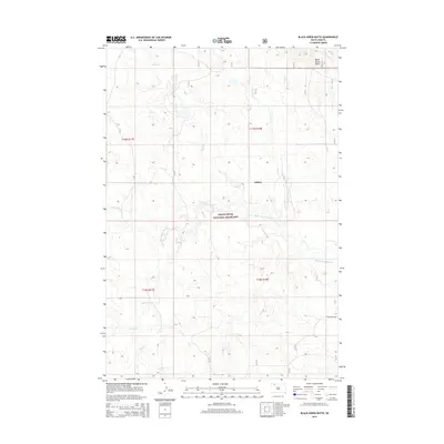 2015 Black Horse Butte2015 Print · USGSCovers Athboy, including Rock Creek District, Corson County, and other nearby areas
 - 2017 Map of Black Horse Butte, 2017 Print
 2017 Black Horse Butte2017 Print · USGSCovers Athboy, including Rock Creek District, Corson County, and other nearby areas
 - 2021 Map of Black Horse Butte, 2021 Print
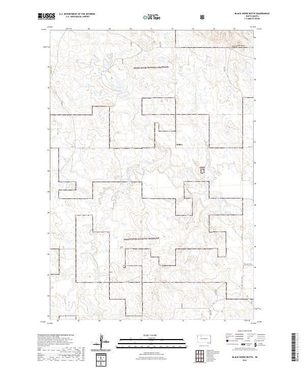 2021 Black Horse Butte2021 Print · USGSThe open prairies of Corson County are documented here as they appeared in the early 2020s. Researchers can trace the drainage of Black Horse Butte Cr and locate the settlement of Athboy or the prominent landmark of Black Horse Butte.
End of results
Showing maps 1-9 of 9
Frequently asked questions
- What are the different types of historical maps available for Athboy?
- What is the oldest map of Athboy?
- Where can I purchase historical maps of Athboy for my home or office?
- Where can I download high-res historical maps of Athboy?
- Are there historical topographic maps available for Athboy?
- Is there historical aerial imagery available for Athboy?
- Where are historical maps of Athboy sourced from?