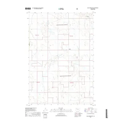
2017 Map of Black Horse Butte
USGS Topo · Published 2017About this map
Grand River National Grassland dominates this section of Corson Co, defining a landscape where public grazing lands intersect with private holdings in the Rock Creek District. The small settlement of Athboy sits at the junction of 126th St and Co Rd, serving as a localized hub in an area primarily shaped by its drainage networks and geological landmarks. The map is defined by the prominent Black Horse Butte, which stands as a clear navigational point above the winding path of Black Horse Butte Cr. A complex web of waterways, including Second Cr, Beef Cr, and Darling Cr, creates a rugged riparian geography that has historically dictated the placement of roads and the boundaries of the Public Land Survey System, specifically within townships t19n r17e and t18n r18e.
Find a feature on this map
19 named features on this map. Tap any name to fly to it.
Don’t see what you’re looking for? This feature index may not catch every label — zoom into the map to look around manually.
Map Details
Editions of this 2017 Black Horse Butte Map
This is the sole edition of this map. No revisions or reprints were ever made.
Other maps of this area

1953 · McIntosh
USGS Topo · 1:250,000

1954 · Lemmon
USGS Topo · 1:250,000

1957 · Lemmon
USGS Topo · 1:250,000

1958 · McIntosh
USGS Topo · 1:250,000

1972 · Black Horse Butte NW
USGS Topo · 1:24,000

1972 · Black Horse Butte
USGS Topo · 1:24,000

1972 · Twin Butte
USGS Topo · 1:24,000

1972 · Black Horse Butte NE
USGS Topo · 1:24,000

1980 · McIntosh
USGS Topo · 1:100,000

1982 · Glad Valley
USGS Topo · 1:24,000