2020s Maps of Scandinavia Township, South Dakota
Explore 6 historic maps of Scandinavia Township from the 2020s. These maps offer a rare glimpse into what life looked like during the 2020s — showing old roads, neighborhoods, homes, and landmarks that have changed or disappeared over time.
Whether you're researching your family's past, planning a metal detecting trip, or studying how Scandinavia Township's landscape evolved across the 2020s, these high-resolution maps are a powerful tool for exploring the history of this region.
- Focus on a specific era: All maps on this page are from the 2020s, giving you a focused view of this time period.
- See what’s changed: Compare century-old streets, trails, and buildings to today's modern landscape using overlays and satellite layers.
- Research with precision: Use these maps for genealogy, historical research, land use analysis, or educational projects.
- View, download, or print: Maps are fully viewable online in high resolution, and can be downloaded or printed for your own records.
Start exploring Scandinavia Township's history through authentic maps from the 2020s. This is your window into the past.
Scandinavia Township, SD maps
(6)- 2021 Map of Clear Lake South, 2021 Print
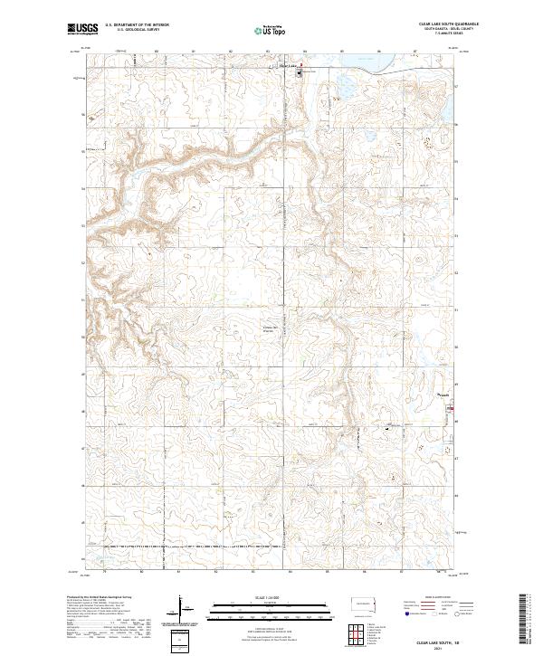 2021 Clear Lake South2021 Print · USGSDeuel County's high prairie landscape is captured here in the early twenty-first century, showing the rural sections between two local centers. Researchers can locate Lakeview Cem and Highland Cem or trace the headwaters of Hidewood Cr.
 - 2021 Map of Toronto, 2021 Print
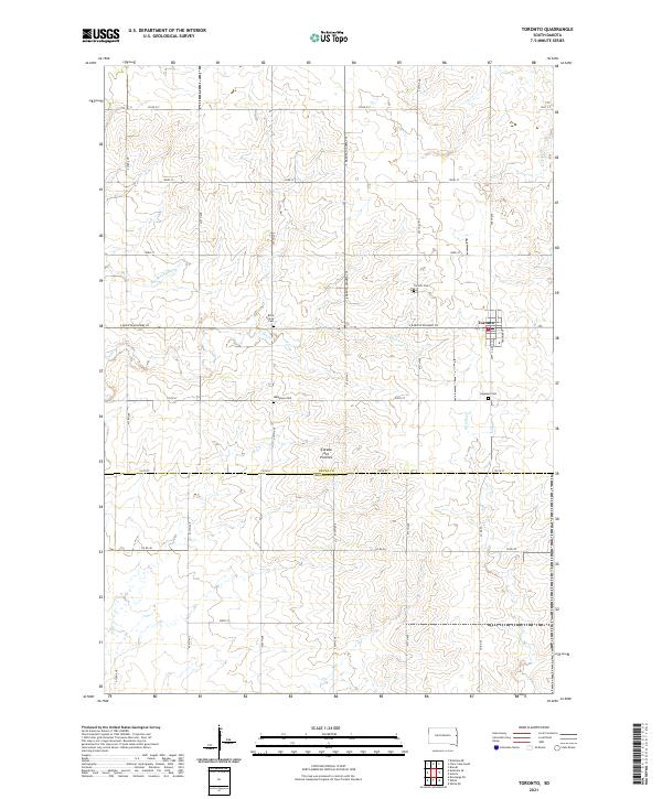 2021 Toronto2021 Print · USGSThe eastern South Dakota prairie is captured here in the early twenty-first century, centered on the community of Toronto. Researchers can locate ancestral sites across the Coteau des Prairies at Toronto Cem, Mikkelson Cem, and Leganger Cem.
 - 2021 Map of Brandt, 2021 Print
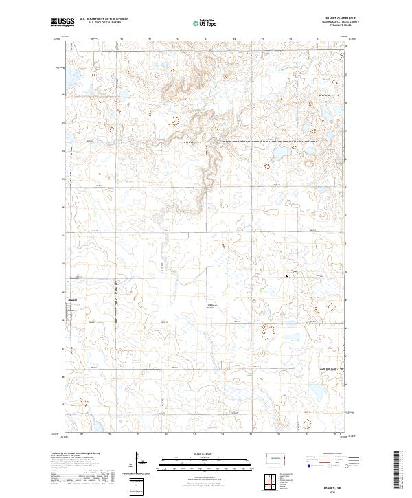 2021 Brandt2021 Print · USGSDeuel County's agricultural highlands are documented here during the early twenty-first century, centered on the town of Brandt. Genealogists can locate family landmarks like the East Highland Lutheran Cem and trace water features like Fox Lake and Cobb Cr.
 - 2021 Map of Astoria, 2021 Print
 2021 Astoria2021 Print · USGSThe high plateau of the Coteau des Prairies meets the rural grid of Deuel County in this contemporary survey of eastern South Dakota. Researchers can locate the town of Astoria, trace the waters of Oak Lake, and find local family sites at Bethlehem Cem.
 - 2022 Map of Hendricks, 2022 Print
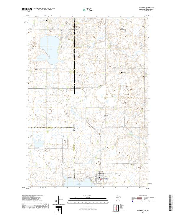 2022 Hendricks2022 Print · USGSThe high plains of the Minnesota-South Dakota border come into focus in this recent survey of the Coteau des Prairies. Genealogists can trace rural roots through several local landmarks like Swedish Mission Church and Bohemian Cem near Hendricks.
 - 2022 Map of Canby NW, 2022 Print
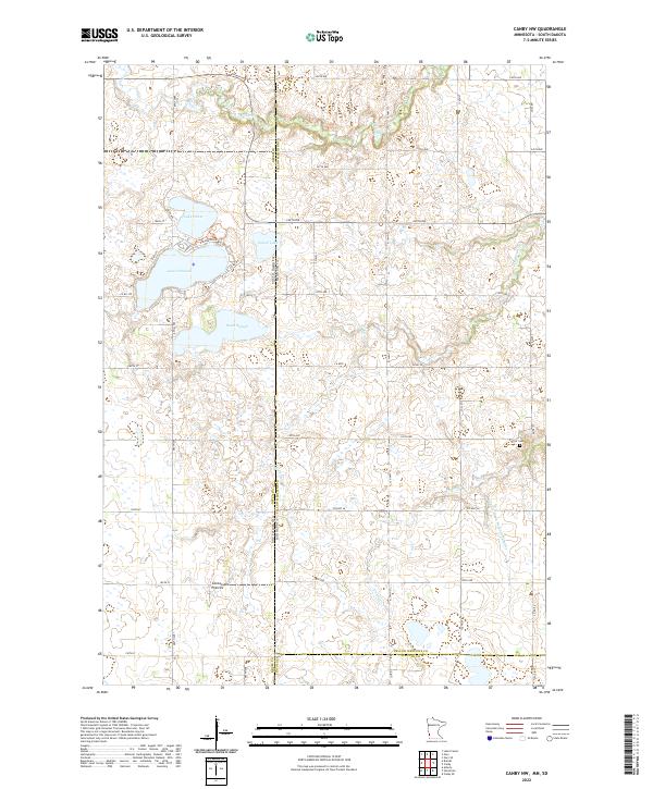 2022 Canby NW2022 Print · USGSThe high prairie plateau of the Coteau des Prairies along the Minnesota and South Dakota border is mapped here in the early twenty-first century. Researchers can trace land ownership patterns near Lake Cochrane and find local heritage sites like the Fortier Cem and South Slough.
End of results
Showing maps 1-6 of 6
Top cities near Scandinavia Township
- Clear Lake historical maps
- Hendricks historical maps
- White historical maps
- Gary historical maps
- Toronto historical maps
- Astoria historical maps
See more
Top neighborhoods of Scandinavia Township
Frequently asked questions
- What are the different types of historical maps available for Scandinavia Township?
- What is the oldest map of Scandinavia Township?
- Where can I purchase historical maps of Scandinavia Township for my home or office?
- Where can I download high-res historical maps of Scandinavia Township?
- Are there historical topographic maps available for Scandinavia Township?
- Is there historical aerial imagery available for Scandinavia Township?
- Where are historical maps of Scandinavia Township sourced from?