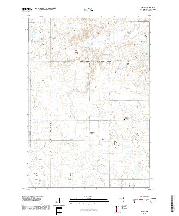
2021 Map of Brandt
USGS Topo · Published 2021About this map
Brandt lies along the western edge of this agricultural landscape in Deuel County, situated within the distinctive geologic region of the Coteau des Prairies. The town's grid is defined by Madison St and Jefferson St, serving as a central hub for the surrounding farmsteads. To the east, the East Highland Lutheran Cem provides a significant touchstone for local family histories, overlooking a terrain punctuated by small wetlands and drainage patterns including the N Br Cobb Cr and Cobb Cr.
Find a feature on this map
28 named features on this map. Tap any name to fly to it.
Don’t see what you’re looking for? This feature index may not catch every label — zoom into the map to look around manually.
Map Details
Editions of this 2021 Brandt Map
This is the sole edition of this map. No revisions or reprints were ever made.
Other maps of this area

1953 · Watertown
USGS Topo · 1:250,000

1958 · Watertown
USGS Topo · 1:250,000

1967 · Gary
USGS Topo · 1:24,000

1967 · Canby NW
USGS Topo · 1:24,000

1967 · Hendricks
USGS Topo · 1:24,000

1970 · Brandt
USGS Topo · 1:24,000

1970 · Astoria
USGS Topo · 1:24,000

1970 · Clear Lake South
USGS Topo · 1:24,000

1970 · Toronto
USGS Topo · 1:24,000
1973 · Lake Francis
USGS Topo · 1:24,000