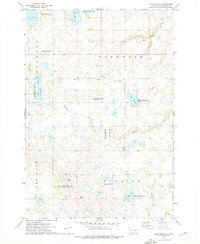
1973 Map of Lake Francis
USGS Topo · Published 1976About this map
The glacial prairie landscape of Deuel County, South Dakota, is defined by an extensive network of wetlands and lakes, many of which were managed as public hunting and waterfowl production grounds by the early 1970s. The small settlement of Moritz sits near the center of the sheet, adjacent to an Old Railroad Grade that speaks to the former transportation corridor of the region. This area is characterized by its high concentration of protected habitats, including the Lake Francis State Public Shooting Area, Mud Lake State Public Shooting Area, and multiple National Waterfowl Production Area parcels. In addition to the large bodies of water like Lake Alice and Rush Lake, the map traces the winding course of Monighan Creek and the West Branch Lac qui Parle River as they move through the townships of Glenwood and Herrick.
Find a feature on this map
25 named features on this map. Tap any name to fly to it.
Don’t see what you’re looking for? This feature index may not catch every label — zoom into the map to look around manually.
Map Details
Editions of this 1973 Lake Francis Map
This is the sole edition of this map. No revisions or reprints were ever made.
Other maps of this area

1953 · Watertown
USGS Topo · 1:250,000

1958 · Watertown
USGS Topo · 1:250,000

1967 · Gary
USGS Topo · 1:24,000

1967 · Canby NW
USGS Topo · 1:24,000

1967 · Gary NW
USGS Topo · 1:24,000

1970 · Brandt
USGS Topo · 1:24,000

1970 · Clear Lake South
USGS Topo · 1:24,000

1973 · Tunerville
USGS Topo · 1:24,000
1973 · Clear Lake NE
USGS Topo · 1:24,000
1973 · Clear Lake North
USGS Topo · 1:24,000