Old Maps of Edmunds County, South Dakota for Metal Detecting
Plan your next treasure hunt with 190 historic maps of Edmunds County. Find old homesites, ghost towns, trails, and gathering spots that may be lost to time — perfect for identifying promising metal detecting locations.
- Locate forgotten sites: Uncover places like long-lost settlements, abandoned rail lines, or gathering spots.
- Plan better hunts: Use map overlays combined with LiDAR or satellite views to narrow in on historically rich areas.
- Made for detectorists: Thousands of hobbyists use these maps to discover relics, coins, and hidden history.
Use these historic maps to boost your research and find new opportunities beneath the surface of Edmunds County.
Edmunds County, SD maps
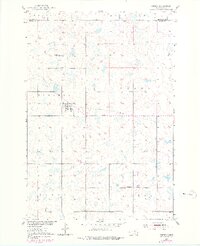
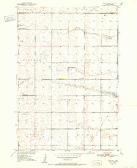
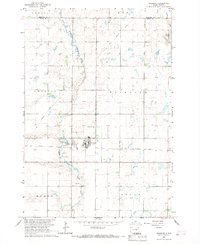
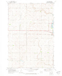
(190)- 1899 Map of Ellendale
 1899 Ellendale1899 Print · USGSNorth Dakota and South Dakota borderlands come into focus at the close of the nineteenth century as the railroad transforms the prairie. Genealogists and historians can trace the early growth of Ellendale and Leola along with vanished stops like Alpha and Delhi.2 unique versions available
 - 1899 Map of Northville
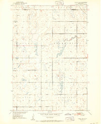
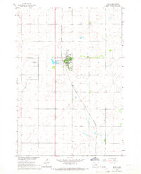
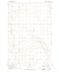
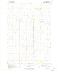
 1899 Northville1899 Print · USGSNortheastern South Dakota in the 1890s was a landscape defined by the expansion of the rails and the settlement of the prairie. You can trace the path of the Chicago and Northwestern RR through early townsites like Northville and Rudolph.2 unique versions available
 - 1950 Map of Onaka, 1978 Print
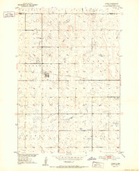
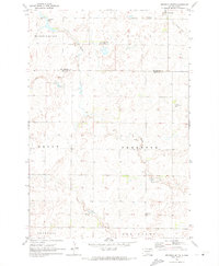
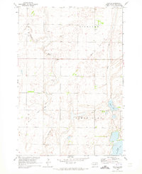
 1950 Onaka1978 Print · USGSOnaka and the surrounding prairie townships are captured here at mid-century during a period of shifting rural infrastructure. Genealogists and local historians can locate the East Sherman Sch, trace the Old Railroad Grade, and explore the Madison Hills.
 - 1951 Map of Clark Lake
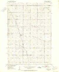
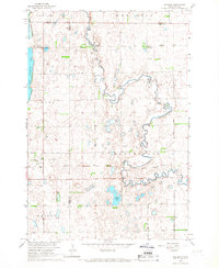
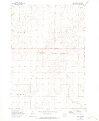
 1951 Clark Lake1951 Print · USGSFaulk County during the early fifties remained a landscape of scattered rural schools and prairie townships. You can trace the path of the Old Railroad Grade and locate family-centered landmarks like Stevenson Sch and Saratoga Sch.
 - 1952 Map of Onaka
 1952 Onaka1952 Print · USGSThe rural prairie of Faulk and Edmunds counties is captured in the early fifties as the local economy transitioned away from rail. Researchers can trace the Old Railroad Grade through Onaka and locate rural landmarks like East Sherman Sch.
 - 1952 Map of Norbeck
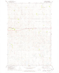
 1952 Norbeck1952 Print · USGSThe prairie townships of Faulk County come into focus in the early fifties, showing a rural landscape defined by the railroad and local schools. Genealogists and researchers can pinpoint the Millard Cem, the tiny settlement of Norbeck, and the Orleans Sch across the open plains.
 - 1952 Map of Wecota
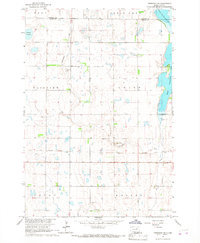
 1952 Wecota1952 Print · USGSMid-century Faulk County comes into focus in this survey of the northern prairie. Genealogists and historians can trace the foundations of Wecota and find rural landmarks like Immanuel Ch, Lindhorst Sch, and an Old Railroad Grade.2 unique versions available
 - 1954 Map of Aberdeen, 1964 Print
 1954 Aberdeen1964 Print · USGSNortheastern South Dakota in the mid-fifties remains a world of rail-dependent prairie towns and sweeping waterfowl refuges. Genealogists can trace family roots through settlements like Eureka and Ipswich or locate rural landmarks near Richmond Lake.2 unique versions available
 - 1956 Map of Aberdeen
 1956 Aberdeen1956 Print · USGSUpper South Dakota during the mid-fifties remains a landscape of rail-connected farming towns and expansive glacial lake basins. Genealogists and historians can trace the paths of the Minneapolis and St Louis railroad through Gettysburg or locate vanished stops near Elm Lake and Richmond Lake.
 - 1965 Map of Onaka, 1966 Print
 1965 Onaka1966 Print · USGSThe town of Onida and its surrounding prairie landscape are captured here in the mid-1960s. Researchers can trace the Chicago and North Western rail line and locate local landmarks such as the County Fairground and the Cem.
 - 1966 Map of Chelsea, 1967 Print
 1966 Chelsea1967 Print · USGSThe prairie landscape at the borders of Faulk and Spink counties is documented here in the mid-1960s. Genealogists and researchers can locate the Chelsea settlement, several Cem sites, and the path of an Old Railroad Grade.
 - 1966 Map of Cresbard NE, 1967 Print
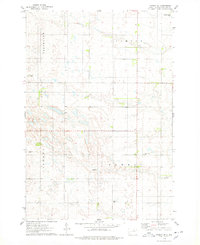
 1966 Cresbard NE1967 Print · USGSPrairie life in Faulk and Edmunds Counties is captured here in the mid-1960s, showing a landscape defined by water and agriculture. Researchers can trace the path of the Old Railroad Grade or locate family sites near the United Cem and the shores of North Scatterwood Lake.
 - 1966 Map of Cresbard, 1968 Print
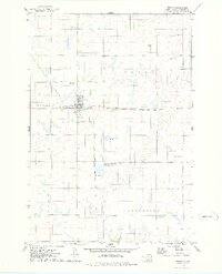
 1966 Cresbard1968 Print · USGSThe prairie landscape of Faulk County is captured here in the mid-1960s, centered on the small town of Cresbard. Genealogists and local historians can trace family locations across Fairview Twp and find the Cresbard Cem and Hope Cem.
 - 1970 Map of Lake Parmley, 1973 Print
 1970 Lake Parmley1973 Print · USGSThe prairie landscape of Brown and Edmunds Counties was in transition during the early 1970s as new rail lines were established. Researchers can trace the progress of the Chicago Milwaukee St Paul and Pacific line and locate recreation sites near Lake Parmley.
 - 1970 Map of Mina SW, 1973 Print
 1970 Mina SW1973 Print · USGSEdmunds County's rural landscape is captured here in the early seventies, showing a quiet agricultural region defined by its township borders. Genealogists and local historians can locate St Herbert Cem, the local Townhall, and the path of an Old Railroad Grade.
 - 1970 Map of Lake Parmley SW, 1973 Print
 1970 Lake Parmley SW1973 Print · USGSThe rural border of Brown and Edmunds Counties is captured here in the early seventies, showing a landscape shaped by prairie townships. Genealogists and historians can trace the Old Railroad Grade or locate the community Townhall and Snake Creek.
 - 1970 Map of Wetonka South, 1973 Print
 1970 Wetonka South1973 Print · USGSEdmunds County at the start of the 1970s reveals a quiet agricultural landscape organized by established township lines. Genealogists and local historians can trace the community history of Wetonka while locating the Pembrook Cem and an Old Railroad Grade.
 - 1970 Map of Mina NW, 1973 Print
 1970 Mina NW1973 Print · USGSEdmunds County at the start of the seventies reveals a landscape of prairie townships and rail-connected hamlets. Genealogists and local historians can trace family roots at Strasburg Cem or follow the path of Preachers Run past Craven.
 - 1970 Map of Richmond SW, 1973 Print
 1970 Richmond SW1973 Print · USGSThe Brown and Edmunds county lines met in this corner of South Dakota during the early 1970s, as the prairie was shifting toward modern farming. You can trace the remnants of the Old Railroad Grade and find water landmarks like Richmond Lake and the Flowing Well.
 - 1970 Map of Mina, 1973 Print
 1970 Mina1973 Print · USGSMina and the surrounding Edmunds County townships are captured here in the early 1970s as the regional infrastructure evolved. Genealogists and rail historians can trace the Milwaukee Road line and land patterns in Fountain and Cortlandt.
 - 1970 Map of Leola SW, 1973 Print
 1970 Leola SW1973 Print · USGSThe northern prairie on the Edmunds and McPherson county line is captured here in the early seventies. Genealogists and local historians can locate Plainview Colony No 2 and trace the township boundaries of Belle, Washington, and Howard.
 - 1970 Map of Mina SE, 1973 Print
 1970 Mina SE1973 Print · USGSEdmunds County at the start of the 1970s reveals a quiet prairie landscape shaped by glacial waters and early transportation. Researchers can trace rural genealogy at the Richland Cem or follow the path of the Old Railroad Grade and Preachers Run.
 - 1974 Map of Gretna, 1978 Print
 1974 Gretna1978 Print · USGSEdmunds County's prairie landscape is captured here in the mid-1970s, showcasing the intersection of rail transport and conservation. Researchers can trace the legacy of local families at Cloyd Valley Cem or follow the Chicago Milwaukee St Paul and Pacific tracks through Gretna.
 - 1974 Map of Ipswich SE, 1978 Print
 1974 Ipswich SE1978 Print · USGSEdmunds County townships were surveyed in the mid-1970s, revealing a landscape of section-line roads and prairie settlements. Genealogists and local historians can trace family locations near Powell, Pleasant Hill Cem, and the rural station of Chester.
 - 1974 Map of Roscoe, 1978 Print
 1974 Roscoe1978 Print · USGSThe rail-centered town of Roscoe is captured here in the mid-1970s at the junction of the CHICAGO MILWAUKEE ST PAUL AND PACIFIC. Researchers can trace the local landscape from Morningside Cem to the sprawling National Waterfowl Production Area.
Showing maps 1-25 of 190
Top cities of Edmunds County
- Ipswich historical maps
- Bowdle historical maps
- Roscoe historical maps
- Hosmer historical maps
- Powell historical maps
Frequently asked questions
- What are the different types of historical maps available for Edmunds County?
- What is the oldest map of Edmunds County?
- Where can I purchase historical maps of Edmunds County for my home or office?
- Where can I download high-res historical maps of Edmunds County?
- Are there historical topographic maps available for Edmunds County?
- Is there historical aerial imagery available for Edmunds County?
- Where are historical maps of Edmunds County sourced from?