2020s Maps of Milk's Camp Segment, South Dakota
Explore 13 historic maps of Milk's Camp Segment from the 2020s. These maps offer a rare glimpse into what life looked like during the 2020s — showing old roads, neighborhoods, homes, and landmarks that have changed or disappeared over time.
Whether you're researching your family's past, planning a metal detecting trip, or studying how Milk's Camp Segment's landscape evolved across the 2020s, these high-resolution maps are a powerful tool for exploring the history of this region.
- Focus on a specific era: All maps on this page are from the 2020s, giving you a focused view of this time period.
- See what’s changed: Compare century-old streets, trails, and buildings to today's modern landscape using overlays and satellite layers.
- Research with precision: Use these maps for genealogy, historical research, land use analysis, or educational projects.
- View, download, or print: Maps are fully viewable online in high resolution, and can be downloaded or printed for your own records.
Start exploring Milk's Camp Segment's history through authentic maps from the 2020s. This is your window into the past.
Milk's Camp Segment, SD maps
(13)- 2021 Map of Burke, 2021 Print
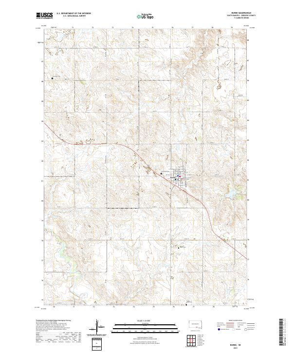 2021 Burke2021 Print · USGSThe town of Burke and its surrounding Gregory County farmsteads are documented here in the early twenty-first century. Genealogists can trace local family landmarks through multiple burial sites including Sacred Heart Cem and Cournoyer Cem.
 - 2021 Map of Dixon SE, 2021 Print
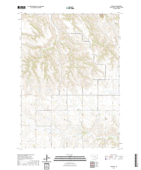 2021 Dixon SE2021 Print · USGSGregory County's high prairie and deeply etched creek draws are captured here in the early twenty-first century. Genealogists and local historians can trace the rural road network including Huston Township Hwy and the drainages of Landing Cr and S Fork Whetstone Cr.
 - 2021 Map of Dixon NE, 2021 Print
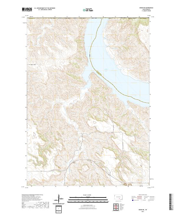 2021 Dixon NE2021 Print · USGSThe Missouri River breaks of Gregory and Charles Mix counties are captured here in the early twenty-first century. Researchers can trace drainage patterns along Landing Cr and Rush Cr as they feed into the expansive Lake Francis Case.
 - 2021 Map of Gregory SE, 2021 Print
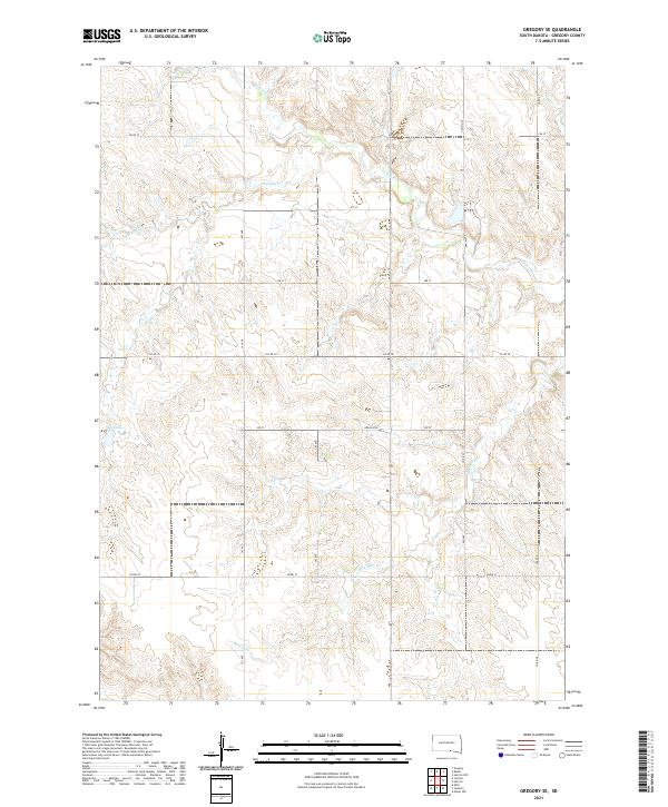 2021 Gregory SE2021 Print · USGSGregory County's rural landscape is captured here in the early twenty-first century, showing the enduring grid of section-line roads and prairie drainages. Genealogists and land researchers can trace property boundaries along Co Rd 18 and the banks of Ponca Cr or Blue Eyes Cr.
 - 2021 Map of Herrick, 2021 Print
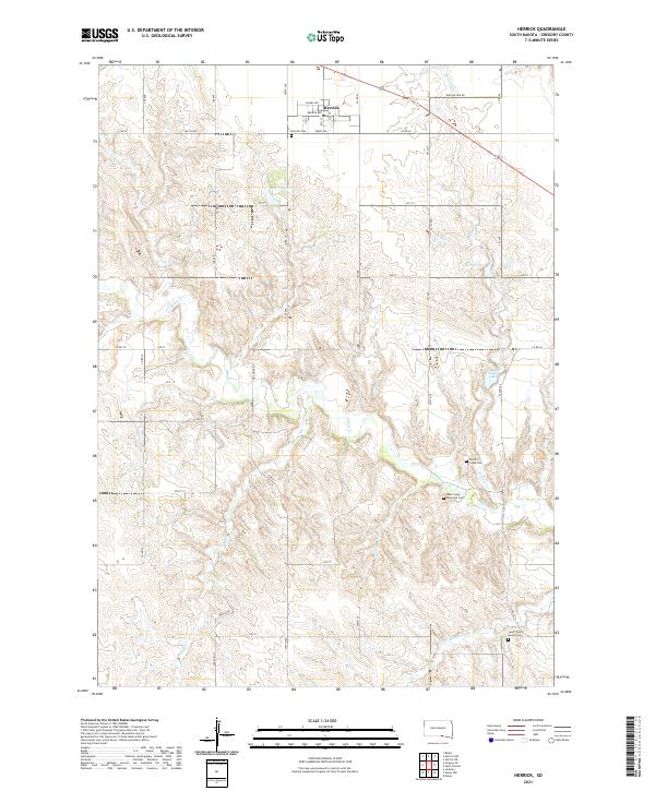 2021 Herrick2021 Print · USGSHerrick and its surrounding prairie landscape are captured here in the early twenty-first century. Genealogists and local historians can trace the locations of family burial sites at Herrick Cem, Ponca Creek Cem, and Milks Camp Episcopal Cem.
 - 2021 Map of Herrick NW, 2021 Print
 2021 Herrick NW2021 Print · USGSGregory County's prairie landscapes are frozen in time during the early twenty-first century, showing the remote ranching country near the Nebraska border. Researchers can trace rural property access and modern water drainage patterns along S Fork Whetstone Cr, Turkey Ridge Rd, and Petes Cr.
 - 2021 Map of Saint Charles, 2021 Print
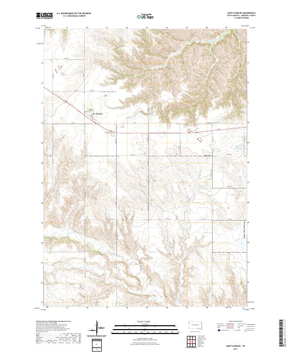 2021 Saint Charles2021 Print · USGSGregory County's agricultural landscape is documented here during the early twenty-first century, centered on the settlement of St. Charles. Local historians can trace the paths of Ponca Cr and Oscar Micheaux Cr amidst a grid of rural section roads.
 - 2021 Map of Herrick NE, 2021 Print
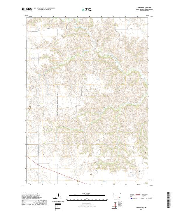
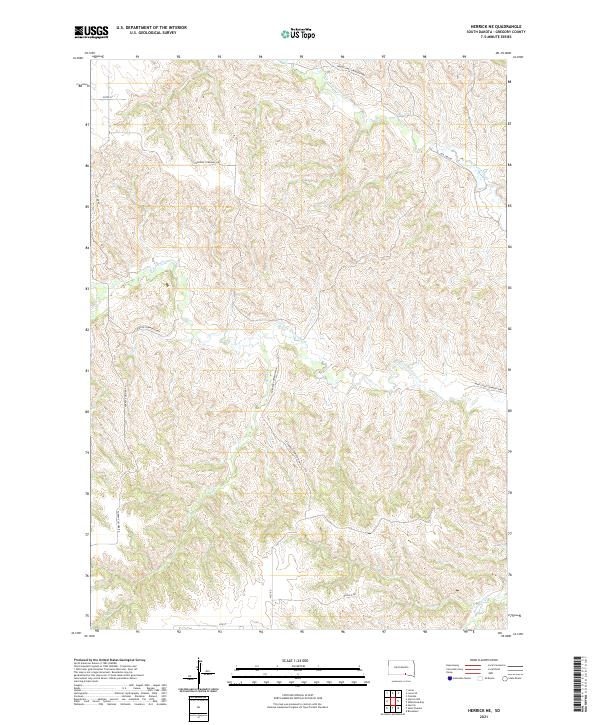 2021 Herrick NE2021 Print · USGSGregory County's rural prairie landscape is documented here in the early twenty-first century as the Whetstone Creek forks traverse the township grids. Researchers can trace land divisions and local routes like Old 1806 Rd, Turkey Vulcher Rd, and Sand Cr.
 - 2021 Map of Dixon SW, 2021 Print
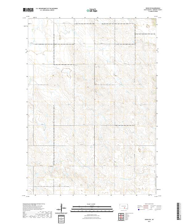 2021 Dixon SW2021 Print · USGSGregory County's rural uplands are shown in detail here during the early 2020s, revealing a landscape of prairie drainage and section-line roads. Researchers can trace the paths of Lone Tree Cr and S Fork Whetstone Cr alongside local routes like Co Rd 19.
 - 2021 Map of Lucas, 2021 Print
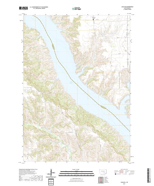
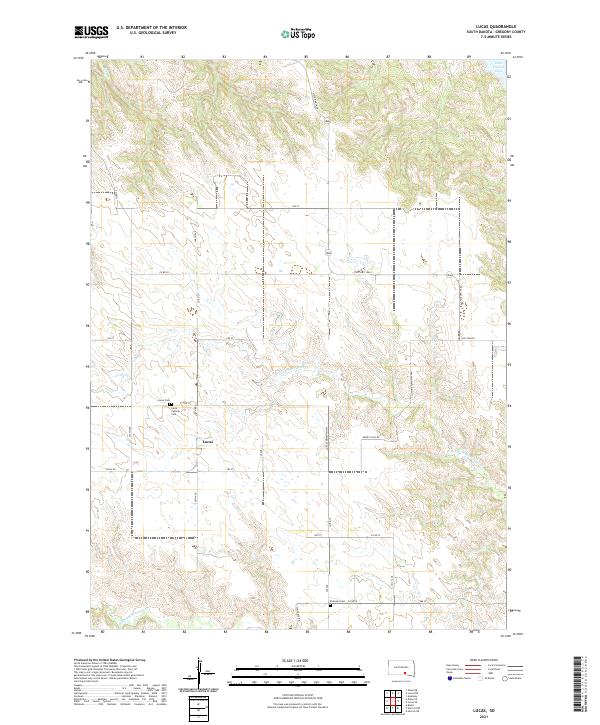 2021 Lucas2021 Print · USGSThe Gregory County prairie surrounding Lucas is captured in this recent survey of south-central South Dakota. Genealogists and local historians can trace burial sites at Lucas Catholic Cem and Petersen Cem near the headwaters of Rush Cr.
 - 2021 Map of Bonesteel, 2021 Print
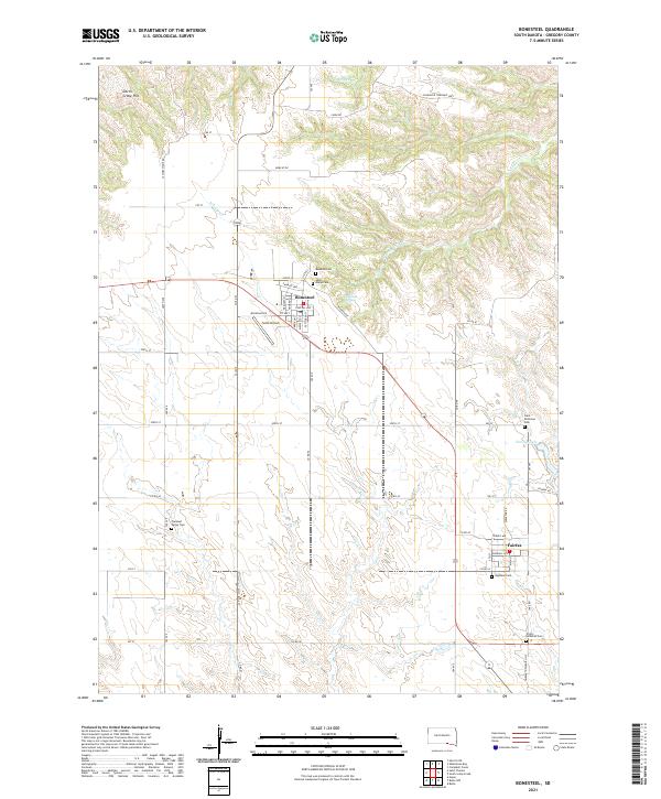 2021 Bonesteel2021 Print · USGSGregory County's agricultural heartland and the settlements of the southern plains are captured here in the early 2020s. Researchers can locate numerous family burial sites, including Pleasant Valley Cem, and trace landmarks like Selle Airport and the waters of Fairfax Lake.
 - 2021 Map of Dixon, 2021 Print
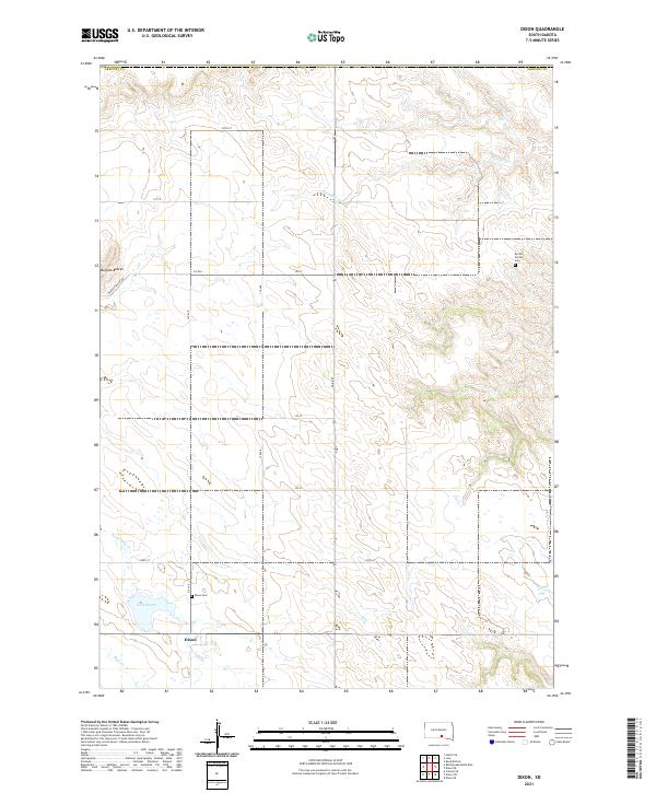 2021 Dixon2021 Print · USGSGregory County's rural heartland is documented here in the early twenty-first century, centered on the settlement of Dixon. Local historians can locate the Brozik Family Cem and Dixon Cem, or trace the path of Fivemile Cr past Buffalo Buttes.
 - 2021 Map of Lucas SE, 2021 Print
 2021 Lucas SE2021 Print · USGSThe Missouri River breaks of Gregory County are captured here in the early twenty-first century as they meet the expansive Lake Francis Case. Researchers can locate rural landmarks like the West Trinity Lutheran Church or trace the transition from Old 1806 Rd to modern township highways.
End of results
Showing maps 1-13 of 13
Top cities near Milk's Camp Segment
Frequently asked questions
- What are the different types of historical maps available for Milk's Camp Segment?
- What is the oldest map of Milk's Camp Segment?
- Where can I purchase historical maps of Milk's Camp Segment for my home or office?
- Where can I download high-res historical maps of Milk's Camp Segment?
- Are there historical topographic maps available for Milk's Camp Segment?
- Is there historical aerial imagery available for Milk's Camp Segment?
- Where are historical maps of Milk's Camp Segment sourced from?