1960s Maps of Hand County, South Dakota
Explore 13 historic maps of Hand County from the 1960s. These maps offer a rare glimpse into what life looked like during the 1960s — showing old roads, neighborhoods, homes, and landmarks that have changed or disappeared over time.
Whether you're researching your family's past, planning a metal detecting trip, or studying how Hand County's landscape evolved across the 1960s, these high-resolution maps are a powerful tool for exploring the history of this region.
- Focus on a specific era: All maps on this page are from the 1960s, giving you a focused view of this time period.
- See what’s changed: Compare century-old streets, trails, and buildings to today's modern landscape using overlays and satellite layers.
- Research with precision: Use these maps for genealogy, historical research, land use analysis, or educational projects.
- View, download, or print: Maps are fully viewable online in high resolution, and can be downloaded or printed for your own records.
Start exploring Hand County's history through authentic maps from the 1960s. This is your window into the past.
Hand County, SD maps
(13)- 1966 Map of Big Bend Dam NE, 1967 Print
 1966 Big Bend Dam NE1967 Print · USGSThe Missouri River Basin in the mid-1960s reveals a sparse ranching landscape divided by the Crow Creek Indian Reservation Boundary. Genealogists and researchers can locate landmarks like the Knippling Ranch, Como, and Curtis Sch among the forks of Elm Creek.
 - 1966 Map of Burdette, 1967 Print
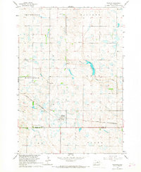
 1966 Burdette1967 Print · USGSHand County prairie life in the mid-sixties is centered on the settlement of Burdette and its surrounding townships. Genealogists can trace early landmarks like the Sunbeam Ch Townhall, Burdette Cem, and the winding path of North Wolf Creek.
 - 1966 Map of Miranda, 1967 Print
 1966 Miranda1967 Print · USGSThe prairie landscape of Faulk and Hand County is captured here in the mid-1960s, centered on the railroad town of Miranda. Genealogists and local historians can locate the Miranda Cem and trace the Chicago and North Western rail line near Dove Creek.
 - 1966 Map of Rockham SW, 1967 Print
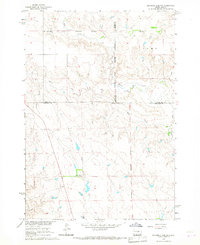
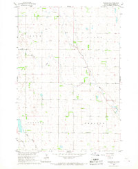
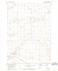
 1966 Rockham SW1967 Print · USGSThe rural prairie of Hand County is documented here during the mid-1960s, showing a landscape of family farms and community townships. Genealogists can locate vital landmarks like the Howell Cem, St Michael Ch, and the small settlement at Hand City.
 - 1966 Map of Rockham, 1967 Print
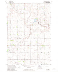
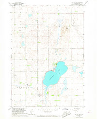
 1966 Rockham1967 Print · USGSIn the mid-1960s, the prairie landscape surrounding Rockham was a patchwork of family farmsteads and rural townships. Researchers can trace the path of the Chicago and North Western railroad or locate local landmarks like the Rockham Cem and Zell Lake.
 - 1966 Map of Rockham SE, 1967 Print
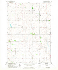
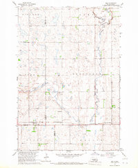
 1966 Rockham SE1967 Print · USGSHand County agricultural life in the mid-sixties is captured here through its township grids and prairie watercourses. Genealogists and researchers can trace the locations of community landmarks like Wheaton Ch, Center Sch, and the local Townhall.
 - 1966 Map of Zell, 1967 Print
 1966 Zell1967 Print · USGSCentral South Dakota prairie life is captured here in the mid-sixties, where the borders of Faulk, Spink, and Hand counties meet. Trace the rail corridor of the Chicago and North Western through Zell or locate the Mountain Sch.
 - 1966 Map of Redfield SW, 1967 Print
 1966 Redfield SW1967 Print · USGSThe prairie landscape of the Hand and Spink county line is captured in the mid-1960s, showing a region defined by its water and game management. Genealogists and historians can trace the borders of the State Game Refuge and locate Cottonwood Lake and the Cem to its north.
 - 1967 Map of Tulare NW, 1968 Print
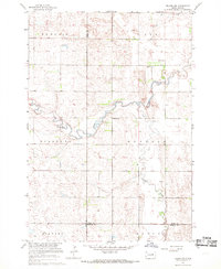 1967 Tulare NW1968 Print · USGSSpink and Hand counties are captured in the mid-1960s, showing a prairie landscape defined by meandering creek beds and rural townships. Researchers can trace local history through landmarks like St Johns Ch, Buffalo Cem, and a notable Flowing Well.
 - 1967 Map of Miller, 1968 Print
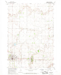 1967 Miller1968 Print · USGSMiller and St. Lawrence appear at a mid-century peak in the late sixties, anchored by the busy Chicago and North Western rail line. Genealogists and local historians can trace family roots through the St Anns Cem, GAR Cemetery, and the Drive-in Theater.
 - 1967 Map of Miller SE, 1968 Print
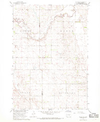
 1967 Miller SE1968 Print · USGSHand County prairie life in the late sixties is documented here as the local rail and water networks supported a growing agricultural landscape. Genealogists and historians can trace the Chicago and North Western line, locate the Beulah Ch, and identify numerous Flowing Well sites.
 - 1967 Map of Tulare SW, 1968 Print
 1967 Tulare SW1968 Print · USGSBeadle and Hand counties appear in the late sixties as a landscape of rural townships and prairie streams. Genealogists and local historians can locate the Tipton Community Ch, early Townhall sites, and family lands along Turtle Creek.
 - 1967 Map of Miller NW, 1969 Print
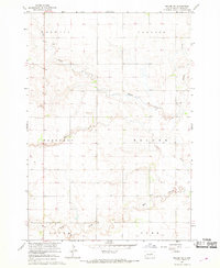 1967 Miller NW1969 Print · USGSHand County prairie land in the late sixties is documented here as a network of rural townships and winding creek beds. Genealogists and local historians can locate several rural schoolhouses, including Spring Valley Sch, Sunrise Sch, and Odessa Sch.2 unique versions available
End of results
Showing maps 1-13 of 13
Top cities of Hand County
- Miller historical maps
- St. Lawrence historical maps
- Ree Heights historical maps
- Burdette historical maps
Frequently asked questions
- What are the different types of historical maps available for Hand County?
- What is the oldest map of Hand County?
- Where can I purchase historical maps of Hand County for my home or office?
- Where can I download high-res historical maps of Hand County?
- Are there historical topographic maps available for Hand County?
- Is there historical aerial imagery available for Hand County?
- Where are historical maps of Hand County sourced from?