1970s Maps of Hand County, South Dakota
Explore 11 historic maps of Hand County from the 1970s. These maps offer a rare glimpse into what life looked like during the 1970s — showing old roads, neighborhoods, homes, and landmarks that have changed or disappeared over time.
Whether you're researching your family's past, planning a metal detecting trip, or studying how Hand County's landscape evolved across the 1970s, these high-resolution maps are a powerful tool for exploring the history of this region.
- Focus on a specific era: All maps on this page are from the 1970s, giving you a focused view of this time period.
- See what’s changed: Compare century-old streets, trails, and buildings to today's modern landscape using overlays and satellite layers.
- Research with precision: Use these maps for genealogy, historical research, land use analysis, or educational projects.
- View, download, or print: Maps are fully viewable online in high resolution, and can be downloaded or printed for your own records.
Start exploring Hand County's history through authentic maps from the 1970s. This is your window into the past.
Hand County, SD maps
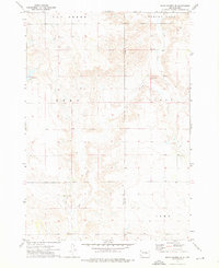
(11)- 1973 Map of Ames, 1976 Print
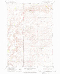
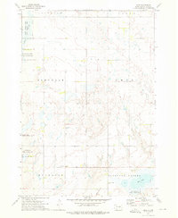 1973 Ames1976 Print · USGSHand County's prairie landscape near Ames comes into focus in the early 1970s, showing a region shaped by wildlife management and rural infrastructure. Genealogists can trace family land across MONDAIN or GLENDALE near the Pleasant Valley Ch and Wall Lake.
 - 1973 Map of Macs Corner NE, 1976 Print
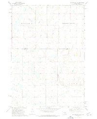
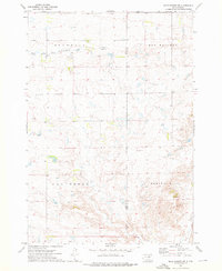 1973 Macs Corner NE1976 Print · USGSHyde and Hand counties appear here during the mid-1970s, showcasing the high plains terrain between Bramhall and Spring Hill. Trace the Old Indian Treaty Boundary or follow the path of South Fork Medicine Knoll Creek.
 - 1973 Map of Miller Dale Colony SW, 1976 Print
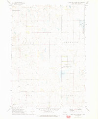 1973 Miller Dale Colony SW1976 Print · USGSHand County was characterized by vast public wetlands and scattered rural schoolhouses in the early 1970s. Local researchers can trace the Old Indian Treaty Boundary or locate community centers like Cedar Sch and Cedar Cem.
 - 1973 Map of Big Bend Dam 4 NW, 1976 Print
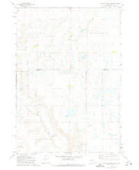 1973 Big Bend Dam 4 NW1976 Print · USGSBuffalo County and Hand County are shown in the 1970s, a period when the prairie landscape remained largely agricultural and sparsely settled. Genealogists and local historians can trace the Old Indian Treaty Boundary and locate rural landmarks like Prairie Center Sch and Elm Creek.2 unique versions available
 - 1973 Map of Macs Corner SE, 1976 Print
 1973 Macs Corner SE1976 Print · USGSThe Hyde and Hand county border in the early seventies shows a rural South Dakota landscape defined by creek drainage and high prairie hills. Researchers can locate landmarks like Cedar Ch, the Helm site, and terrain features including Spring Hill and Van Order.
 - 1973 Map of Big Bend Dam 4 NE, 1976 Print
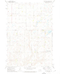
 1973 Big Bend Dam 4 NE1976 Print · USGSBuffalo and Hand counties meet on the South Dakota prairie in the early 1970s, showing a rural landscape defined by wide townships. You can trace local landmarks like Duncan Ch and the winding path of Crow Creek through Eden and Mondamin.2 unique versions available
 - 1973 Map of Cottonwood Lake, 1976 Print
 1973 Cottonwood Lake1976 Print · USGSThe South Dakota prairie near the Jerauld and Hand County line comes into focus in the early 1970s, showing a landscape of scattered lakes and rural townships. Trace local landmarks like the New Zion Zion Cem, the Townhall, and the shores of Spring Lake.
 - 1973 Map of Wessington Springs NW, 1976 Print
 1973 Wessington Springs NW1976 Print · USGSThe prairie lake country of Jerauld and Hand Counties is shown in the early seventies as a hub for conservation and agriculture. Researchers can trace land divisions in Harmony and Cherry or locate the small settlement of Bates near Long Lake.
 - 1973 Map of Mittelstedt Slough, 1976 Print
 1973 Mittelstedt Slough1976 Print · USGSThe wetlands of central South Dakota are meticulously detailed in the early 1970s, showing the intersection of Hand, Buffalo, and Jerauld counties. Researchers can trace rural landmarks like the Ebenezer Ch, the small settlement of Eden, and the National Waterfowl Production Area.
 - 1973 Map of Miller Dale Colony NW, 1976 Print
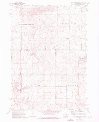
 1973 Miller Dale Colony NW1976 Print · USGSHand County prairie land in the early seventies shows the intersection of historical boundaries and rural utility. Researchers can trace the Old Indian Treaty Boundary and locate specific sites like the Flowing Well or the high ground at Ree Heights.
 - 1973 Map of Miller Dale Colony, 1976 Print
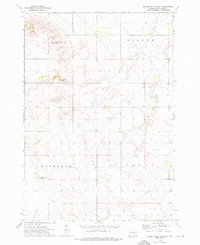 1973 Miller Dale Colony1976 Print · USGSHand County agricultural life in the early seventies is recorded here, highlighting communal settlements and water features. Genealogists can locate Miller Dale Colony, a local Cem, and landmarks like Camp Da-Ko-Ta and Collins Slough.
End of results
Showing maps 1-11 of 11
Top cities of Hand County
- Miller historical maps
- St. Lawrence historical maps
- Ree Heights historical maps
- Burdette historical maps
Frequently asked questions
- What are the different types of historical maps available for Hand County?
- What is the oldest map of Hand County?
- Where can I purchase historical maps of Hand County for my home or office?
- Where can I download high-res historical maps of Hand County?
- Are there historical topographic maps available for Hand County?
- Is there historical aerial imagery available for Hand County?
- Where are historical maps of Hand County sourced from?