Old Maps of Hand County, South Dakota for Academic Research
Study the evolution of Hand County with 222 high-resolution historic maps. Whether you're teaching, researching, or modeling changes in land use, these maps provide essential visual documentation of urban, environmental, and geographic change.
- Analyze long-term change: Track patterns in development, transportation, and natural features.
- Ideal for environmental or urban studies: Support academic projects with primary historical map data.
- Use in the classroom or lab: Educators and researchers rely on these maps to bring historical context to life.
These maps are a powerful tool for teaching, research, and visualizing how Hand County has changed over the decades.
Hand County, SD maps
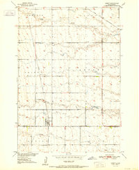
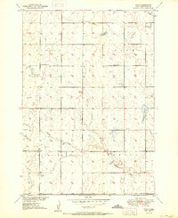
(222)- 1899 Map of Redfield
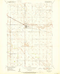
 1899 Redfield1899 Print · USGSAgricultural expansion across Spink and Hand Counties is in full swing here during the late nineteenth century. Genealogists can trace early rail-side settlements like Redfield, Rockham, and Tulare alongside prairie outposts such as Burdette and Florence.2 unique versions available
 - 1949 Map of Ree Heights NW, 1967 Print
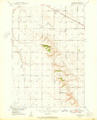
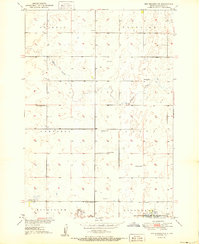
 1949 Ree Heights NW1967 Print · USGSHand County is captured here in the late 1940s, highlighting a landscape of rural schoolhouses and water resources. Local historians can trace the foundations of the community at Van Zee Sch, NE Riverside Sch, and the Flowing Well sites near Lake Louise.
 - 1949 Map of Vayland SE, 1976 Print
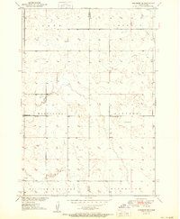
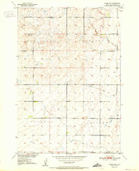
 1949 Vayland SE1976 Print · USGSHand County townships are mapped here in the late 1940s, showing a landscape defined by prairie agriculture and rural school districts. Genealogists can trace early homestead life through the locations of Rose Hill Ch, Cem, and Rowen Sch.
 - 1949 Map of Vayland SW, 1976 Print
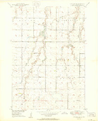
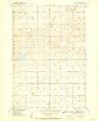
 1949 Vayland SW1976 Print · USGSHand County prairie life is documented here during the late 1940s, showing a landscape defined by township grids and rural school districts. Researchers can pinpoint several local landmarks like Spring Lake, Pleasant Valley Ch, and Horseshoe Bend Sch.
 - 1950 Map of Ree Heights SE
 1950 Ree Heights SE1950 Print · USGSHand County at the midpoint of the century shows a landscape of small townships and rural school districts organized around the rail line. Genealogists can locate family landmarks like Greenleaf Ch, Odd Fellows Cem, and several local schools including Moncur Sch and Spiers Sch.2 unique versions available
 - 1950 Map of Vayland
 1950 Vayland1950 Print · USGSMid-century Hand County is captured here at a time when rural schoolhouses still anchored the prairie community. Genealogists and local historians can locate several family-named landmarks, including Vitters School, Kanaly School, and the Town Hall near Majors Gulch.2 unique versions available
 - 1950 Map of Highmore NE
 1950 Highmore NE1950 Print · USGSThe Hyde and Hand county line was a landscape of remote rural townships and prairie schools during the mid-century. Researchers can trace the placement of local landmarks like Washington Sch and West Campbell Sch across the open plains of Eden and Ontario.
 - 1950 Map of Wessington
 1950 Wessington1950 Print · USGSThe town of Wessington straddles the Hand and Beadle county line in the mid-twentieth century, centered on its vital rail connection. Genealogists can locate rural landmarks like Bothwell Sch, Rogers Sch, and the Wessington Cem.3 unique versions available
 - 1950 Map of Vayland NW
 1950 Vayland NW1950 Print · USGSHand County prairie life is documented here during the mid-century, showing a landscape defined by meandering creek beds and rural township life. Researchers can trace the locations of the Town Hall and local schools like Lone Star and Corrin Sch.2 unique versions available
 - 1950 Map of Ree Heights
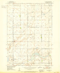
 1950 Ree Heights1950 Print · USGSRee Heights and the surrounding Hand County prairie are captured here in the post-war era as the Missouri River Basin developed. Researchers can trace the Chicago and North Western rail line and locate rural landmarks like Morningside Cem, Steptoe Sch, and Lake Louise.2 unique versions available
 - 1950 Map of Highmore SE
 1950 Highmore SE1950 Print · USGSThe rural expanse of central South Dakota is captured here in the mid-twentieth century as part of the Missouri River Basin development. Genealogists and historians can locate community cornerstones like the Hamilton Sch, West Riverside Sch, and the Chicago and North Western rail line.
 - 1950 Map of Rezac Lake NE, 1957 Print
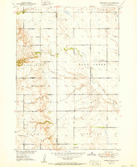
 1950 Rezac Lake NE1957 Print · USGSThe prairie crossroads of Faulk, Hyde, and Hand counties are captured here in the early fifties as the Missouri River Basin development program was underway. Local historians can trace the paths of an Old Railroad Grade and locate rural landmarks like Taylor Sch and Hill Spring.
 - 1950 Map of Rezac Lake, 1960 Print
 1950 Rezac Lake1960 Print · USGSThe Hyde and Hand County line in the early postwar era shows a landscape of small townships and prairie schools. Genealogists and researchers can locate the Bohemian Cem and family-centered landmarks like Weiss Sch and Eden Sch.
 - 1951 Map of Rezac Lake NE
 1951 Rezac Lake NE1951 Print · USGSFaulk County and its neighbors are captured here in the early fifties, showing a rural landscape shaped by the townships of Latham and Harrison. Genealogists and historians can trace local landmarks like Taylor Sch and the diagonal Old Railroad Grade.
 - 1951 Map of Orient
 1951 Orient1951 Print · USGSThe rural agricultural landscape of Faulk County is captured here in the early fifties, centered on the rail terminus at Orient. Genealogists and local historians can locate family-named landmarks and essential community sites like Selting Sch and the Orient-Prairieview Cem.2 unique versions available
 - 1951 Map of Ree Heights NW
 1951 Ree Heights NW1951 Print · USGSHand County farming townships like Fairview and Campbell are captured in the early fifties before widespread school consolidation. Genealogists can locate family-named landmarks and rural hubs such as Steptoe Sch and the Lake Louise Recreational Area and Wildlife Refuge.2 unique versions available
 - 1951 Map of Orient SW
 1951 Orient SW1951 Print · USGSHand County townships like Harrison and Spring are shown here at the start of the 1950s, documenting a prairie landscape defined by family farmsteads. Genealogists and local historians can trace rural school locations including Palmer Sch and Kolda Sch before their later removal.
 - 1951 Map of Rezac Lake
 1951 Rezac Lake1951 Print · USGSHand and Hyde Counties are captured here in the early fifties, showing a rural landscape of scattered schoolhouses and prairie section lines. Researchers can locate the Bohemian Cem and trace the footprints of old rural schools like Eden Sch and Weiss Sch.2 unique versions available
 - 1951 Map of Polo
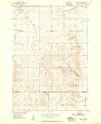
 1951 Polo1951 Print · USGSHand County, South Dakota, is captured here in the early 1950s as a landscape of rural schoolhouses and prairie cemeteries. Genealogists and historians can trace local landmarks like St Michaels Cem, Center Sch No 2, and the settlement of Polo.
 - 1951 Map of Vayland SW
 1951 Vayland SW1951 Print · USGSMid-century Hand County is documented here during the Missouri River Basin development program. Researchers can trace the density of rural settlement through numerous country schools like McCool Sch and Keck Sch, as well as landmarks like Spring Lake.2 unique versions available
 - 1951 Map of Wessington SW
 1951 Wessington SW1951 Print · USGSThe border of Hand and Beadle counties comes alive in the early 1950s, showing a prairie landscape shaped by township farming and rural education. Genealogists can trace family footprints near McNeil Sch, McGillvery Sch, and a lonely prairie Cem.3 unique versions available
 - 1951 Map of Orient NW
 1951 Orient NW1951 Print · USGSThe rural prairie along the border of Faulk and Hand counties is captured here in the early fifties. Genealogists and local historians can locate early educational landmarks like Maloney Sch and Progress Sch alongside Vogeler Lake.
 - 1951 Map of Ree Heights NE
 1951 Ree Heights NE1951 Print · USGSHand County at the start of the 1950s reveals a quiet landscape of prairie townships and rural schoolhouses. Researchers can trace the legacy of local farming families through sites like Alden Cem and school districts including Eaton Sch and Prairie View Sch.
 - 1951 Map of Vayland SE
 1951 Vayland SE1951 Print · USGSThe rural prairie of Hand County is captured here in the early fifties, showing a landscape defined by small townships and school districts. Genealogists can locate family landmarks like Rose Hill Ch and several country schools including Rowen Sch and Todd Sch.2 unique versions available
 - 1953 Map of Huron, 1959 Print
 1953 Huron1959 Print · USGSCentral South Dakota comes alive in the mid-1950s as a thriving rail and agricultural corridor between the Missouri and James Rivers. Trace the legacy of family farms and prairie towns like Huron, Faulkton, and Wessington Springs along the historic Chicago and North Western rail lines.3 unique versions available
Showing maps 1-25 of 222
Top cities of Hand County
- Miller historical maps
- St. Lawrence historical maps
- Ree Heights historical maps
- Burdette historical maps
Frequently asked questions
- What are the different types of historical maps available for Hand County?
- What is the oldest map of Hand County?
- Where can I purchase historical maps of Hand County for my home or office?
- Where can I download high-res historical maps of Hand County?
- Are there historical topographic maps available for Hand County?
- Is there historical aerial imagery available for Hand County?
- Where are historical maps of Hand County sourced from?